Howard Hughes Medical Institute
Measuring Biodiversity in Gorongosa
Take your biology class' understanding of biodiversity to a whole new level! Ecology scholars use data to calculate three different diversity indices based on the organisms in the Gorongosa National Park. The four-part activity uses an...
EduGAINs
Go H2O! Investigating Residential Water Systems
Before your learners excuse themselves to get a drink at the water fountain, prompt them to think about where that water comes from. A middle school science lesson encourages groups to research their community's source of drinking water,...
Curated OER
All Around the Neighborhood
Second graders explore the roles, responsibilities and skills of community leaders as they discuss the definition of community. They brainstorm businesses in the community and explore the importance of each profession represented in the...
Curated OER
Bradford England
Students explore the locality and diversity of culture within the Bradford District of England. Through map activities and discussion, they identify the major forms of transport, people and places in the region. Students compare and...
Curated OER
Taxi: A Book Of City Words
First graders engage in a literature study that helps them to focus on the concepts of goods and services. They describe the various skills people may need at home, school, and work. Students create a map of businesses found in the city.
Curated OER
The Fabric of Our World
Students discuss cultural diversity, and examine how the community reflects the cultural background of the inhabitants. They read the book, People, take a community walk, create a rainbow chart, and research other states for relocation...
Curated OER
The Big Circle
Students explore geography by participating in a mapping activity. In this concentric ring instructional activity, students utilize a poster board, string and markers to identify their current location within the entire world. Students...
Curated OER
Community Building
Seventh graders discover the similarities and differences between cities, towns, and rural communities. Using a Neighborhood map Machine, they create a Venn diagram and map of their own community. Students build a 3-D representation of...
Curated OER
Community and Colonization
Eighth graders explore the nature of the European colonization in the Americas. They compare how it relates to the inception of their community. Students identify the major players in America's colonization and explore the motivations...
Curated OER
We Are All Pieces of the Puzzle
Seventh graders are shown a small puzzle. They are explained that without all the pieces, a puzzle is not complete. Students are explained that the same principle applies to the world of work. They are also explained that each person who...
US Environmental Protection Agency
Mapping Greenhouse Gas Emissions Where You Live
After investigating the US Environmental Protection Agency's climate change website, your environmental studies students discuss greenhouse gas emissions. They use an online interactive tool to look at data from power production...
New York State Education Department
Global History and Geography Examination: June 2011
People in Ukraine, Rwanda, and Cambodia have all faced challenges to their human rights and even genocide. Using primary and secondary sources, scholars evaluate these challenges and the international community's role in them. The...
National Wildlife Federation
Go with the Flow
The quality of a watershed has a direct impact on the community it services. Learners study their own watershed using a topographical map. They recreate the watershed components using colored pencils to track the upstream and downstream...
Curated OER
Compass Rose Directions
Second graders use cardinal and intermediate directions to locate places on maps and places in the classroom, school, and community. They draw a setting map of "Little Red Riding Hood." Students give five steps of cardinal or...
Curated OER
Using Maps to Make Public Health Descisions Case Study: Harmful Algal Blooms in the Gulf of Mexico
Students are introduced to GIS and its uses. Students participate as public health scientists to deliberate a course of action to explore possible research questions. Pupils interpret spatial data, and make predictions based on GIS data,...
Curated OER
Third Grade Social Studies Quiz
In this social studies worksheet, 3rd graders complete multiple choice questions about communities, maps, distances, and more. Students complete 11 questions.
Curated OER
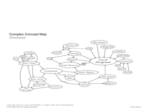
Project Jukebox
Students analyze an interview with the Climate Change Project Jukebox in order to help them undertand how to use a concept map. In this writing and climate change lesson, pairs of students log onto the Internet site for Climate...
Curated OER
Schools
First graders complete a unit of lessons on school and how schools have changed. They read a Laura Ingalls Wilder excerpt, view and discuss a Norman Rockwell painting, conduct an interview, construct a school map, and create an ABC book...
Curated OER
Map Making with Lewis and Clark
Students develop maps based on a virtual internet expedition of The Louisiana Purchase land area. They create the maps based on an actual outdoor expedition of their communities. Student create two maps, one based on the Louisiana...
Curated OER
Getting to the Core of World and State Geography
Students create topography relief maps. In this geography skills lesson, students review geography core knowledge skills, design and make a state relief map, and compile a student atlas.
Curated OER
The Sexton and the Compass
Students evaluate how movement patterns create and affect interdependence. They analyze the interactions within and between regions and engage in artistic inquiry, exploration, and discovery in collaboration with others. They design...
Curated OER
Sense of Place
Students identify the major folk regions of Louisiana and the relationship between folklife, geography, and ecology. They give deeper thought to what makes their own community unique, what their sense of place actually is. Students...
Curated OER
The American Revolution and Its Heroes
Students, through a variety of activities, discover historical aspects of the American Revolution. They make maps and create timelines to track significant events. They create a book about the American Revolution and re-enact Paul...
Curated OER
Map on the Wall
Students examine the Ogallala aquifer water storage facility, identify rivers that refill the aquifer, and locate major cities near by. Students make maps of the area.


