Curated OER
Snack Search
Students make maps to show where the agricultural products used to produce various packaged snacks are grown. They bring in snacks from home and utlize a worksheet imbedded in this plan.
California Academy of Science
California's Climate
The United States is a large country with many different climates. Graph and analyze temperature and rainfall data for Sacramento and Washington DC as you teach your class about the characteristics of Mediterranean climates. Discuss the...
Curated OER
Bears and Panthers Aplenty: Early Settlers Make a Home in Arkansas
Young historians research the Southwest Trail, which ran through Arkansas back in the 19th century. Pupils are divided into four groups. Each group researches a pioneer who blazed the Southwest Trail. Then, the group presents an oral or...
Scholastic
Study Jams! The Ocean Floor
Under the sea, the geography is as varied as it is on land! Young oceanographers find out about continental shelves, abyssal plains, seamounts, trenches, and mid-ocean ridges by viewing and reading the eight high-quality slides. Then...
Curated OER
Summertime Travel
Third graders write about a summer event they participated in. For this paragraph writing lesson, the teacher models how to write about a place they have visited. Students then write their own paragraphs. Students will point out on...
Curated OER
Put Me in My Place: Using Alphanumeric Grids to Locate Places
Students practice locating points on a large wall grid and create and label a neighborhood map. In this geography lesson, students spell and discuss places as the teacher places them on the map. They discuss the concept of an...
Curated OER
Name That Continent
Students practice locating the seven continents, four hemispheres, and four oceans using a large world map and a review song. They also import a world map to the Kid Pix computer program then type in proper labels on the map. There are...
Curated OER
Where's the Sand?
Students identify the characteristics of deserts. In this geography lesson plan, students discuss the characteristics of a desert and label a map with the names of deserts.
Curated OER
Know Your Area
Young scholars investigate transit by analyzing their school surroundings. In this local geography lesson, students identify their school in relation to the rest of their state, country and globe. Young scholars discuss their personal...
Curated OER
Climate Characteristics of Canadian Localities
Tenth graders match the climate data to a Canadian city. They justify their choice, referring to factors that affect climate. They use the Atlas of Canada's Advanced Search to locate specific communities.
Curated OER
The Hopi Indians
Fourth graders read and look at maps of the Hopi Indians and compare and contrast their lives with the Hopi Indians. In this Hopi Indians lesson plan, 4th graders learn about different cultures and answer short answer questions.
Curated OER
Discovering Prehistoric Trails
Eighth graders examine prehistoric terrain. In this geography lesson plan, 8th graders discover necessary resources for settlers. Students work in small groups to create a trail crossing the state of Kansas.
Curated OER
Continents
Learners investigate World Geography by researching the different continents. In this Asian Geography lesson, students discuss the continent of Pangaea and color a worksheet of the continents. Learners locate China on the map worksheet...
Curated OER
United States Map Quiz
For this online interactive geography quiz worksheet, students respond to 50 identification questions about the shapes of countries shown. Students have 5 minutes to complete the quiz.
Curated OER
Oceania Map Quiz
In this online interactive geography quiz worksheet, learners respond to 14 identification questions about Oceania. Students have 2 minutes to complete the quiz.
Curated OER
Australia Cities Map Quiz
In this online interactive geography quiz worksheet, students respond to 17 identification questions regarding Australian cities. Students have 3 minutes to finish the timed quiz.
Curated OER
Chinese Cities Map Quiz
In this online interactive geography quiz learning exercise, students respond to 10 identification questions about Chinese cities. Students have 3 minutes to complete the quiz.
Curated OER
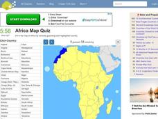
Africa Map Quiz
For this online interactive geography quiz worksheet, learners respond to 53 identification questions about the countries of Africa. Students have 6 minutes to complete the quiz.
Curated OER
Flat Stanley
Students read Flat Stanley, and make a poster board Flat Stanley which they sent out to family members in different states. They create an adventure for their Flat Stanley based on his "travels" and map out his trip.
Curated OER
Spanish Cities Map Quiz
In this online interactive geography quiz worksheet, students respond to 11 identification questions about Spanish cities. Students have 3 minutes to complete the quiz.
Curated OER
The European Union
Students complete an in-depth exploration of the European Union using the five themes of geography as a guide. In small groups, students use traditional and technological resources to answer questions about the European Union, with each...
Curated OER
I Can Compass, Can You?
Young scholars discover how to use geographic tools. In this compass lesson, students identify cardinal directions by appropriately using compasses along with a number of various maps.
Curated OER
5 Themes Awareness of Current Event Issues
Young scholars identify the 5 themes of geography as being location, place, human-environmental interaction, movement and region. They explain a current event from the perspective of each theme and their interrelationship..
Curated OER
Mapping Lab and Lead Poisoning
High schoolers are introduced to GIS and its uses. They make predictions before viewing the actual lead poisoning cases by location of Dade County. Pupils use actual Miami-Dade County spatial data to explore basic principals. Students


