Curated OER
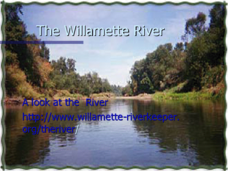
The Willamette River
An informative set of slides inspects the Willamette River. Hydropower dams, agriculture, and the presence of major cities on its banks have led to increased bacteria, temperature, and mercury content as well as skeletal deformities in...
Los Angeles Unified School District
River Systems
Scholars must react to the ecosystems of a river. They use inquiry-based learning along with maps and visuals to better understand the impact of rivers on everyday life. To finish, they create final written projects and presentations.
Curated OER
World Rivers
In this world rivers worksheet, students match 20 major world cities on the left side of the sheet to the rivers that they lie on found on the right side of the sheet.
Curated OER
Rivers Run Through It
Using a relief map of New York State, learners answer questions about the distance between different cities, identify bodies of water, and more. First, they discuss vocabulary related to the Hudson River area. Then, they complete a...
Curated OER
Rivers of the World
In this geography worksheet, students match the name for each of 20 rivers of the world with the major city where it is located.
Curated OER
The Yangtze River: Lifeline of China
Students locate the Yangtze river on a map, and label major cities and landmarks. Students identify and interpret the diversity of the people living along the Yangtze. Students explain the pros and cons of the
Three Gorges Dam project.
Curated OER
Fun With Pacific Northwest Cities and Towns
Intended for fun only, learners play with the names of cities common to their region or state. This activity includes a list of cities in Oregon and not much else. What you and your class choose to do with your list of cities is up to you.
Curated OER
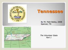
Tennessee: The Volunteer State Part 1
Explore the state of Tennessee, PowerPoint style! Regions, geographical features, and some amazing state facts are yours for the asking. Major cities are named and followed by related facts. This neat presentation on an interesting state...
Curated OER
Move Around the Map
Fourth graders, while working with a partner, label and identify on a tarp map six major cities and five major rivers in Indiana. They traverse along the rivers utilizing a different locomotor skill (hop, skip, walk, run, leap, gallop,...
Curated OER
City Life In Europe
Students explore Paris. In this geography skills lesson plan, students watch "City Life in Europe," and conduct further research on the city of Paris and the country of France. Students create postcards that feature Parisian landmarks.
Curated OER
The Mighty Mississippi River
Learners acquire in-depth knowledge of the geographic significance of the Mississippi River. They identify and expand their knowledge of the role of the river in the development of cities. Finally, students gain insight into the ways...
Curated OER
Important Rivers of the World
Third graders become familiar with names of the different parts of a river, define and locate drainage basins, locate six of the continents and explore the major rivers on each one, conduct research on a river of their choice.
Curated OER
Map on the Wall
Students examine the Ogallala aquifer water storage facility, identify rivers that refill the aquifer, and locate major cities near by. Students make maps of the area.
Curated OER
Maps
Maps, globes, and computer software aid young explorers as they locate state capitols, major cities, geographic features, and attractions for states they are researching. They then use desktop publishing software to create a map to share...
Curated OER
China - the Geography of European Imperialism - Spheres of Influence in China
Ninth graders create a map of China. They identify the various spheres of influence carved out by the Imperialist powers of Europe as well as locating geographical features of china and major cities. They explain the global impact of...
Curated OER
Finding River Cities
Using a wall map, students will find major rivers in the four regions of the United States. Then they answer questions about how people use natural resources, such as rivers.
Curated OER
Cities as Transportation Centers
Middle schoolers work in small groups to identify some of the major transportation centers, recommending two as possible sites for a national political convention, based on population density and the travel networks available in 1835.
Curated OER
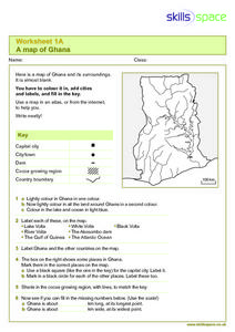
A Map of Ghana
For this Map of Ghana worksheet, students are given a blank map and key. They are told to label major features and color according to directions.
Curated OER
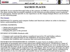
Sacred Places
Young scholars examine places considered sacred in both India and the U.S. They read and discuss a website on the Ganges River, discuss places considered sacred in the U.S., and write an essay comparing/contrasting personal sacred places...
Curated OER
Colonial North America
Showcase the religion, conflicts, daily life, and politics of Colonial North America. A very well-done presentation highlights all the major colonial groups, social norms, demographics, and political struggles of the time. Perfect for an...
Curated OER
Mongolia Geography
Students examine the geography and culture of Mongolia. Individually, they cut out cut-outs of animals to place on their maps and label the grasslands and desert areas. They locate major cities and rivers along with vegetation.
Curated OER
Rockin' Round New York State
Students discuss their favorite rock groups and bands. They create rock groups that will be touring New York State. Students research cities in New York, determine dates of concerts, create touring itineraries, and develop Inspiration...
Curated OER
The Exploration and Settlement of North America
Young scholars locate place in Canada and explore highlights of early of early American exploration and settlement. In this North American history lesson, students locate provinces, major cities, and physical features of Canada. Young...
Curated OER
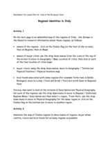
Regional identities in Italy
In this Italy map activity worksheet, students complete 2 map activities that require them to identify major cities and landforms in the country.


