Curated OER
Applications of GIS
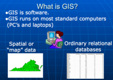
Don't be concerned that the title slide of this presentation mentions Virginia's Geospatial Extension Program; this slide show is very informative for any technology-focused curriculum when considering global information systems. It...
CK-12 Foundation
Location on the Earth: Longitude and Latitude
To what degree do learners understand coordinates? Get them some practice in Yosemite National Park in a simple, fun interactive. Pupils explore a map and locate coordinates of popular sights within the park, then answer questions...
National Wildlife Federation
By Air, Land, or Sea: The Formation and Location of Our Natural Resources
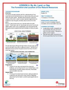
Coal forms from the ancient remains of plants that were alive on Earth before the dinosaurs! Scholars use their t-charts from the previous lesson over resources and research to determine if their information is correct. Through analysis...
Curated OER
Water Quality and Watersheds: A GIS Investigation
Requiring more than one class period, this resource takes earth science learners on a journey through a watershed. Using ArcGIS Explorer, an online geographic information system, they view maps of watersheds and surrounding landscapes....
Teach Engineering
Earthquakes Living Lab: Locating Earthquakes
There are patterns in nearly everything — even earthquakes. Pairs research current earthquakes to see if there are any patterns. They determine the mean, median, and mode of the earthquake data, along with the maximum and...
Curated OER
Researching and gathering information
Though text heavy, these nine slides present clear instructions for each stage of the research method that students should use to organize information about Saguaro Cacti. A good introduction to organizing research for a writing...
Environment Agency - Abu Dhabi
Find the Most Spectacular Volcanoes in the World!
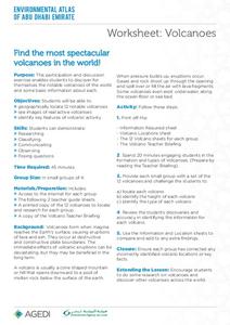
Heat things up in your earth science class with this collaborative lesson on volcanoes. After first being introduced to the different types of volcanoes and how they are formed, young geologists work in small groups to...
Curated OER
Reading Comprehension: History of the Periodic Table
Although the article that launches this lesson is about the history of the Periodic Table, the objective is reading comprehension. Using the eight-page informational text, learners answer five comprehension questions and craft one essay....
California Academy of Science
Discovering Rainforest Locations
How many rainforests are there, where are they, and do global factors effect their locations? These are great questions that have great answers. Children in grades four through eight use several different maps to determine why...
Curated OER
Exploring Energy with GIS
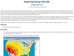
Learners examine GIS technology as it is used to locate energy sources. For this GIS lesson, student access an assigned website to locate a series of lessons using the GIS software. They use the maps that are located on the primary...
Curated OER
Planet Data
Sixth graders use various resources to locate information for a database (name of planets, diameter of planets, etc.). They enter the data onto a prepared data grid. Use of Access to sort data is accented within this lesson. Students...
Midnight Martian
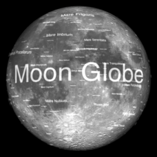
Moon Globe
Not just a simple globe of the moon, this interactive version allows you to choose lighting according to the location of the sun, views from different positions on Earth, and more! Satellite images and topographic data have been combined...
Curated OER
Chemical Information Search
Students research information using various internet resources. In this chemistry lesson, students demonstrate their ability to navigate websites and gather necessary information. They evaluate the potential usefulness of the databases...
Curated OER
Lesson 1: Identifying Information in Nonfiction
If you are in need of a lesson on identifying information in a non-fiction text, look no further. The class learns how to use a KWL chart to identify explicit information in the book, Frogs by Gail Gibbons. They fill out the KWL...
Curated OER
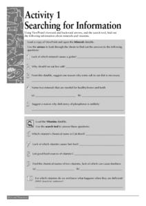
Searching for Information
For this computer worksheet, students use ViewPoint's forward and backward arrows, and the search tool to locate information given about minerals and vitamins. They load the Vitamins datafile and use the search tool to respond to five...
PBS
Map a Model Solar System
Creating a solar system map is a snap thanks to a hands-on activity! Science scholars explore the solar system by building it wherever they choose during an interactive from PBS's Space series. Users pick both the location and scale for...
Curated OER
Communicating through Engineering Information Technology
Learners analyze prior labs by keeping a lab notebook. They share their lab notebook by electronically sending it to their classmates. Students demonstrate evaluation of other lab notebooks within the same classroom and those from other...
Curated OER
Digging for Dinosaur Information
Students explore how to locate dinosaur information. They read the book, Catch Me If You Can! and discuss the popularity of dinosaurs among children, identify various kinds of dinosaurs and select a dinosaur to research. TAs they...
Curated OER
Practical GPS Applications in Forestry & Agriculture
An explanation of the Global Positioning System (GPS) and the Geographic Information System (GIS) is given in this presentation. Uses and applications are considered. How it works and sources of error are also touched upon. A large...
Curated OER
Save an Endangered Species
Have your young learners work in pairs to find and research an endangered species. They use research to develop ideas about saving their animal from extinction. Pairs develop a three-dimensional model of the animal's habitat. Then,...
Curated OER
Butterflies, Butterflies, Butterflies
Transform your class into a butterfly museum! Research different types of butterflies, their habitat, and life cycle. Interactive components such as PowerPoint presentations, Claymation movies, and webpages add pizzaz to the museum...
Curated OER
Traveling Through Literature
Integrate geography with literature in this interdisciplinary instructional activity. Begin by reading a poem such as The Time We Climbed Snake Mountain by Leslie Marmon Silko. On a large map, place push pins in the cities or states...
Space Awareness
Let's Map the Earth
Before maps went mobile, people actually had to learn how to read maps. Pupils look at map elements in order to understand how to read them and locate specific locations. Finally, young cartographers discover how to make aerial maps.
It's About Time
Taking a Ride on a Lithospheric Plate
Assist your pupils and broaden their horizons with several activities that determine the exact positioning of various communities over the globe. Pupils use data from the Global Positioning System to determine the position and rate of...
