Curated OER
Geographic Landforms
Each slide is a simple notebook page with one landform in blue and its definition in red. There are 26 vocabulary terms in all, some you may want to use, and others easily hidden. It is recommended that you add photos or other graphic...
Curated OER
Geography Terms
In this geography learning exercise, students match vocabulary words to their definition. They identify words such as valley, peninsula and others dealing with land formations. Students solve 23 matching problems.
Curated OER
Vocabulary Words of the Southwest
A simple vocabulary definition worksheet has young geographers of the Southwest putting term meanings into their own words. The fifteen words include (but are not limited to) adobe, butte, canyon, economy, erode, fossil, and landform....
Curated OER
Land Elevation
Students investigate land elevation. In this map skills lesson, students use a physical map to identify various elevations of the land. Students find landform features such hills and coastlines.
Curated OER
Landforms By Hand: Geography, Map Skills
Learners experiment with landform vocabulary by using their own hands and a bar of soap as media.
Curated OER
Matching Worksheet: Geography
In this vocabulary worksheet, students match geography words to their definition. Students identify the definition to words dealing with the physical and human features of land, and terms dealing with interpreting a map. They solve 12...
Compton Unified School District
How Can We Locate Places?
How can we locate places? Maps, of course! Expose second graders to the tools available in maps and discuss how these tools can help people find locations. Students also look at communities, including what makes a community and the...
Montana State University
Meet Mount Everest
Learning about one landform might seem boring to some, but using the resource provided practically guarantees scholar interest. The second in a sequential series of eight covering the topic of Mount Everest includes activities such as a...
Curated OER
Landforms of Illinois
Learners discover the primary landforms of Illinois. They examine how those landforms were formed as well. In groups, they research one of the landforms from their vocabulary list. They create their landform in a shoebox and present it...
Alabama Learning Exchange
Forces that Change the Land
Students conduct Internet research find information about the following landforms: mountains, canyons, and valleys. They create travel brochures of their findings.
Curated OER
Atlas Vocabulary
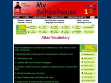
In this atlas terms and definitions online interactive worksheet, students read the definitions and match them with Atlas vocabulary words. Students match 49 answers.
Curated OER
Landforms
Young scholars study how landforms affect all aspects of a community. Students work in groups to identify landforms from other works of art. In cooperative groups Young scholars select a work of art depicting a particular land form and...
Curated OER
Map Skills
Learners create two types of maps. In this map skills lesson, students discuss map vocabulary and view maps of Florida. Learners draw a free hand map of Florida and include major cities, bodies of water and land forms. Students work...
Read Works
Columbus Was an Explorer
Get the inside scoop on the European explorer, Christopher Columbus, with a response to reading worksheet that requires scholars to answer who, what, why, when, and a variety of other questions about the word crew.
Curated OER
Sea to Sky
Students investigate the Earth's major landforms and how they occur, and how engineers apply this knowledge for the design of transportation systems, mining, and measuring natural hazards. They listen to a teacher-led lecture, match...
Curated OER
The Geography - Writing Connection
Students examine and describe the four physical systems of the Earth. Using two of the systems, they practice their writing skills and use vocabulary associated with the different types of landforms. They predict the types of shelters...
Curated OER
Our Country's Geography
Third graders study geography. For this United States landforms lesson, 3rd graders create a map of the U.S. made out of dough. They use various edible treats to mark the country's capital, the plains, the mountains and the rivers &...
Curated OER
Map Your State: Regions of Arizona
Fourth graders define vocabulary and locate physical features on maps. In this mapping instructional activity, 4th graders explore regions of Arizona through landforms found on topographic maps. Students research the history and...
Curated OER
Deep Blue: Exploring the Deep Ocean
Students examine landforms. In this social studies lesson, students bounce a beach ball around in order to discover that seventy percent of the Earth is covered in water. Students
Curated OER
Traveling to Texas
First graders read "Where the River Begins" by Thomas Locker and discuss the Texan landscape. They use construction paper to make suitcases and then fill them with types of Texan landforms and scenery they might see on a trip to Texas.
Curated OER
Science: Draining the Land - the Mississippi River
Students use topographic maps to identify parts of rivers. In addition, they discover gradient and predict changes in the channels caused by variations in water flow. Other activities include sketching a river model with a new channel...
Curated OER
Landforms
Pupils begin their examination of landforms. Using a map, they locate and identify the major landforms on Earth. They discuss how landforms affect the lifestyle of the community and determine which goods and services the community produces.
Curated OER
I Am A Rock, I Am An Island: Describing Landforms and Bodies of Water
Students identify common landforms and bodies of water from descriptions of distinguishing features. In this landforms and bodies of water lesson plan, students describe the features they see in the pictures given to them.
Channel Islands Film
A Time Capsule of a Lost Early California Lifestyle
After viewing The Last Roundup, a documentary that examines the transitioning of Santa Rosa from a privately owned island to a National Park, class members adopt the point of view of Tim Vail, a member of the family that once owned the...


