Curated OER
Exploring the Various Regions of Boyle Heights: Continuity and Change
Student study the local landscape of Boyle Heights, California and draw a sketch of the area. Students use map making skills in this activity. Studient make a portfolio of information and photographs they accumulate over time on the area.
Curated OER
Mississippi Gulf Coast Islands
Fourth graders complete a variety of exercises as they study the creation, history, and geography of the Mississippi coastal islands. They discover the natuaral forces that act on the islands and how these forces affect the habitats and...
Curated OER
Historical Indian Treaties and Aboriginal Population
Sixth graders navigate an online atlas of Canada and compare the land area of of historical Aboriginal peoples in Manitoba to present-day figures.
Curated OER
Microsoft Publisher Country Brochure
Learners explore geographic information. In this geography and technology instructional activity, students choose a county and answer related questions on a Webquest. Learners create a word web and design a country brochure.
Curated OER
Identifying Possible Effects
In this Current Events worksheet, students study the Census. Students complete a graphic organizer on possible economic, social or environmetal effects of population change.
Curated OER
Canada's Immigration patterns: 1950 to Present
Learners examine the changing immigration pattern of Canada. In this immigration activity, students use statistical data from a web-site to complete a worksheet and graph their findings.
Curated OER
Between the Rivers
Second graders compare and contrast historical American cultures. In this American history lesson, 2nd graders participate in reading, writing, oral, and hands on activities. Students discuss the similarities and differences between...
Curated OER
Geography: Mapping Neighborhoods
Students examine their neighborhoods and draw maps reflecting land use. In addition, they make predictions about their community's future. Students also consider the impact of business and industry on their communities and predict ...
Curated OER
Case Studies: Cross-Cultural Comparison
Students examine maps of Lebanon, Vietnam and Nigeria, discuss relationship between ethnicity, land and conflict, review material from case studies, complete comparison chart, and write essays comparing two of the case studies.
Curated OER
Google Earth Geology Field Trip
Learners take a virtual field trip around California using Google Earth. In this geology field trip lesson, students explore landforms and a variety of rocks located in California. Learners compare environments where rocks are formed....
Curated OER
Cartographer on Assignment: Creating a Physical Map of Africa
Students use geographic information to make an outline map of Africa, then demonstrate their understanding of the physical landscape of Africa by using a variety of materials to create a physical map of Africa
Curated OER
Natural Resources
Students explore Iowa geography and topographic maps. In this geography and topographic maps lesson, student investigate maps, newspapers, Iowa flora and fauna. Students gain an understanding of how different landforms can be identified...
Curated OER
Build the Tallest Building
Students examine the design and construction of skyscrapers. They use the internet to research information about different types of skyscrapers. They create their own building and defend it to the class.
Curated OER
Regional Landforms and Native People
Third graders study the Native American tribes of Maidu and Miwok by studying Internet artifacts, culture, language, music, storytelling, architecture, food, clothing, crafts and geology.
Curated OER
Louisiana's Major Folk Regions
Learners study the three major folk regions of the state. They break the regions down into smaller folk regions or use the concept of three regions: North Louisiana, South Louisiana, and New Orleans. They identify some of the markers...
Curated OER
Will You Pick My Cotton?
Use this cross-curricular history lesson plan to work on your students' informational writing skills. After listening to songs and stories related to Sultana, they engage in a several activities to boost their understanding of slavery...
NET Foundation for Television
1850-1874 The Kansas-Nebraska Act
How the Kansas-Nebraska Act created Bleeding Kansas is complicated—until scholars research and examine documents from the time. After completing activities that include mapping, photo, document analysis, and discussion, learners...
Beverly Hills High School
French Revolution
What led up to the French Revolution? Middle and high schoolers explore the factors that contributed to the storming of the Bastille on July 14th, 1789, as well as the events following that fateful day, with a presentation on the French...
Curated OER
The Secret Garden
Students research the culture and geography of India and England while reading "The Secret Garden". Using this information, they write at least three predictions about what they believe might happen in the story. Using the Internet,...
Curated OER
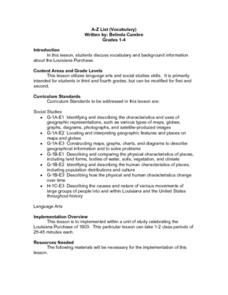
A-Z List
Students practice using vocabulary terms about the Louisiana Purchase by creating a picture dictionary, an ABC book of terms, a word sort, or a game. Each project should include people, places and terms as they relate to the Louisiana...
Curated OER
Map Reading
After examining a map from 1803 and 2003, they explore how to become map readers. They describe what they see on the map from 1803 and compare the information to the map from 2003. Students create their own map of the neighborhood that...
Curated OER
Sandscapes to Landscapes
Learners explore landscapes and create their own in a creative project.
Curated OER
The Age of Exploration
Young scholars apply computer skills to gain further insight into early exploration. They analyze the role of each explorer and evaluate their importance. Students comprehend the Chronology of Discovery and Trade of early explorers. ...
Curated OER
A New Federation
Students describe the relationships between state and federal parliaments in Australia. They identify responsibilities shared between federal and state and territory governments. Students explore an alternative federal structure by...


