DiscoverE
LIDAR: Mapping with Lasers
We would be lost without maps! How are they made? Introduce junior topographers to LIDAR technology with a fascinating activity. Set up a mock city, then have learners operate a laser measure to determine the shape of the landscape using...
Curated OER
Arkansas Map
In this Arkansas worksheet, students analyze an outline map of the state of Arkansas and label the capital city. Students label other important cities and important attractions and color the map.
Curated OER
Asia Outline Map
In this Asia outline map learning exercise, students explore the continent as they label the 47 countries. The countries are numbered and lines for the answers are provided on the sheet.
Curated OER
Australia/Oceania Outline Map
In this Australia and Oceania outline map worksheet, students explore the region of the world as they label the 14 countries. The countries are numbered and lines for the answers are provided on the sheet.
Curated OER
South America Map
In this map of South America worksheet, students identify and label the countries in South America. Students improve their understanding of South America.
Curated OER
Across the United States- Home Learning Activity
In this home-school United States map worksheet, students work with a family partner as they study a map of the United States. They talk about the states they have visited, play a game by giving each other clues about states, and write...
Curated OER
Geography and Culture of China
Take out a map, a paper, a ruler, and those coveted colored pencils for a lesson plan on Chinese culture and geography. This is a multifaceted approach to basic geography skills that incorporate story telling, class discussion, primary...
Curated OER
Map of Norway
In this geography of Norway worksheet, students color and label a map with major cities and physical features. Students need to do their own research.
Ms. Catsos
Ancient Rome Map Worksheet
It wasn't just the great leaders of ancient Rome that shaped their civilization—the geography of the region played a major role as well. After first identifying major land masses, bodies of water, and city states on a map of Europe,...
Curated OER
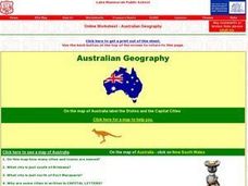
Australian Geography
In this map reading instructional activity, students label a map of Australia by adding the names of states and cities. They answer eight questions about the map.
Curated OER
Waldseemuller's Map: World 1507
Students investigate the 1507 word map. In this world geography lesson, students examine the details of each section of the map and then draw conclusions about how the people of 1507 understood the world. Students are evalated on...
Curated OER
Draw a Map
Students draw a map. In this map drawing lesson students draw a map to show where a character is from and where they are going in the story. Students are writing an odyssey.
Curated OER
Map Memory
Fifth graders, working in a whole class setting, label a United States map with the names of all the states that they know. They transfer the names of the states to an individual map and color it. Next, they receive directions on how to...
Curated OER
Labeling a Map of the British Isles and Elapsed Time
In this map work and elapsed time activity, students label England, Scotland, Wales, and Ireland on a map. They calculate the elapsed time of a delivery that is described in a word problem that is broken down into four parts.
Curated OER
How Big is the Playground: Creating a Map
Students create a topographical map of an area outside of the school. In this mapping instructional activity, students compile data on angles, distances, and key landmarks for a predetermined area on the school grounds to create a map...
Seterra
Northern Europe: Countries - Map Quiz Game
Remembering geography is a tiring and tedious task to many scholars. Change it up by assigning the map quiz game. Elementary and middle schoolers alike test their knowledge and compete with the clock to match as many countries as...
Curated OER
The Roman Empire-Map Activity
In this Roman Empire worksheet, students complete a map activity in which they label and color civilizations, countries and physical features as instructed. There are no maps included.
Curated OER
Holocaust Map Studies
Students analyze maps and answer discussion questions related to WWI. In this geography lesson, students analyze historic maps to determine causes and effects of WWI in Europe. Students read testimonies of Holocaust survivors and label...
Curated OER
United States Map- State Capitals
Students explore map skills. In this state capital lesson, students view a United States Political Map and identify and use post-it notes to label the state capitals.
Curated OER
United States Map - Lesson 11
Students explore lakes of the United States. In this geography lesson, students identify noteworthy lakes on a map of the United States.
Curated OER
Alabama Outline Map
In this Alabama outline map worksheet, learners examine political boundaries of the state and the placement its capital city as well as its major cities. This map is not labeled.
Curated OER
Alaska Outline Map
In this Alaska outline map learning exercise, students examine political boundaries of the state and the placement its capital city as well as its major cities. This map is not labeled.
Curated OER
Arizona Outline Map
In this Arizona outline map instructional activity, students examine political boundaries of the state and the placement its capital city as well as its major cities. This map is not labeled.
Curated OER
Arkansas Outline Map
In this Arkansas outline map worksheet, students examine political boundaries of the state and the placement its capital city as well as its major cities. This map is not labeled.
Other popular searches
- Map Labeling
- Africa Map Labeling
- Midwest Map Labeling
- Geography Map Labeling
- Labeling a Map Continents
- Blank Labeling Maps
- Labeling Maps Pangaea
- Labeling Map Parts


