Curated OER
Planning a Garden Using a Grid
Third graders plan for a garden. In this garden planning lesson plan, 3rd graders investigate the use of a grid to accurately map out and plan for a vegetable garden. Students predict the space requirements for different vegetables.
Curated OER
Important Decisions Don't Just Happen! Using Data to Plan Your Services
Students interpret statistics. In this data instructional activity, students examine and organize given data. They present the data in a grid format. Using the census data, students determine the best location for a...
Mathematics Assessment Project
Journey
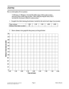
Drive home math concepts with an engaging task. Learners follow a verbal description to fill in a table and create a distance-time graph representing a car journey. They then answer questions by interpreting the graph.
Illustrative Mathematics
Latitude
The greater the latitude, the less of the Earth is north. Scholars graph the relationship between the latitude and the percentage of the Earth that is north of the latitude. Using the graph and the table, class members interpret values...
Curated OER
The Treasure Map
Third graders problem solve using drawings and map interpretations. They preview graphs and Cartesian geometry. They follow directions on a map using a grid and compass references while simulating they are reading a pirate map.
Curated OER
Draw an Inch, Walk a Mile
Students work in small groups to solve the problems presented. The main project, mapping the classroom, use these discussions to collaborate in creating a tangible demonstration of their understanding.
Inside Mathematics
Vencent's Graphs
I like algebra, but graphing is where I draw the line! Worksheet includes three multiple-part questions on interpreting and drawing line graphs. It focuses on the abstract where neither axis has numbers written in, though both are...
Curated OER
Mapping with a Compass: A Simulated Survey
Students use compasses and grids to map the locations of artifacts found in a simulated dig site. In groups, they role-play as future archeologists excavating a school site. Groups begin at their assigned datum and site the artifacts...
Curated OER
Coordinate Grid: Mapping Archeological Sites
Fourth graders discover how to apply the Cartesian coordinate system by figuring out the length and width of their school playground. They determine that pacing is an important tool for the initial mapping of a site. Students conduct a...
Curated OER
Mapping and Excavating a Jello Mold
Fifth graders, in groups, map the three layers of different colored jello layers in molds and note the placement of fruit in them. On the grid paper they draw each grape, raisin, or other object and carefully remove each layer. After...
Curated OER
A Contouring We Go
Students examine the built environment and infrastructures of their community by constructing contour equipment, using the equipment, and comparing their results to current topographical maps of the same area
Curated OER
Bird and Dog Race
Your pupil's pet dog and bird are racing down the city streets. In order to know who is going to win, they better know something about calculating rates, the Pythagorean Theorem, and applying those topics to the map of the city.
Curated OER
Rescue!
Middle schoolers explore movement and position concepts. They follow directions using left , right, up, down, North, South, East and West. Students draw and follow a path on a grid to show a route followed. They label and follow legends...
Curated OER
TE Activity: Nidy-Gridy
Students make a grid and coordinate system map of their classroom as they investigate why it is important to have a common map making system. They look at how landmarks are used for navigating an area.
Curated OER
Traveling aroud Our Town
Learners are asked to describe to a partner how he or she walks to school or the bus stop. They are shown on the overhead an one-inch grid paper, and at the intersection of two lines on the grid paper, students are shown a house and...
EngageNY
Ordered Pairs
Scholars learn to plot points on the coordinate plane. The activity introduces the idea that the first coordinate of a coordinate pair represents the horizontal distance and the second coordinate represents the vertical distance.
Curated OER
Red October
Fourth graders follow directions given in bearings. They invent their own maps using them and use a protractor to help them with their designs. Students
produce their own maps with instructions for navigating the maps. The channels...
Curated OER
Comparing Ratios
In this comparing ratios worksheet, students solve and complete 3 different problems using the screens shown. First, they write a ratio that compares the shaded part to unshaded part illustrated. Then, students use the same grid to...
Curated OER
Arrays Hooray
Second graders write and solve story problems which involve whole numbers, using addition, subtraction, multiplication, or division. They solve multiplication problems by using strategies other than counting all. They interpret and solve...
Curated OER
Plotting Amish Farmland
Second graders listen to the book, Down Buttermilk Lane by Barbara Mitchell. They discover how to read a grid and then together as a class, plot 2 squares, one yellow and one green. Then they plot the remaining squares independently and...
Curated OER
Proofs of the Pythagorean Theorem
Working individually and collaboratively, geometers gain a clear understanding of the Pythagorean theorem. They create, explain, and compare proofs of the theorem. Proofs involve areas of trapezoids, squares, and triangles, congruent...
Curated OER
Latitude
Your young geologists generate a graph given a table of values from the context of latitude and percent of the earth's surface north of that latitude. The questions in the activity then focus the learners to a deeper understanding of the...
Curated OER
X Marks the Spot
Fourth graders use games and puzzles to explore co-ordinate systems and their uses. Students are given the opportunity to invent their own systems by locating counters on a sheet of paper and by finding the dead center of a set of objects.


