Curated OER
Take a Hike
In this geography skills worksheet, students respond to 9 questions that require them to read topographic maps and interpret them. The topographic maps are not included.
Curated OER
Hemingway Hangouts
Students use printed maps and websites to estimate driving distances and plan routes to Hemingway's home. They visit several locations online and record facts about each location.They calculate, distances, driving time, and other factors.
Curated OER
The Hopi Indians
Fourth graders read and look at maps of the Hopi Indians and compare and contrast their lives with the Hopi Indians. For this Hopi Indians lesson plan, 4th graders learn about different cultures and answer short answer questions.
Curated OER
Aerial Photography
Eleventh graders compare the artistic values of Terry Evans' photography with LandSAT images and other images made for purely scientific, government and commercial purposes. They consider the artistic choices made in aerial photography.
Curated OER
From Hypothesis to Conclusion...Reading Maps to Understand Proofs
Tenth graders explore the concept of proof. In this proof lesson, 10th graders work in groups to collectively write proofs for directions to places on a map. Students give directions to specific places in big cities such as from the New...
Curated OER
How Far Did They Go?
Students create a map. In this direction and distance instructional activity, students come up with familiar places in the community and calculate the distances from these places to the school. Students create a map that displays these...
Curated OER
Do You Know Your 50 States?
Learners use the names and abbreviations of the 50 states to label a blank map of the United States.
Curated OER
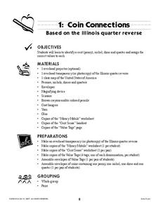
Coin Connections
A wonderful lesson on identifying the penny, nickel, dime, and quarter awaits your young mathematicians. They engage in a multi-session lesson which allows them to practice using the values of each coin in worksheets and activities...
Curated OER
National expansion of the United States (1815 to 1850), and its connection to local Illinois history.
Students discuss the importance of establishing the I & M Canal water route. They watch a video about the canal's history. They collect and write a personal migration story by interviewing a family member. They analyze trends and...
Curated OER
Traveling Cat Flown Home to Family
Students locate Wisconsin and Belgium on a world map, then read a news article about a cat that stowed away on ship from the U.S. to Europe. In this current events lesson, the teacher introduces the article with map and vocabulary...
Curated OER
Project Map: Latitude And Longitude Worksheet
In this latitude and longitude worksheet, learners find the coordinates of 14 cities around the world and use this information to complete 14 short answer questions. This worksheet includes online atlas web links.
Curated OER
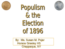
Populism & the Election of 1896
Populism and the rise and fall of the Populist Party are the topics of this presentation, which details the Presidential Election of 1896 and the role of silver. Detailing main points with clever political cartoons and informative maps,...
American Battlefield Trust
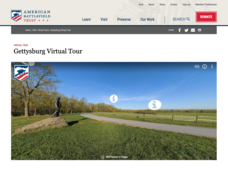
Gettysburg Virtual Tour
Step into one of the most iconic battlefields of the American Civil War with an educational interactive resource. Young historians learn about key moments, locations, soldiers, and turning points in the battle with a clickable map and...
ReadWriteThink
Biography Project: Research and Class Presentation
I Have A Dream ... that after the lesson, all individuals master the reading, writing, researching, listening, and speaking skills the biography project helps them develop. Martin Luther King, Jr. serves as a topic example for a model...
ProCon
Israeli - Palestinian Conflict
Many people think the best solution to the Israeli-Palestinian conflict is a two-state solution. After reviewing the available resources, scholars determine whether they agree with that approach. They analyze graphs and charts about...
Curated OER
Geography Grid
Fourth graders search a database to find images and scan and affix them on an 8-foot long map of the state of Illinois. They then use it as a basis for discussion.
Curated OER
The Civil War - Lesson #1 of 3
Eleventh graders design a newspaper, with images, that reflects historically accurate information about how Illinois residents felt and acted during the Civil War.
Curated OER
The Great Chicago Fire Survivors
Students compare and contrast the experiences of two survivors of the Great Fire of Chicago using a Venn Diagram.
Curated OER
The Great Chicago Fire Survivors
Students examine documents describing the experiences of survivors of the Great Chicago Fire, and write condolence letters.
Curated OER
Places We Live
Young scholars compare/contrast rural and urban communities, and view and discuss the images on the Illinois quarter. They discuss Abraham Lincoln's life, complete a chart and a Venn diagram comparing urban and rural settings, and create...
Curated OER
Natural Resources and Transportation in the United States
Students study thematic maps (included with the lesson) to determine possible relationships. They develop three hypotheses about the relationship. Students choose one of their hypotheses to explain. The explanation is to include reasons...
Curated OER
The Lincoln-Douglas Debates of 1858: Interactive Map Activity
Students utilize an interactive map to explore the 1858 Senate campaign in Illinois. They examine how factors such as population, transportation, and party strongholds can affect campaign strategies. Students write an essay discussing...
Curated OER
The Lincoln-Douglas Debates of 1858: Interactive Map Activity
Eleventh graders utilize an interactive map to explore the 1858 Senate campaign in Illinois and how factors such as population, transportation, and party strongholds can affect campaign strategies.
Curated OER
Scaling the Map
Middle schoolers practice determining map distances using the map scales. They discover how much an area represents on the map in relation to the actual area. They decide on the best place to build their cavern.
Other popular searches
- Map of Illinois
- Illinois Map Skills
- Illinois Map Symbols
- Illinois Map Lessons
- Student Map of Illinois
- Illinois Map Activity Sheets
- State of Illinois Map
- Illinois Maps and Flags


