Curated OER
Solar Cell Energy Availability From Around the Country
Students determine areas that are the most likely to produce solar energy by using NASA data. In this solar energy lesson students analyze plots and determine solar panel use.
Curated OER
Radiation Comparison Before and After 9-11
Using the NASA website, class members try to determine if changes could be detected in cloud cover, temperature, and/or radiation measurements due to the lack of contrails that resulted from the halt in air traffic after the attacks...
Virginia Department of Education
A-Mazing Plants
Have your young scientists questioned why plants grow a particular way? Through this learning opportunity, scientists gain firsthand knowledge about how plants develop and various factors that affect rates of growth as they bring plants...
Curated OER
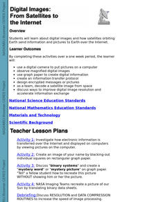
Digital Images: From Satellites To The Internet
Students examine digital images and how satellites orbiting Earth send information and pictures to Earth over the Internet. They use a digital camera to put pictures on a computer and decode a satellite image from space.
Curated OER
Geography Skills
Young scholars practice their geography skills. In this geography skills lesson plan, students locate, plot, and label places on maps and globes.
Curated OER
Rain, Rain, Go Away
Students conduct a number of experiments involving evaporation and condensation. They view and discuss a video about the water cycle and then design posters about the rain based on the book "Cloudy With A Chance of Meatballs".
Curated OER
How Mountains Shape Climate
Students use raw data to make a climatograph; they explain the process of orographic precipitation and the concept of a rain shadow.
Curated OER
Sunrise-Sunset
Learners gather data, make and share predictions about the time of sunrise ans sunset in their area. Patterns are analyzed and shared with students from other areas.
Curated OER
What is the Rock Cycle and Its Processes?
Geology beginners examine three different rock samples and determine their origin by their characteristics. By making and recording observations, they become familiar with features of igneous, metamorphic, and sedimentary rock types....
Curated OER
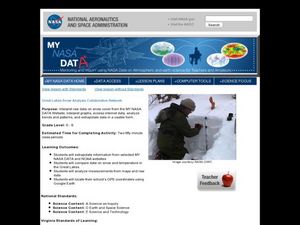
Great Lakes Snow Analysis Collaborative Network
Students interpret data on snow cover and analyze trend patterns. In this snow lesson students compare data and locate their school's GPS coordinates.
Curated OER
Analysis of Atmospheric Conditions for a High Mountain Retreat
Students examine the relationship between altitude, atmospheric pressure, temperature and humidity at a particular location. They practice science and math in real world applications. They write reports detailing their scientific...
Curated OER
High Mountain Retreat
Learners explore and analyze atmospheric conditions for a high mountain retreat. They examine the relationship between altitude, atmospheric pressure, temperature and humidity at a particular location. In addition, they write reports...
Curated OER
Counting on the Havoc of Hurricanes
Learners define and classify all the different ways in which numbers are used in forecasting and coping with the effects of a hurricane. They conduct research to compare and contrast these numbers as they apply to Hurricane Floyd and
Curated OER
Hurricane Frequency and Intensity
High schoolers examine hurricanes. In this web-based meteorology lesson, students study the relationship between ocean temperature and hurricane intensity. They differentiate between intensity and frequency of hurricanes.
Curated OER
Math is Everywhere!
In this everyday math skills pretest, students answer ten multiple choice questions based on their knowledge of everyday math skills such as estimation, addition, and measurement.
Curated OER
An Introduction to Sensors
Students research the International System (SI) of units of measurements. They make measurements using the metric system. They study key concepts used in building and use of sensors, how sensors work and their role in measuring...
Curated OER
Surveying the Land
Students explore the different kinds of maps and the purpose of each. For this Geography lesson, students work in small groups to create a map which includes the use of a map key.
Curated OER
Paint Property Experiments
Students identify various kinds of paints by using the scientific method. In this solvents lesson students collect data and identify paint samples while working in teams.
Curated OER
Laurence Yep's, Dragonwings
Students discuss vocabulary words and compare definitions. They read chapters 6-9 of the novel, Dragonwings, and discuss point of view, and complete a plot diagram. Then they review the four types of conflict and identify the conflicts...
Curated OER
Documents of Diversity
Eighth graders explore the cultural diversity in their own families. They examine the cultural profile and historical development of their own community through developing a walking tour, in booklet or web-based form.
Curated OER
City Life or Desert Life
Learners study the Anza-Borrego Desert. They complete the Patterns Project and survey the history of San Diego. They present their research to the class in the form of poster or report.
Curated OER
Scientist Tracking Network
Students correlate surface radiation with mean surface temperature of several geographic regions. They observe how these parameters change with latitude and construct an understanding of the relationship of solar radiation to seasonal...
Curated OER
Mapping West Virginia
Fourth graders explore West Virginia. In this Unites States geography lesson, 4th graders discuss the type of land and the cities in West Virginia. Students create two overlays, with transparencies, that show the natural land and the...


