Curated OER
An Introduction to GPS
GPS is a technological tool that has become available for use by the general public. Navigate the components and science involved in this remote sensing system. Here is a comprehensive collection of slides that would be valuable to share...
Curated OER
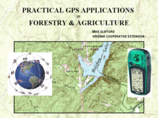
Practical GPS Applications in Forestry & Agriculture
An explanation of the Global Positioning System (GPS) and the Geographic Information System (GIS) is given in this presentation. Uses and applications are considered. How it works and sources of error are also touched upon. A large...
Texas Education Agency (TEA)
GIS GPS in Agriculture
Let's navigate! Using the informative resource, pupils perform a WebQuest on the benefits of Geographic Information Systems and Global Positioning Systems. Then, they write a brief summary describing how both systems benefit the...
Curated OER
TE Lesson: GPS on the Move
Middle schoolers participate in a scavenger hunt and a drawing activity to examine the use of Global Positioning Systems including a handheld GPS receiver for personal navigation. They practice using the GPS receivers while collecting...
Space Awareness
Where on Earth Am I?
Almost every phone has GPS installed, but a large number of teens don't know how the technology works. An initial activity illustrates how GPS determines a location on Earth. Scholars then apply trilateration procedures to a...
Curated OER
Where Am I: Navigation and Satellites
Students explore the concept of triangulation that is used in navigation satellites and global positioning systems designed by engineers. They determine ways these technologies can help people determine their position or the location of...
Curated OER
Lesson on GPS
Students investigate global positioning systems. In this technology and mapping lesson, students view a PowerPoint presentation in which they identify the features of a GPS, state its uses, and follow steps to find a waypoint.
Curated OER
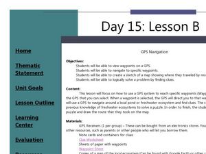
GPS Navigation
Students search for clues given a map and a GPS. In this technology lesson, students solve a puzzle using the clues they gathered in the activity. They write a short reflection about the activity.
Curated OER
Finding the Way
Students identify and research navigational tools used in deep sea explorations. They are introduced to a compass, the Global Positioning System and sonar technology and then describe their uses in underwater exploration.
Curated OER
GPS Treasure Hunt
Students explore geography by participating in a treasure hunt activity. In this Global Positioning System lesson, students define the terms latitude and longitude while utilizing an electronic GPS device. Students view a PowerPoint...
Curated OER
The Mathematical Dynamics of Celestial Navigation and Astronavigation
High schoolers explore the different methods used in celestial Navigation and astronavigation. In this math lesson plan, students construct a sextant and demonstrate how it works.
Curated OER
TE Lesson: Navigating at the Speed of Satellites
Students study the basic concepts of the Global Positioning System and how it increases the accuracy of navigation. They examine trilateration and how the speed of light is used to calculate distances.
Curated OER
Where Am I - Navigation and Satellites
Learners explore geography by completing a navigation activity in class. For this satellite positioning lesson, students define terms such as orbit, satellite, GPS and triangulation. Learners view diagrams of the Earth's orbit and...
Curated OER
Where Am I?
Extensive background on marine navigation is provided for you as the teacher. Assign groups to research marine navigation techniques and construct astrolabes. Resource links are listed for extension ideas. If you are teaching an...
PHET
Mapping the Ambient Magnetic Field
No GPS allowed! High school scientists continue to explore magnetic fields with a hands-on activity. After mapping the ambient magnetic field in the classroom and completing data analysis, they write about the similarities and...
Curated OER
Where is Here?
Young scholars are shown the very basics of navigation. The concepts of relative and absolute location, latitude, longitude and cardinal directions are discussed, as well as the use and principles of a map and compass.
Curated OER
GPS Scavenger Hunt
Pupils go on a GPS scavenger hunt. They use GPS receivers to find designated waypoints and report back on what they found. They compute distances between waypoints based on the latitude and longitude, and compare with the distance the...
Curated OER
It's About Time
Students investigate how Global Positioning Systems work and how and why GPS receivers make errors. They graph data points and apply estimation and prediction to real-life GPS situations, discuss time delay, and complete a worksheet.
Curated OER
GPS Art
Middle schoolers design their own logo or picture and use a handheld GPS receiver to map it out. They write out a word or graphic on a field or playground, walk the path, and log GPS data. The results display their "art" on their GPS...
Curated OER
GPS Treasure Hunt for Knowledge
Students examine themselves as being part of a global community. In this global community lesson, students investigate GPS systems. Students gain knowledge on how the device works. Students discover that satellites provide information...
Curated OER
GPS Ecosystem (Ecotone) Scavenger Hunt
High schoolers describe the characteristics of an ecotone. In this ecotone lesson, students pick out their area and describe the visual appearance, conditions, ecosystem, biodiversity, predators, prey, and trees in their ecotone. They...
NOAA
Calling All Explorers
Let's get moving! The second installment of a 2-part series of six adventures helps learners take part in individual explorations by sea and by land. After navigating the waters in an informative WebQuest, groups create and hide their...
Edgate
Why Map a Map?
After brainstorming reasons why Native Americans mapped their lands, your young critical thinkers will work together to review their ideas and determine the definition of a map. With today's extensive use of mapping technology and GPS...
Curated OER
Basic Mapping Skills
Establish and study the parts of a map with your class and, then they will work in small groups to create their own detailed map, including a legend. There are specific instructions to follow on what needs to be included.


