Curated OER
Around the Town
In the world of GPS, make sure your kids can still read maps and determine distances between locations. You will need neighborhood street maps, ideally of your class' home turf. Ask kids questions about different locations in relation to...
Curated OER
Where in the World?
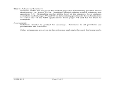
Students explore how GPS works, the mathematics behind the technology, and how GPS is used. They find positions in one and two dimensions, and participate in a WebQuest that explores how math is used to find a location on Earth using GPS.
Curated OER
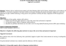
Growing Plants Using Space Technology
Students explain why delivering planet nutrients to crops at the correct time and amount is important. Students list possible negative effects of improper nutrient delivery. Students descrive two problems that farmers are now able to...
Curated OER
Finding our way
Tenth graders investigate the use of a GPS. In this math lesson, the students will use a GPS type system to determine positioning in two dimensions. They will complete questions out of a student workbook.
Curated OER
State Your Position
Middle schoolers practice using a global positioning system. They discuss the use of celestial objects as navigation points and its problems. They list the advantages and disadvantages of GPS as well.
Curated OER
Got Park? Or if you build it, they will come!
Students use GIS and GPS technology to evaluate, research, locate, and recommend where a new park should be located that benefit the community.
Curated OER
You want me to do what with this Dirt?
Eighth graders explore how to take soil samples and use GPS to determine the location of the site they have chosen to take the samples.
Curated OER
Lichens as Air Quality Indicators: A beginning lichen identification study (2003
Students use GPS and trees to explore lichens and air quality.
Curated OER
Testing Soils for Garden Planting
Sixth graders collect soil samples and record the location of the samples by using GPS.
Curated OER
Glacial Striation Investigation
Students operate a GPS unit to investigate the direction of glacier movement. They describe the motion of glacier movement by interpreting a graph. Students explain how scientists use glacier striations to determine glacier movement.
Curated OER
Donde en el mundo estas?
Students give & follow directions given in Spanish, using oral, written and graphics. They use maps, globes, atlases, and remote sensing, GIS, and GPS to acquire and process information about places.
NOAA
Calling All Explorers
Let's get moving! The second installment of a 2-part series of six adventures helps learners take part in individual explorations by sea and by land. After navigating the waters in an informative WebQuest, groups create and hide their...
Teach Engineering
What is GIS?
Is GIS the real manifestation of Harry Potter's Marauders Map? Introduce your class to the history of geographic information systems (GIS), the technology that allows for easy use of spatial information, with a resource that teaches...
Teach Engineering
Projections and Coordinates: Turning a 3D Earth into Flatlands
Introduce your class to map projections and coordinates, the basics for the work done in a GIS, with an activity that uses Google Earth to challenge learners to think about the earth's shape.
Curated OER
And a Star to Steer Her By: A Field Trip Guide for the Planetarium Show
In this field trip study guide for the planetarium show lesson, students construct a model of the Earth and describe the relative positions of the continents using latitude and longitude. Students construct a star chart to find...
Curated OER
Where is Here?
Students are shown the very basics of navigation. The concepts of relative and absolute location, latitude, longitude and cardinal directions are discussed, as well as the use and principles of a map and compass.
Curated OER
Finding the Way
Students identify and research navigational tools used in deep sea explorations. They are introduced to a compass, the Global Positioning System and sonar technology and then describe their uses in underwater exploration.
Curated OER
Places on the Planet: Latitude and Longitude
Students locate different places on globes and maps by learning about latitude and longitude lines. In this latitude and longitude lesson plan, students identify specific locations based on the degrees of latitude and longitude.
Curated OER
Space Age Technology Comes to Earth
Students explore eight career and technical areas and make connections with business, family and consumers, and technology. They examine and describe how agriculture and natural resources impact our quality of life. They explore and...
Curated OER
Where Am I: Navigation and Satellites
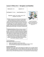
Students explore the concept of triangulation that is used in navigation satellites and global positioning systems designed by engineers. They determine ways these technologies can help people determine their position or the location of...
Curated OER
Fostering Geospatial Thinking: Space to Earth: Earth to Space (SEES)
Students locate and access data to help them with their science inquiry. In this geographical positioning lesson students evaluate and compare data sets.
Curated OER
U.S. History: What Happened Here?
Students apply the global positioning system to create maps of local historical sites. By collaborating with local historical groups, they research events and relate them to broader, national history. In addition to writing essays...
Curated OER
Rock Creek Water Quality
Ninth graders test water in a local creek using chemical kits and probes. They take GPS readings and digital photos. They calculate the Water Quality Index and create a spreadsheet of the test data.
Curated OER
Rock Creek Water Quality
Ninth graders test water in a local creek using chemical kits and probes. They take GPS readings and digital photographs. They calculate the Water Quality Index and create a spreadsheet.
Other popular searches
- Gps Navigation
- Gps Technology
- Using Gps
- Latitude and Gps
- Gps Device
- Gps Lesson Plans
- Gps Rubrics
- Gps Record
- Gis and Gps Technology
- Gis Gps
- Gps Maths
- Gps + Maths


