Curated OER
(S-1B) Global Climate, Global Wind Flow
Learners discuss how the horizontal transport of heat from equatorial regions polewards drives global wind systems.
Curated OER
Investigating the Climate System - Clouds
Here is a fabulous instructional activity on the Earth's radiant energy system. This amazing, 31-page document is chock-full of great activities, worksheets, lab sheets, quizzes, rubrics, and assessments. Learners model and explain cloud...
Curated OER
Environment: Wild Wind Direction
Students examine the different types of wind patterns. Using common materials, they construct weather vanes to measure and record wind direction over a two-week period. After analyzing the data, they draw conclusions about the...
Curated OER
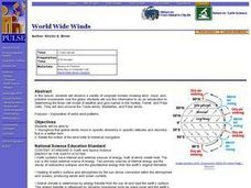
World Wide Winds
Learners recognize that global winds move in specific directions in specific latitudes and describe that in a written form. They relate the motion of the wind belts to historical navigation.
Curated OER
Winds Go Spinning Around
High schoolers simulate the Coriolis Effect to comprehend why winds in the Westerlies are prone to cyclonic and anti-cyclonic motion. They arrive at an explanation of processes that drive world wind patterns
Curated OER
Formation of Wind
Students correctly sequence the steps leading to the formation of wind, and describe the cause and effect relationships involved in the formation of wind. This task assesses students' abilities to classify, generalize, infer, interpret...
Space Awareness
The Intertropical Convergence Zone
Young scientists know it is hotter along the equator, but why is it also rainier? Through the process of completing two experiments and a worksheet, scholars discover the answer is the intertropical convergence zone. First, they...
NASA
Earth's Global Energy Budget
Introduce your earth science enthusiasts to the earth's energy budget. Teach them using an informative set of slides that include illuminating lecturer's notes, relevant vocabulary, embedded animations, colorful satellite maps, and a...
Curated OER
Wind Circulation, Surface Currents and Climate
Students describe connections between wind patterns, surface currents, and ocean climate zones. In small groups, they color the ocean climate zones in four different shades of blue. Students then answer questions like what four...
NOAA
A Laboratory Simulation of Ocean Surface Currents
Stimulate interest in ocean currents with a simulation. The first installment of a five-part middle school series teaches future oceanographers about the forces that interact to cause ocean currents. A simulation shows how wind and...
Curated OER
Understanding Weather
A succinct set of slides covers the main points for your weather unit. From the factors that contribute to conditions, to fronts and extreme occurrences, to the different types of clouds, numerous facts are listed in bullets. The only...
Curated OER
Clouds and the Earth's Radiant Energy System
Wow! What a lesson plan! Six terrific activities are described in great detail, in this 31-page document! Learners will model and explain cloud formation, sketch and identify certain cloud types, calculate and compare incoming and...
Curated OER
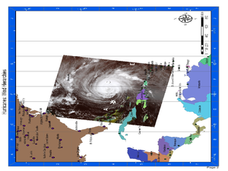
Hurricane Winds: A Spatial Hierarchy of Processes at Different Scales
In this earth science lesson, students study a satellite image of hurricane Isabel and write answers to 5 questions that follow. They match predictions to the map locations.
Curated OER
Puzzle it Out
Learners study the Earth's climatic system and construct a puzzle that names all of the pieces of the components involved. In this Climate instructional activity, students draw a picture on a puzzle piece depicting a specific...
Curated OER
Finding the Way
Learners identify and research navigational tools used in deep sea explorations. They are introduced to a compass, the Global Positioning System and sonar technology and then describe their uses in underwater exploration.
Curated OER
Investigating the Climate System: Energy, A Balancing Act
Earth science explorers design an experiment to demonstrate that the albedo of a surface affects its temperature. They test to find out if moisture on the surface affects temperature. They discover whether or not concrete or asphalt heat...
Curated OER
What Is El Niño?
Students access information at remote sites using telecommunications, identify impacts by reviewing past El Ni??o events, make and use scale drawings, maps, and maps symbols to find locations and describe relationships.
Curated OER
Cloud Observations using GLOBE Protocols
Students observe which of ten types of clouds are visible and how much of the sky is cloud covered. They see that by observing clouds, we can get information about temperature, moisture, and wind conditions in different places in the...
Curated OER
Global Water
Students collect data on their household water use and calculate how many gallons of water a person uses per day. They investigate how students in different parts of the world get their drinking water.
Curated OER
T3 Lesson Plan: Number 3
Sixth graders investigate local water. In this water cycle lesson, 6th graders take samples from surrounding water sources. Students record data from the samples, compare and graph the results.
Curated OER
Horrific Hurricanes
Students study hurricanes and how scientists predict them. In this hurricane lesson students read an article on hurricanes, complete an activity and take a quiz.
Glynn County School System
Terrestrial Planets
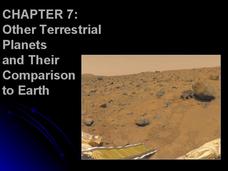
Mercury, Venus, Earth, and Mars are collectively known as the terrestrial planets. Although part of the same group, each planet has its own set of characteristics. Scholars explore the characteristics that make the planets unique and...
Curated OER
Fallout!
High schoolers plot the locations of fallout from two disasters that polluted much of the world's air. They plot the ash fallout from the 1980 Mt. St. Helen's eruption to see what the wind patterns in the United States look like overall....
Curated OER
You Can Die Here
Young scholars examine Death Valley including the amount of precipitation and winds that it gets. In this climate based lesson students explain the reasons for the amount of precipitation and windward patterns in Death Valley.

