Curated OER
Changing Planet: Permafrost Gas Leak
Pair earth scientists up to use an amazing online arctic portal mapping tool and Google Earth to analyze permafrost changes. They compare changes to data on atmospheric concentrations of methane to see if there is a correlation. Then...
Curated OER
Terrestrial Ecosystem Response to Climate Change
An extensive investigation of the Earth's climate changes awaits your environmental science classes. This top-notch presentation begins by looking at the history of Earth's climate and then predicts the impact on each major terrestrial...
National Wildlife Federation
Quantifying Land Changes Over Time in Areas of Deforestation and Urbanization
Is qualitative or quantitative research more convincing when it comes to climate change? In the eighth lesson during this 21-part series, scholars begin by performing a quantitative analysis of deforestation and urbanization. Then, they...
It's About Time
The Changing Geography of Your Community
Lead your class in exploring their local communities as well as the general environment. As they determine continental distributions by investigating minerals, rocks, and fossils located in their local region, pupils construct a...
Curated OER
Convergence with The Cay: Exploring Geographic Concepts Wrapped in a Story
Here's an awesome unit that uses The Cay as the anchor text. The 16-page packet is loaded with teaching ideas, activities, and suggested adjustments.
Curated OER
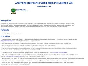
Analyzing Hurricanes Using Web and Desktop GIS
Young scholars analyze hurricanes. In hurricanes lesson, students use the Internet and GIS to analyze hurricanes. Young scholars view the National Atlas of Maps to discuss the direction hurricanes move. Students study the wind and...
Curated OER
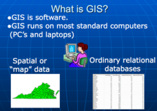
Applications of GIS
Don't be concerned that the title slide of this presentation mentions Virginia's Geospatial Extension Program; this slide show is very informative for any technology-focused curriculum when considering global information systems. It...
Curated OER
Leaf Stomata as Bioindicators of Environmental Change
Students perform an experiment to determine the stomaltal index on the upper and lower epidermis of two species of leaves. Stomatal densities change in response to changing atmospheric levels of carbon dioxide and to annual rainfall.
Curated OER
Mountain Barriers
Students examine geographical change. In this mountain barriers instructional activity, students conduct an experiment to discover how mountains affect surrounding land. Students draw conclusions on how change in land affects plant and...
Curated OER
Geography 12
Geography is such a fascinating subject for learners of all ages. Prepare learners with good guiding questions, which they can use while reading their texts. Each of the provided 13 questions requires a full paragraph response on the...
NASA
Climate Change Inquiry Lab
With global temperatures on the rise faster than ever recorded, the effects of a heating planet could be devastating. Allow learners to discover just what the world is in store for if the warming continues through a series of videos, a...
National Wildlife Federation
I Speak for the Polar Bears!
Climate change and weather extremes impact every species, but this lesson focuses on how these changes effect polar bears. After learning about the animal, scholars create maps of snow-ice coverage and examine the yearly variability and...
Curated OER
Exploring Energy with GIS
Learners examine GIS technology as it is used to locate energy sources. In this GIS activity, student access an assigned website to locate a series of lessons using the GIS software. They use the maps that are located on the primary...
Curated OER
Land Use Change Over Time
Young scholars use historical aerial photographs and current aerial photographs to compare the change over time to the land. In this land changing lesson plan, students analyze, compare, contrast, and list the land change in their own...
Curated OER
Regions Change
Middle schoolers examine how geography can have an impact on change in a region. They discuss what their local area might be like in 50 years, and in pairs, select a situation and write a short story to describe how it changed from one...
Curated OER
Climate Change
Students discuss global warming. In this global warming lesson, students read an article about global warming and list five things they learned. Students work in small groups to compare what they wrote. Students illustrate one of the...
Curated OER
Time For Change
Students examine and discuss the inventions and changes created by the Industrial Revolution. They create posters or clay models about inventions, write paragraphs about the advantages and disadvantages of the changes, and develop a...
Curated OER
Climate Shifts
Eight slides of information related to shifts in the climate make up this presentation. The vocabulary and concepts displayed are geared toward high school meteorology learners. Content is not cohesive from slide to slide, but the...
Curated OER
Tools of the Trade: The Use of Geographic Tools
Learners examine the tools of demographic analysis and apply them to real-world situations. They analyze maps, define terminology, and write an information paper for the appropriate government agency to recommend an action or policy change.
Curated OER
The Missouri Compromise of 1820
Students use a map of the Missouri Compromise to explain the geographical changes it brought to the U.S. and why the changes provoked a debate over the expansion of slavery in the U.S.
Curated OER
Image Classification
Students explore what are "multi-spectral" or "multi-band" images? They investigate how landscapes change over time- at least over the time-span of satellite imagery, particulary due to human influences. Students explore how to train...
National Wildlife Federation
Get Your Techno On
Desert regions are hotter for multiple reasons; the lack of vegetation causes the sun's heat to go straight into the surface and the lack of moisture means none of the heat is being transferred into evaporation. This concept, and other...
Curated OER
Things w/ Geographic Names Quiz
For this online interactive geography quiz worksheet, learners respond to 31 identification questions about products or things with geographic names. Students have 4 minutes to complete the quiz.
Curated OER
Geographically Speaking
Students play a matching game to reinforce the retention of vocabulary words. In this geography lesson, students watch a PowerPoint to define vocabulary words associated with geography, play a memory game with the words, and write an...


