Curated OER
Become the Meteorologist
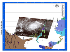
Seventh graders analyze the data from Hurricane Tracking maps. For this earth science lesson, 7th graders plot data points on their maps and predict where the storm will most likely hit. They compare their prediction with the actual...
EduGAINs
Go H2O! Investigating Residential Water Systems
Before your learners excuse themselves to get a drink at the water fountain, prompt them to think about where that water comes from. A middle school science lesson encourages groups to research their community's source of drinking water,...
Curated OER
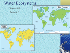
Water Ecosystems
Freshwater and Saltwater ecosystems are the focus of this Earth Science PowerPoint. Presentation is full of interesting facts, photographs, and maps. A slide with review questions appears at the end of the presentation. Very nice!
Curated OER
Take Me to the River! Using the Black River for Earth Science Review
Ninth graders use maps to identify landscape regions and drainage patterns producing the Black River. They create PowerPoint presentations pertaining to the Black River watershed, its geologic history and highlighting safe rafting...
Curated OER
Journey Through Earth
Students study plate tectonics. In this plate tectonics lesson students build a cutaway scale model of the Earth.
Curated OER
Earth Viewer
Pupils explore the Earth. In this space lesson, students view the " Earth and Moon Viewer" web site and complete a related worksheet.
Curated OER
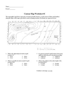
Contour Map Worksheet #1
Being able to read a topographic map is a standard in middle school earth science units and imperative for outdoor enthusiasts. As you introduce learners to this skill, you can assign this as an assessment or reinforcement. Pupils view a...
Curated OER
Weather
In this earth science worksheet, students use the clues given at the bottom of the sheet to solve the crossword puzzle related to weather. They identify various cloud types and how they are formed. Students also identify atmospheric...
Curated OER
Hurricane Frequency: Identifying Regions with Similar Numbers of Hurricanes
In this earth science instructional activity, students answer 6 questions about the hurricane map and data provided. They create a data table based on the information provided on the map.
Curated OER
Hurricane Winds: A Spatial Hierarchy of Processes at Different Scales
In this earth science lesson, students study a satellite image of hurricane Isabel and write answers to 5 questions that follow. They match predictions to the map locations.
Curated OER
Solar System and Planets
Students identify the main components of the solar system. In this earth science lesson, students order the planets according to their distances from the Sun. They differentiate planets from dwarf planets.
Curated OER
Shaky New Zealand
Students explore Earth science by building a model in class. In this tectonic plate lesson, students identify the impact tectonic shifts have on humans and animals and where the plates and faults lie under New Zealand. Students examine...
Curated OER
Thunder and Lightning
In this earth science worksheet, students read and study about the formation of lightning and thunder using online resources. They complete 8 short answer questions that follow.
Curated OER
The Weather
Students explore earth science by reading articles in class. In this weather identification lesson, students analyze weather science articles on the Internet and view their own local weather patterns as well. Students define a list of...
Curated OER
Volcanoes and Plate Tectonics
For this earth science worksheet, students read and study about divergent and convergent boundaries, tectonic plates and volcanoes to complete 1 data chart 7 short answer questions.
Curated OER
Factors Affecting Ocean Currents
Students design and conduct an experiment to determine the effect of salinity and temperature changes in the movement of ocean currents. In this earth science lesson, students record observations and collect data. They share their...
Curated OER
Hands on Biome-Building: Build a Forest
Learners explore Earth science by identifying environmental factors. In this biome lesson, students discuss the importance of a functioning ecology and design a biome diorama. Learners utilize images of trees and plants which represent a...
Curated OER
Plotting Earthquakes
Students plot earthquakes on a map. In this lesson on earthquakes, students will explore recent earthquake activity in California and Nevada. Students will plot fault lines and earthquake occurrences on a map.
Space Awareness
Valleys Deep and Mountains High
Sometimes the best view is from the farthest distance. Satellite imaging makes it possible to create altitude maps from far above the earth. A three-part activity has your young scientists play the role of the satellite and then use...
Texas State University
Earth: Deposition and Lithification
Geology geniuses analyze sediment samples with a hand lens and sort according to physical characteristics. They also learn about the processes of cementation, compaction, and lithification within the rock cycle. The lesson plan is...
Laboratory for Atmospheric and Space Physics
Charting the Progress of New Horizons
In 2006, New Horizons began its mission to fly to Pluto. As it continues its journey, scholars track its progress with the help of an informative website, all the while reinforcing measurement concepts with the construction of a scaled...
Howard Hughes Medical Institute
Lesson 6: Biomes and Landscapes
Aside from the amazing animals in Gorongosa National Park, what else is there to discover? The sixth installment in an eight-part themed series contains an interactive map where scholars can learn more about the geographic features of...
Laboratory for Atmospheric and Space Physics
Planetary Distances on the Playground
There's no need to stay inside; get out of the classroom and create a scaled map of the solar system on your playground field! In collaborative groups, scholars identify the distance between the sun and other planets, place planet...
Curated OER
Plate Tectonics: Sixth Grade Lesson Plans and Activities
Here is a set of pre-lab, lab, and post-lab lesson plans on plate tectonics. After completing the previous labs on volcanoes and earthquakes, sixth graders use the gained knowledge to explore plate boundaries and the movement of...


