Curated OER
Use Google Maps to Teach Math
Capture the engagement of young mathematicians with this upper-elementary math lesson on measuring time and distance. Using Google Maps, students first measure and compare the distance and time it takes to travel between different...
Curated OER
Create a Math Road Trip
Learners create a Road Trip. They work in small groups. Students are given a road map for each group. They plan a road trip between two cities on opposite edges of the map, estimating a reasonable distance to travel each day. Learners...
EngageNY
Distance on the Coordinate Plane
Scholars learn how to find the distance of vertical and horizontal line segments on the coordinate plane in the 19th installment of a 21-part module. The use of absolute value comes in handy.
Curated OER
Lesson 3: Seven Day Road Trip
Students plan a seven day road trip. In this travel lesson, students plan a driving trip that includes five major cities or attractions in Florida or another state of their choice. They show the trip on a map, calculate distances that...
Curated OER
Scale Skills
In this mapping skills activity, students read an excerpt that describes three different types of scales and how to calculate distance on a map. They respond to two short answer questions using the map provided on the sheet and to...
Curated OER
Playground Mapping
Students convert their physical models of a playground from a previous lesson into a map of the playground that includes a scale and key. They examine and discuss examples of maps, view an image to map photo essay, and create a map using...
Curated OER
Trade Along the Silk Roads: A Silk Road Encounters Resource
Students review information on the Silk Road from previous lessons. Using maps, they create an illustrated altas of the Silk Road and the goods traded on it. They write an essay on the Silk Road's importance and how both good and culture...
Civil War Trust
Map the Civil War
Mapmaking was a very important element in successfully planning attacks on enemies during the Civil War. Guide pupils through the process of pacing to find the average length of their steps, measure the distance between one object to the...
Curated OER
Ease on Down the Road
In this math quantities activity, students utilize a variety of strategies to strengthen their concepts between two quantities while experiencing family road trips. Students calculate miles per hour, cost of gasoline per gallon, marking...
Curated OER
Map the Civil War
Students explore the Civil War through original maps. In this mapping lesson, students calculate distance and show it on an original map. Students examine the type of landscape and its landmarks and draw symbols on the map.
Royal Geographical Society
An Introduction to Maps
First graders are introduced to a variety of maps such as globes, street maps, atlases, and different types of floor plans. The focus of the lesson plan requires individuals to create their own plan of the classroom using the PowerPoint...
Curated OER
A Road Map for the Roman Empire, Ca. 250 CE
Students consider how empires are created and sustained, examine Peutinger Table as a whole and in detail as tool of empire for Rome, c. 250 CE, create ancient time-distance travel chart that synthesizes series of strip maps, and...
Curated OER
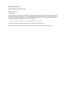
Mt. Whitney to Death Valley
This is an intriguing problem that brings together real-world data, technology, and mathematical problem solving. If visibility wasn't an issue, could you see from the highest point in the lower 48 states, Mt. Whitney, to the lowest...
Curated OER
Map Studies
Students study maps and use web based activities to develop their mapping skills. In this mapping skills lesson, students use the internet to define cartography they make a list of information regarding a typical road map and explain the...
Curated OER
Learning to Read a Regional Map
Students locate the local community, surrounding communities and major geographic features of the SE Utah and the Four-Corners region on a map, after receiving direct instruction.
Curated OER
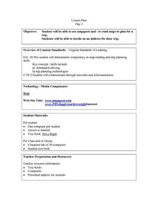
Plan a Trip
Young scholars plan for a trip. They use map quest and / or road maps to decide on an address for their trip. They determine the mileage, lodging, gasoline to be used, shortest distance and fastest distance.
Curated OER
Introducing Topographic Maps: Guiding Students from Concrete Models to Graphic Representations
Students interpret topographic maps and infer human activity as it is influenced by the landscape.
Curated OER
Calculating Distance On Maps
Fourth graders determine the mileage from the local community to various scenic attractions in the Four-Corners-Region. They receive direct instruction and carry out activities in cooperative group settings.
Curated OER
Where Did We Go on Holiday This Year?
In this differentiated whole-group activity worksheet, students list all the places they visited over the summer, record the places on a flip chart, calculate the distances on a road map and graph the data they collect.
Curated OER
Map of the Ottawa Valley
Students locate Ottawa Valley on a map. They then answer questions in reference to the map such as: What was the first use of timber in the Ottawa Valley?, What occurred first in Gatineau?, and On the Ontario side of Ottawa River, how...
Concord Consortium
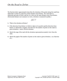
On the Road to Zirbet
The road to a greater knowledge of functions lies in the informative resource. Young mathematicians first graph a square root function in a short performance task. They then use given descriptions of towns and the key features of the...
Concord Consortium
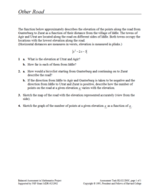
Other Road
Take the road to a greater knowledge of functions. Young mathematicians graph an absolute value function representing a road connecting several towns. Given a description, they identify the locations of the towns on the graph.
Curated OER
Introducing the Concept: Proportions
Students measure distances. In this proportions lesson, students use a map to find how far it is between different cities. Students use their knowledge of measurement, multiplication and fractions to find the distances.
Curated OER
Add and Subtract with Hudson River shipping
Rivers aren't just a place for animals to live, they also provide industrial transportation. The class will examine the Hudson River on a map, discuss all the commercial vessels that use the River to transport materials, then complete a...


