Curated OER
From Maps to Models
Young scholars explore watersheds through the use of a topographic map. They observe topographical maps and discuss their characteristics. In groups, students create a model clay island and make a topographical map of it. Afterward,...
Curated OER
Maps
Maps, globes, and computer software aid young explorers as they locate state capitols, major cities, geographic features, and attractions for states they are researching. They then use desktop publishing software to create a map to share...
Curated OER
Make a Classroom Map
Young scholars map the items in their classroom to explain the importance of coordinate systems.
Curated OER
Weather Map Challenge
In this weather worksheet students use a weather map to answer given questions. Students answer questions using map symbols and make predictions based on map. Students create additional questions with answers using the same map.
Curated OER
North Carolina Salt Dough Map Social Studies Project
In this lesson, North Carolina Salt Dough Map, 4th graders create a salt dough map of North Carolina, Students use dough to form the shape of the state of North Carolina. Students label the three regions of North Carolina and all of...
Curated OER
Classifying Matter: A Concept Map
In this classifying matter worksheet, students create a concept map to show the relationships between given terms such as elements, matter, substances and solutions.
Curated OER
Fairy Tale Maps
Students study direction as they listen to the stories of Little Red Riding Hood and The Jolly Postman. In this cardinal direction lesson, learners create a map to show the path Little Red Riding Hood took in the story and label the path...
Curated OER
Play Doh Map of Your State
Students create a state map using Playdoh. In this hands-on state geography instructional activity, students work in groups to form a three-dimensional map of their state using Playdoh made at home following a (given) recipe. Students...
DiscoverE
LIDAR: Mapping with Lasers
We would be lost without maps! How are they made? Introduce junior topographers to LIDAR technology with a fascinating activity. Set up a mock city, then have learners operate a laser measure to determine the shape of the landscape using...
Baylor College
Mapping the Spread of HIV/AIDS
Where is HIV/AIDS most prevalent and what are the current trends regarding HIV? Have groups work together to map the world's HIV/AIDS rates, then create a class map with all the data. Lesson includes cross-disciplinary concepts including...
Curated OER
Semantic Mapping In Biochemistry
Students create a semantic map utilizing material learned in previous biochemistry lessons. Their maps will include material on the four types of organic compunds previously explored in class.
Curated OER
Creating Mind maps
Learners discuss their impressions of Africa. They work in groups to create a mind map. Students are explained what a mind map is. They discuss what they think are the defining features of the continent of Africa. Learners create a giant...
Curated OER
Studying Mind Maps Created at Other Schools
Students explore Africa and mind maps created by students from other schools. They discuss Africa and the number of countries, diversity of language, cultures, races, religions, and lifestyles and in groups study a mind map from another...
Curated OER
Mapping My Spot in History
Young scholars create their own town's history. They place themselves on the map in a literal as well as figurative sense. Students produce portions of an updated version of an early twentieth century panoramic map. Young scholars gather...
Curated OER
Orienteering - Lesson 8 - Map and Compass
Put your high schoolers' orienteering skills together. Reading a compass and reading a map. In this assignment the class will use their compass and the map scale to determine the distance of a given route. If they finish their...
Curated OER
Where Do I Fit In?: Mental Mapping Student Neighborhoods
Students examine geography through the themes of place, human/environment interaction, and region. They create a mental map of their own neighborhood, analyze their role in the world, and design a neighborhood that reflects their needs.
Curated OER
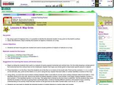
Map Grids
Students examine how grids are created and used to locate positions of objects or features on a map.
Curated OER
Student Exploration: Building Topographic Maps
In this earthquake exploration worksheet, students complete 2 prior knowledge questions, then use "Building Topographic Maps Gizmo" to conduct several activities, completing short answer questions when finished.
Curated OER
Mapping Out the Story
Discuss the reading comprehension strategy of summarization with your elementary schoolers! They read a chapter from their social studies textbook, Regions Near and Far, and create a map, or word web, for the chapter. They identify...
Curated OER
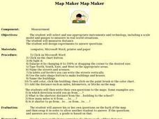
Map Maker, Map Maker
Map maker, map maker, make me a map! Your class can sing this tune as they work to create their own regional maps by taping paper to the wall, projecting an overhead transparency image, and tracing. Where this lesson plan intends for the...
Curated OER
Understanding Topographic Maps
Underclassmen create a cone-shaped landform and then draw a contour map for it. Then they examine a quadrangle (which was easily located with an online search), and relate it to what they experienced. The accompanying worksheet is...
Curated OER
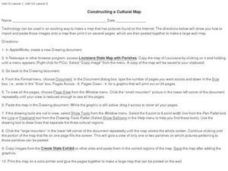
Constructing a Cultural Map
In this constructing a cultural map worksheet, students use cut and paste technology to make a map of Louisiana that has pictures from the Internet.
Curated OER
Landscape Picture Map: Making a Map Grid
Learners create a map grid system. In this map lesson, students discuss how mapmakers use a grid system to make giving directions easier. Learners learn how the grid system works and create a grid system on their landscape pictures.
Curated OER
Report Writing: Creating and Using a Mind Map
Walk your class through the process of creating a mind map. Learners begin with a specific topic and add details. Then, they use their mind maps to write a report. This is a creative approach to teaching writing.
Other popular searches
- Reading and Creating Maps
- Creating Maps Social Studies
- Creating Maps of Landforms
- Creating Maps for Vacation
- Teaching and Creating Maps


