Hi, what do you want to do?
National Geographic Kids
National Geographic Kids: The Netherlands
Click-through facts-and-photo file about the geography, nature, history, people, culture, and government of the Netherlands. Includes a map of the country that pinpoints its European location on the western coast of the continent.
The History Cat
The History Cat: Containing Communism
Describes how the Soviets under Stalin managed to infiltrate Eastern European countries and establish Communist governments, dividing the continent into East and West with a symbolic Iron Curtain separating the two. America scrambled to...
Other
The True Size
In an effort to illustrate the spatial concepts of maps, this program provides the ability to select countries or continents and move them over others to better visualize the sizes of each of them.
American Geosciences Institute
American Geosciences Institute: Earth Science Week: Ring of Fire
Students identify plate boundaries as well as continents, countries, and bodies of water to become familiar with an area known as the "Ring of Fire."
Houghton Mifflin Harcourt
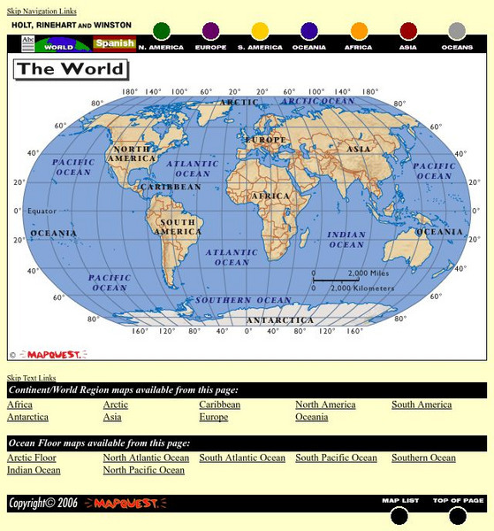
Holt, Rinehart and Winston: World Atlas
This site provides geographic maps of the world by continent, ocean, and country.
ClassFlow
Class Flow: Maps and Globes
[Free Registration/Login Required] This flipchart reviews map and globe features. The seven continents, four oceans, and city-county-state-country relationships are also explained. Student assessment on directions is included.
abcteach
Abcteach: Social Studies: Places
[Free Registration/Login Required] Generate graphic organizers, report forms, Venn diagrams, shape books and much more on the continents of the world. Sub-directories include links to games, maps, word searches and comprehension...
University of Texas at Austin
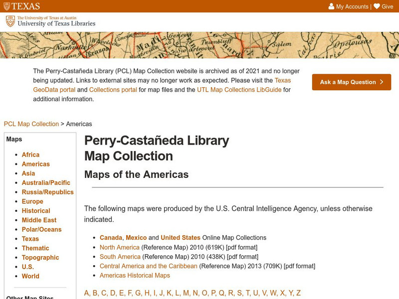
Univerisity of Texas: Maps of the Americas
A large collection of maps of all countries in the Americas including relief maps, political maps, and reference maps.
Other
If It Were My Home: Welcome to ifitweremyhome.com
The lottery of birth is responsible for much of who we are. If you were not born in the country you were, what would your life be like? Would you be the same person? IfItWereMyHome.com is your gateway to understanding life outside your...
Wikimedia
Wikipedia: South America
Offers an overview of the continent of South America, featuring information about politics, geography, and population statistics. Click on the name of a country to discover more details.
Other
Braintrack: Universities Worldwide
This site is a comprehensive index to universities all over the world, organized by continent and country.
National Endowment for the Humanities
Neh: Edsit Ement: Go West: Imagining the Oregon Trail
A 2,000-mile trek across a continent-with no idea what awaits you on the other side. Tell your students to put on their traveling shoes and prepare for the journey of their lives! In this lesson, students compare imagined travel...
World Geography Games
World Geography Games: Countries: World
Test your knowledge of world geography with this learning game.
Other
Just Maps: World Maps
An index of maps and flags of countries throughout the world. Also provides political maps, time zones, population, and religious maps of every region of the world.
Enchanted Learning
Enchanted Learning: Zoom School: Africa
What continent is bordered by the Atlantic Ocean, Indian Ocean, Red Sea, and the Mediterranean Sea? Click here and find out. Explore art, animals, flags, crafts, explorers, geography, and more to learn about Africa.
Other
Escolar: Mapas De Continentes, Mapas Politicos Y Mapas De Paises
Check out this sizable selection of different maps of continents, countries, and states. Each page will give you additional information about the particular country or state.
Quia
Quia: World Capitals Matching
Use this website to practice matching world capitals and the corresponding country.
Quia
Quia: World Capitals Concentration
Use this website to practice matching world capitals and the corresponding country in a concentration game type format.
ClassFlow
Class Flow: Our Great Big Beautiful Planet
[Free Registration/Login Required] This flip chart teaches the continents and oceans.
ClassFlow
Class Flow: World Regions
[Free Registration/Login Required] This flipchart is designed to quiz students about their general understanding of regions around the world and includes countries that are in many of these regions. Use as a pre-test or review with...
US Department of State
U.s. Department of State: Youth Passport Activity Book [Pdf]
Students will virtually travel the world and complete a passport. Activities include researching flags of countries, stamps, coloring, and completing a puzzle. At the end of the lesson, students will have their very own simulated passport!
Other
Space Hopper: Where Is This?
Study the place shown in the photograph. Where is it on the big map? Try interacting with the image or slideshow to look for more information about the location. Find the location on the map and click the red dot to make your choice,...
World Geography Games
World Geography Games: Regions
Identify the world's major regions through this interactive quiz. Regions include the Great Plains, Southeast Asia and Micronesia
Other
Mama Lisa's World: Songs & Rhymes of All Nations
This resource was organized by a mother who wanted to give people a sense of the nursery rhymes and songs from around the world. Find rhymes and songs from every continent, in many languages--you can even listen to some online.


