Curated OER
Mapping Worksheet #1
Get out the compass and a pencil its time to use a coordinate grid to practice mapping skills. Young cartographers use the prompts and provided grid to plot locations, draw parallel lines, and determine distances between points.
Scholastic
Volleyball Road Trip
Review coordinate mapping with your young geographers by matching cities on a volleyball team's road trip itinerary to their appropriate coordinate locations.
Teach Engineering
What's Wrong with the Coordinates at the North Pole?
Here is an activity that merges technology with life skills as individuals use Google Earth to explore the differences between coordinate systems and map projections. The self-guided activity is the fourth segment in a nine-part unit....
PBS
Working with Coordinate Planes: Activities and Supplemental Materials
Seven activities make up a collection of supplemental materials to reinforce graphing on a coordinate plane. Worksheet objectives include plotting coordinates within single and four quadrants, measuring straight and...
Curated OER
Topographic Maps Worksheet
In this geography skills worksheet, students respond to 37 multi-part questions that require them to read and interpret topographic maps.
Curated OER
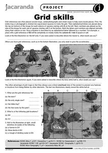
Grid Skills
In this geography worksheet, students use grid references on a map to locate places in the pictures given. They also identify another advantage of using a grid map, which they have an overhead view of the content to prevent any features...
Curated OER
Where Am I? Map Activity
In this map activity worksheet, students determine which countries are shown on a set of 16 maps, then read facts about each country designed to help with a report on that country.
National Center for Case Study Teaching in Science
Mask of the Black God
Finally, an astronomy lesson for the high schooler! Explorers are able to read star maps for finding objects in the night sky by determining celestial coordinates. In particular, they locate the Pleiades and read about a Navajo legend...
Curated OER
States and Capitals - Lesson 4 - U.S. Political Map
For this U.S. state capitals worksheet, students identify the capital cities of the 50 states using the latitude and longitude coordinates provided.
Corbett Maths
Enlargements with Fractional Scale Factors
Enlargements make it bigger, right? A video shows viewers how to perform a basic dilation with a fractional scale factor. They learn how to use the scale factor to find the location of the transformed vertex by multiplying the horizontal...
Curated OER
Latitude and Longitude
In this latitude and longitude worksheet, learners find a set of 7 coordinates on a map. An answer key is included; a website reference for additional resources is given.
Mathed Up!
Translations
Introduce translations as transformations that move figures in horizontal and vertical distances with a video that shows how to translate the figures. A second video covers how to determine the translation that has occurred. Pupils...
EngageNY
Similarity
Use the coordinate plane to show two figures are similar. The lesson incorporates congruence transformations and dilations to move a figure on to another figure. Pupils determine that if a similarity transformation exists...
EngageNY
Informal Proofs of Properties of Dilations
Challenge the class to prove that the dilation properties always hold. The lesson develops an informal proof of the properties of dilations through a discussion. Two of the proofs are verified with each class member performing the...
Curated OER
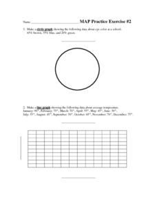
MAP Practice
In this geometry activity, students create circle, line and bar graphs using different comparisons of events. There are 24 questions with an answer key.
Curated OER
Musical Plates-Earthquakes
In this plotting earthquake data worksheet, students use a large world map and given web sites showing the latitude and longitude for the epicenter of recent earthquakes around the world. Students plot 2 weeks of earthquake data...
Geophysical Institute
Latitude and Longitude with Google Earth
Travel the world from the comfort of your classroom with a lesson that features Google Earth. High schoolers follow a series of steps to locate places all over the earth with sets of coordinates. Additionally, they measure the distance...
Curated OER
Expressing Geometric Properties with Equations
Algebra and geometry are not interchangeable. Demonstrate why not with a series of problems that deal with the equations of circles and equations of lines that meet specific criteria.
Curated OER
Plotting Points
In this coordinate pairs activity, students learn to plot points on a graph. Students study the examples and then complete 20 questions. This is intended as an online activity, but may be completed with pencil and paper.
Curated OER
What A Tombstone Can Tell Us
For this coordinates worksheet, students determine the coordinates to visit a cemetery. Students determine 18 coordinates on this worksheet.
Curated OER
Latitude
In this latitude worksheet, students answer questions about latitude that include absolute locations of countries and coordinates. Students complete 12 questions.
Curated OER
Student Exploration: Summer and Winter
In this recognizing the seasons online/interactive worksheet, students explore the Earth's positions and determine the summer and winter season. Students answer 21 short answer questions
Curated OER
The Compound-Complex Sentence
After reading a series of definitions and studying examples, partners craft five of their own compound-complex sentences.
EngageNY
The Geometric Effect of Some Complex Arithmetic 1
Translating complex numbers is as simple as adding 1, 2, 3. In the ninth lesson in a 32-part series, the class takes a deeper look at the geometric effect of adding and subtracting complex numbers. The resource leads pupils into what it...


