Curated OER
Identifying Watersheds with Topographic Maps
Students model a watershed and delineate one using topographic maps. In this hydrology lesson, students use aluminum foil to model a landscape and observe how water moves on it. They also observe the features of a topographic map and use...
Curated OER
Red River Contours
In this contour map worksheet, students use a given contour map to answer 16 questions about the area shown on the map. Topics include the gradient from one spot to another, the elevation, the direction of the flow of the Red River, the...
Curated OER
Common Themes
Tenth graders test usefulness of a model Earth by comparing its predictions to observations in the real world. In this landforms lesson students construct an island from a contour map using model clay then analyze the landscape features...
Curated OER
Contour Map Worksheet #4
There are only four questions here. There is a contour map of Cottonwood, Colorado and the creek that crosses it. Earth scientists tell in what direction the creek flows, identify the highest elevation on the map, draw a topographic...
Curated OER
Outdoor Education; Maps, Elevation
Ninth graders use online topographical maps to fill in a chart regarding elevation and contour lines.
Curated OER
Building a Topographic Map from Benchmarks
In this map worksheet, students draw a topographic map using benchmark points. They draw contour lines showing 20 foot intervals.
Curated OER
Picture This: Telling Our Tales with Self-Portraits
Students view a number of self portraits to determine the importance of pose, setting, clothing, and props in a piece of artwork. They design a self-portrait emphasizing the use of contour lines.
Curated OER
Rain Rain Go Away!
First graders are introduced to and practice the concept of melody when connected to music. They distinguish and demonstrate melodic contour as well as sing a song with accurate melody. Each student discriminates between the pitches and...
Curated OER
Melody II
In this music worksheet, students identify melody as a string of notes that has a rhythm. They identify which notes given are melody and/or harmony. Students also map the contour of "Sweet Georgia Brown."
It's About Time
Volcanic Landforms
Did you know the word volcano comes from the name of the Roman god of fire, Vulcan? During this activity, scholars make a topographic map, interpret topographic maps, and infer how lava will flow based on their analysis.
Curated OER
What Do Maps Show?: Lesson 4 How to Read a Topographic Map
Students examine the use of topographic maps as two dimensional representations that show elevations and slopes with contour lines. They read maps of the Salt Lake City, Utah area and complete the associated worksheets that show map...
Curated OER
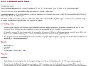
Mapping Mount St. Helens
Students study topographic maps and contour lines and construct a simple three-dimensional model of Mount St. Helens before the May 18, 1980, eruption. They use topographic map skills to interpret the impact of the May 18, 1980, eruption...
Curated OER
Complex Analysis: Residues and Real Integrals
For this integral worksheet, students evaluate contour integrals and real integrals. This two-page worksheet contains approximately three problems. Some explanations and definitions are provided.
Curated OER
Math 312 Spring 98: Cauchy's Integral Formula
In this integral formula activity, students find the area of odd shapes by using the contour integration formula. They compute the area enclosed by an ellipse. This two-page activity contains three problems.
Curated OER
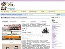
Classic Still Life Drawing
Provide your young artists with an opportunity to study the masters and their techniques to become skilled at drawing still life. They discuss and view images from artists like Degas and Michelangelo, practice drawing techniques such as...
Curated OER
Math 312 Spring 2004: Generalized Cauchy Integral
In this Cauchy integral instructional activity, students consider contour integrals that have been traversed different directions and evaluate it for various contours. This two-page instructional activity contains three problems.
Curated OER
Math 312 Spring 2004 Bonus Quiz. Integrals
In this integral worksheet, students derive a formula for the value of a contour integral. They explain the method of choice. This two-page worksheet contains five problems.
Curated OER
Bonus Quiz Cauchy Principal Value
In this Cauchy Principal worksheet, students identify the value of a function by evaluating the contour integral. This two-page worksheet contains one problem.
Curated OER
Framing the Landscape
Students draw their own drawings after learning about composition of drawings and lines. In this drawing lesson plan, students learn about different lines they can use while drawing. Then they go outside and draw their own.
Curated OER
Put Your Face on the Map
Young scholars investigate topography and contour lines by examining a human face. In this mapping lesson, students create a plaster cast of a face and create a map of the contours of the face one centimeter at a time. Young scholars...
Curated OER
Will There Be a White Christmas This Year?
Learners examine historical weather data, and create map and color key that illustrates the likelihood of a white Christmas in different locations across the United States.
National Geographic
Mapping the Shape of Everest
With Mount Everest as the motivator, your earth science class learns about topographic maps. Begin by showing a film clip from The Wildest Dream: Conquest of Everest, featuring fearsome virtual imagery of a path up world's tallest peak....
National Gallery of Canada
Taken Out of Perspective
Art does not always have to look perfectly realistic. Play with proportion and shape by stretching images. Pupils study works of art by Picasso, Cézanne, and Monet before selecting a photograph to adapt. They use a distorted grid to...
Space Awareness
Valleys Deep and Mountains High
Sometimes the best view is from the farthest distance. Satellite imaging makes it possible to create altitude maps from far above the earth. A three-part activity has your young scientists play the role of the satellite and then use...
Other popular searches
- Contour Maps
- Blind Contour
- Geography Contour Lines
- Contour Maps and Elevation
- Contour Drawings
- Blind Contour Drawing
- Contour Planting
- Contour Line Drawing
- Geography Contour Lines
- Contour Intervals
- Teaching Contour Lines
- Contour Maps Topography


