Curated OER
Volcano Contour Models Activity
Young scholars experiment with water levels and plastic topographic volcano models to determine the contour lines that would be used to create a topograpohic map of a volcano. They use the traced lines to actually develop the map.
Curated OER
Under Pressure: Contour Drawing Prep
Know how to use your tools before you can become a great creator! Here, learners experience their drawing tools using various degrees of pressure as they draw contour lines. This is a preparatory skills practice intended for use prior to...
Curated OER
A Contouring We Go
Students examine the built environment and infrastructures of their community by constructing contour equipment, using the equipment, and comparing their results to current topographical maps of the same area
Curated OER
Contour Maps
Students review various contour maps, including local ones, to identify landforms such as mountains and plains. They create a 3-D contour map of an imaginary location that shows at least 10 changes in elevation. Afterward, they write a...
Curated OER
Orienteering - Lesson 3 - Topographical Maps and Contour Lines
Learn how to read a topographical map and understand what the contour lines mean. Explore longitude and latitude. Find a cliff, a valley, a mountain peak, and more. This is just one of the ten lessons in this unit on oreinteering....
Curated OER
Layers with Lines
Students examine topographical maps and the challenges faced by cartographers when drawing the maps. While creating collages, they use contour lines to add dimension much in the same way they are used on maps to show elevation.
Curated OER
Contour and Cross-Section Skills
In this geography worksheet, learners identify the Wolf Creek Crater and how it was formed. They examine a contour map given of how the crater would look from above. Then, pupils use a ruler to draw lines as on the graph to the side....
Curated OER
Mapping
Introduce middle or high schoolers to topographic maps with this PowerPoint. After a review of longitude and latitude, display and describe contour lines and intervals. Also explain map scale. This is a useful presentation for a social...
Curated OER
Orchid in Blind Contour Format
Young scholars create blind contour drawings. They compare methods of drawing including blind contour and contour approaches. Students follow a blind contour method to produce a drawing of a flower and then complete the piece with a...
Curated OER
Topographic Maps
Sometimes it is difficult to grasp topographic maps. Here is a clever presentation designed to help your middle school earth scientists understand. Beginning with a side view of a pair of mountains, a graphic guy walks up one slope. As...
Curated OER
Identify the Element of Line
Students explore the element of "line." In this beginning art activity, students listen to the book Harold and the Purple Crayon, then describe the types of lines Harold drew. Students identify straight lines, jagged lines, curvy lines,...
Curated OER
Contour Drawing
Third graders are introduced to Contour Drawing. They view examples and non-examples of student contour drawings. After a demonstration of correct technique, 3rd graders produce contour drawings of the top side of their hand.
Curated OER
Contour Drawing
Students create a contour drawing of a hand creating an illusion of depth. After a brief demonstration of contour drawing, students practice by creating pictures of various objects. The final project consists of creating a contour...
Curated OER
Working with Contour Maps
In this contour maps worksheet, students use contour maps to determine the slope and steepness of different land masses. This worksheet has 16 fill in the blank questions.
Curated OER
Tracing Highs and Lows in San Francisco
On a topographic map, high schoolers identify the scale bar, north arrow, and contour interval. They then locate a hill on the map and make note of the contour lines. Students then locate other places with similar contour line patterns....
Curated OER
Draw What You Feel in the Bag: Art Game
Here is a great game to play on a rainy day or as a warm up. Kids feel an object in a paper bag, they do not attempt to identify it, they simply draw what they feel. This results in a contour drawing based on line, feeling, and texture....
Curated OER
Contour Map Worksheet #3
Earth scientists answer five multiple choice questions about the topographical map atop the learning exercise. Use this as a quick assessment of understanding after having taught how to read contour lines and topographic maps.
Curated OER
Contour Drawing Shells
Students develop skills in shading and create eye movement through the use of lights and darks. They show five principles of shading while drawing shells and bones.
Curated OER
Hand Drawing
Explore contour and shape with your class as they complete a hand drawing. This resource outlines important points to focus on as you teach learners of any age how to successfully draw a human hand using a contour or single-line...
Curated OER
Contour Drawing - Portrait - Elements and Principles of Design Review
Students create portrait with contour line - drawing from observation, then contrast warm and cool colors - work with pattern and textures. They work wet in wet graded wash technique and develop skills in using elements and principles of...
Curated OER
Contour Basics: JAVA Mac/PC
Students explore how to draw contour lines from limited data and extend this knowledge to real data sets. They participate in many opportunities from students to assess their own progress and the exercise is completely online.
Curated OER
Plaster Casts of Natural Objects
Fourth graders observe objects in science and create a contour picture of the the object. In this arts and science observation lesson, 4th graders develop a clay sculpture of their object. Students generate a list of texture words to...
Curated OER
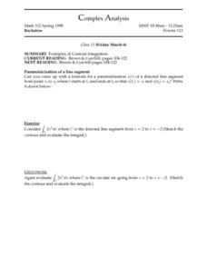
Complex Analysis: Examples of Contour Integration
In this contour integration worksheet, students evaluate an equation, sketch the contour and evaluate the integral. This two-page worksheet contains approximately eight problems.
Curated OER
Complex Analysis: Contour Integration
In this contour integration worksheet, students integrate formulas, sketch the contour and evaluate the integral. This two-page worksheet contains approximately eight problems.
Other popular searches
- Contour Maps
- Blind Contour
- Geography Contour Lines
- Contour Maps and Elevation
- Contour Drawings
- Blind Contour Drawing
- Contour Planting
- Contour Line Drawing
- Geography Contour Lines
- Contour Intervals
- Teaching Contour Lines
- Contour Maps Topography


