Curated OER
What Do Maps Show?
This teaching packet is for grades five through eight, and it is organized around geographic themes: location, place, relationships, movement, and regions. There are four full lessons that are complete with posters, weblinks, and...
Austin Independent School District
Social Studies Strategies: Concept of a Definition Map
Model for your class members how to use a definition map to make connections between new words and prior knowledge. Although the strategy is designed for social studies classes, the approach can be use at any grade level and in any...
Curated OER
Map Skills
Thirds graders reinforce that a map is a drawing that shows what a place looks like from above. They use a map key and symbols to create a map of the school and its neighborhood.
Edgate
Why Map a Map?
After brainstorming reasons why Native Americans mapped their lands, your young critical thinkers will work together to review their ideas and determine the definition of a map. With today's extensive use of mapping technology and GPS...
Curated OER
Map Skills
Do you need to practice map skills? Children with a range of abilities will complete a KWL chart about maps, practice important map vocabulary and then read a few pages from their textbook. They will use their vocabulary words and...
Curated OER
Charts, Maps, and Graphs Lesson on the Holocaust
Students practice interpreting data. In this Holocaust lesson, students research selected Internet sources and examine charts, maps, and graphs regarding the Jewish populations in and out of Europe. Students respond to questions about...
Curated OER
Read a Map ... It's a Snap!
Students are introduced to map and globe skills. They use grids and are able to construct their own simple maps of familiar places. Students are able to define a map, globe, and symbol and use the direction words north, south, east,...
Curated OER
Map Studies
Young scholars study maps and use web based activities to develop their mapping skills. In this mapping skills lesson, students use the internet to define cartography they make a list of information regarding a typical road map and...
Curated OER
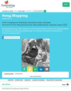
Our Land Lesson 2: Song Mapping
Students study the meaning of philanthropy as giving of time. talent, and treasures. They sing This Land Is Your Land while locating five of the places on a map of the United States showing that relief office are everywhere. They decide...
Curated OER
Exploring Hawaiian Mountain Zones
Fourth graders watch a video that describes the climate and vegetation zones of Hawaii. They describe the different physical conditions that create vegetation zones from the sea to the mountains. In groups, they create an illustrated...
Curated OER
Introduction to Age of Absolutism
Who were the absolute monarchs of Europe and what effect did they have on their countries? Young historians begin by naming qualities they believe are important for a monarch to possess. They then take notes on four key factors...
Curated OER
Geography Terms
Introduce the terms and concepts related to basic map and geography skills. Terms include full definitions and cover latitude, longitude, the Equator, Tropic of Cancer, Tropic of Capricorn, Prime Meridian, and the International Date Line.
Smarter Balanced
American West in the 1800s
To establish a context for an assessment or a study of pioneers and the American frontier in the 1800s, groups examine photos and record observations about clothing, housing, and travel.
Curated OER
US City Quality of Life Analysis and Comparison
Learners analyze US census data and criteria to compare and measure the quality of life in the country's fifty largest cities. After accessing the 2005 quality of life world report online, students conduct their study to compare three...
ReadWriteThink
Biography Project: Research and Class Presentation
I Have A Dream ... that after the lesson, all individuals master the reading, writing, researching, listening, and speaking skills the biography project helps them develop. Martin Luther King, Jr. serves as a topic example for a model...
Geography for Geographers
Five Themes of Iceland
How do the five themes of geography relate to the country of Iceland? Pupils learn about everything from the differences between relative and absolute location to how humans both adapt and change the environment. The presentation...
Curated OER
Mapping the Cold War Arms Race
Seventh graders create a visual representation of the Cold War Arms Race. Using a map of the world, they identify where the events where the Cold War to place.
Students analyze the events and create a journal entry explaining how a...
Curated OER
Geography of Mesopotamia
Students write a letter. In this irrigation lesson, students review how humans and the environment can interact with each other, learn new vocabulary words having to do with Mesopotamia, learn about irrigation and view maps of...
Curated OER
The Final Question
Students analyze their own feelings about the death penalty before considering court cases involving the death penalty. They determine what their definition is of cruel and unusual punishment, and analyze how different states handle the...
Curated OER
Getting to Know My World
Students participate in hands-on activities using maps and globes to identify geographical features. Students use map legends to identify direction. Students locate oceans, continents, countries, states and cities. Handouts and...
Curated OER
Continents and Oceans on the Move
Students create an awareness of the vast percentage of water covering the earth. They relate similarities/differences between topographical maps and other maps of various time periods. Students examine how to use a topographical map.
Curated OER
Topography: Know the topography of your neighborhood
Middle schoolers read and identify features on a topography map. For this topography lesson plan, students learn how to read a topography map, and then go out and take pictures of their own and discuss the topography pictures they took.
Curated OER
The Sweet Connection
Students use maps to find what crops are dominant in areas where honey bees are raised and discuss possible correlations. They mark the top ten honey- producing states on a US map.
Curated OER
This Land Is Our Land
Students research federal land holdings. They explore how those lands are used. They map these lands and design their own legends. They discuss whether or not the land is being used accordingly.


