Curated OER
Circle Compass Course
Students practice using a compass for directions. They use a compass to set and walk a designated course. In addition, they discuss careers and recreation that utilize a compass.
Curated OER
Compass Deviation
Students identify and describe the difference between the magnetic north pole and true north. They consider why sailors could not steer a straight course to the New World from the Old.
Space Awareness
The Sun Compass of the Vikings
Evidence shows the Vikings likely navigated by using a simple sundial to find their course. Videos, a short story, and discussion help bring this time period to life as they study European history with a hands-on experiment. Scholars...
California Academy of Science
Which Way is North?
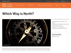
Who needs a compass to find cardinal directions? Just place a stick in the ground and record the movement of its shadow over the course of a day. Then, measure the shadow lengths in order to determine a north-south line. A simple...
Curated OER
Orienteering
Students acquaint with co-participants and identify the practice basic compass functions and orienteering procedures. They also work together to solve a small challenge. Students then identify how the challenge of orienteering relates...
Curated OER
Finding the Way
Learners identify and research navigational tools used in deep sea explorations. They are introduced to a compass, the Global Positioning System and sonar technology and then describe their uses in underwater exploration.
Science Matters
Magnetic Fields: The Earth Acts as a Giant Magnet
Attract learners to an interesting lesson plan! The third in a 14-part series of lessons on electricity and magnetism uses a hands-on approach to exploring magnetic fields. Scholars experiment with a compass to test Earth's magnetic...
Curated OER
Catch the Pollution
Explore environmental care by conducting a pollution experiment. You'll discuss the causes of pollution in our environment and what the overall impact will be if we can't change our ways. Clear plastic tape, a can, and compass are used...
Curated OER
MAPPING THE SCHOOL FOREST
Pupils measure distances and directions using paces and a compass. They determine their own pace, explore how to read a compass bearing, and how to take bearings on given sites.
Curated OER
Follow the Sun
Students use a simple model of the Earth and Sun as seen from space to explore the sun's apparent movement across the sky over the course of a day and year. They consider the apparent direction of movement and changes in the sun's angle.
Curated OER
The Robot Archaeologist
Students discover what is needed to program an underwater robot to complete a course of action. In this robot archaeologist lesson students design an archaeological strategy of an underwater vehicle.
Curated OER
CHARTING A COURSE
Young scholars model how a gyroscope works with string, an old phonograph record and crayon.
Curated OER
What Do You Know!
Students experiment using a compass for navigation and consider how various instruments affect how we travel.
Curated OER
Navigation Across the Seas
Young scholars examine nautical navigation and discover the differences between nautical charts and other types of maps or charts. Students practice setting a course, taking a bearing, and dead reckoning. This gives young scholars an...
Curated OER
Boy Scout: First Class Rank
In this boy scout: first class rank worksheet, 8th graders research the requirements for this level using the websites listed, and answer 14 detailed questions about using a compass, camping, meal planning, safety, first aid,...
Curated OER
Space Science:Wherever You Go, There You Are
Students explore navigation principles by observing, measuring, and interpreting data to determine locations. Using a compass, compass rose, and a transit, they plot courses and discover the workings of the Global Positioning System...
Curated OER
Tomb Guardians
Students practice using compasses to find cardinal directions in this cross-curricular instructional activity about the Chinese art of tomb sculptures. The instructional activity also includes a creative instructional activity extension.
Curated OER
A Sense of Location: The Mental Map
Students consider the ways a mental maps of geographic landmarks can help migrating animals stay on the correct course.
Alabama Learning Exchange
Coral Reefs
Study explore coral reefs. In this coral reef lesson plan, 4th graders examine the physical structure of coral reefs. Students consider why coral reefs need to be protected and ways to protect them.
Curated OER
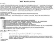
All in the (Insect) Family
Students participate in a series of activities in order to explore the diversity of insects. They explore how insects are grouped and categorized.
Curated OER
Magnets, Electromagnets, and Motors
Students investigate the concepts of magnetism and its properties. They construct a magnet and test foods for iron content. Then students define the use of a motor and make their own electric motor while working in small groups. Then...
Curated OER
Solar Kit Lesson #7 Positioning Solar Panels I: Explorations with Tracking
Students track and record data on the Sun's position in the sky and on the output of a solar panel tracking the Sun. On a second day, students graph and analyze the data to identify relationships between (1) the time of day, (2) the...
Curated OER
Where's My Bot?
Students estimate geographic position based on speed and air travel. In GPS lesson students use GPS to estimate the set and drift of currents.
Curated OER
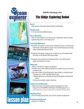
The Ridge Exploring Robot
Students study about an autonomous underwater vehicle and explain the strategies that it uses to locate and map hydrothermal vents. In this marine navigation lesson students design a program for an AUV survey.


