Curated OER
Math with Maps and Globes
Students round out their math skills with these ‘round the world' ideas. In this math and geography lesson, students try out time zone sticks, a polar race, and tic-tac-globe to engage them in learning more about globes and the...
Curated OER
Measure Up!
Students examine parallax and angular measurements. In this investigative lesson students calculate distances of objects and map their results.
Curated OER
Indianapolis Government
Learners read about a girl who takes a trip during the time of the State Capital moving to Indianapolis and then write their own essay about a trip that they took. In this Indianapolis Government lesson plan, students use maps and...
Curated OER
Looking Inside Cells
Seventh graders analyze and identify the role of the cell membrane and nucleus. They create flash cards to help them review cell structures. They also compare plant and animal cells.
Curated OER
Places in My World
Second graders explore where they are located on the globe. In this maps and globes lesson, 2nd graders use a map to show where they live and show the cardinal directions. Students identify characteristics of mountains, flat land,...
Curated OER
Marie Antoinette: The Tragic Queen
Learners view a documentary on Marie Antoinette, who became a symbol of the reviled monarchy. After viewing, students discuss what they saw then create a family line of Marie Antoinette. They compare maps of Europe from her time to ours.
Curated OER
Mud Maps
Learners discuss the location of stores, buildings, and homes in their community. Afterwards, they create a 'mud map' demonstrating the route from one point to another. In pairs, students read travel directions from a brochure, while...
Curated OER
"Now and Then" Comparing Present Day with Medieval Times
Eighth graders compare a present-day social issue with a medieval issue. They use technology tools to conduct their research and demonstrate their new knowledge. Students present their findings to the class in the form of a PowerPoint.
Curated OER
Earth's Magnetic Pole
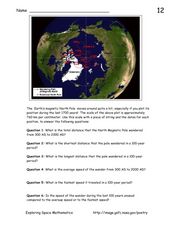
In this Earth's magnetic pole worksheet, students use a diagram showing the changes in the magnetic pole of the Earth over time. Students use the given scale of the changes to answer 6 questions about the average speed of the magnetic...
Curated OER
The Coldest Place at the Bottom of the World
Students examine Ernest Shackleton's journey through the Antarctic and trace Shackleton's Actual Route on a map using longitude and latitude coordinates. Students compare his intended route with his actual and determine how far off...
Curated OER
Fishes and Amphibians
In this fish and amphibian characteristics learning exercise, students will two idea maps to compare fishes and amphibians. Students will complete 2 short answer questions based on these idea maps.
Curated OER
TE Activity: The Trouble with Topos
Students study the uses of topographical maps including the many forms that they take. They discover that the map features show its intended use such as city maps, wilderness maps, and state maps. They complete a worksheet in which they...
Curated OER
To There And Back
Learners calculate distance on a map by using a mileage scale to calculate the distance from their hometown to Niagara Falls. They, in groups, determine the best route, then compose stories about their journey to Niagra Falls.
Curated OER
Mapping the changes in Canada's population
High schoolers find and analyze data found in the census. They compare the population from 1996 to 2001. They explore the type of data they can find in the Census of Population.
Curated OER
CORNER CABINET
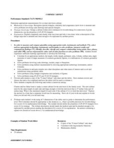
Ninth and tenth graders calculate the length, width, height, perimeter, area, volume, surface area, angle measures or sums of angle measures of common geometric figures. They solve problems involving scale drawings, models, maps or...
Curated OER
A Contouring We Go
Students examine the built environment and infrastructures of their community by constructing contour equipment, using the equipment, and comparing their results to current topographical maps of the same area
Curated OER
Middle Ages Cross Curriculum Project
Middle schoolers complete several projects on the Middle Ages. In this world history lesson, students complete language arts, social studies, math, and science projects. Some of these include: comparing a teenager's life now to that in...
Shakespeare in American Life
Tom Hanks and Caliban: Survivor Superstars
Here’s a clever way to combine language arts and social studies. Shakespeare’s The Tempest is believed to have been inspired by the wreck of the Sea Venture on Bermuda in 1609. The class views a brief scene from Castaway in which Tom...
Curated OER
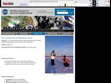
Trends of Snow Cover and Temperature in Alaska
Students gather historical snow cover and temperature data from the MY NASA DATA Web site. They compare this data to data gathered using ground measurements from the ALISON Web site for Shageluk Lake. They graph both sets of data and...
University of Wisconsin
Follow the Drop
Young surveyors look for patterns in water flow around campus. Using a map of the school (that you will need to create), they mark the direction of the path of water. They also perform calculations for the volume that becomes runoff. The...
EngageNY
Dilations as Transformations of the Plane
Compare and contrast the four types of transformations through constructions! Individuals are expected to construct the each of the different transformations. Although meant for a review, these examples are excellent for initial...
Curated OER
Plate Tectonics: Second Grade Lesson Plans and Activities
Second graders explore convection currents and how they relate to the movement of tectonic plates. Then, young geologists reconstruct Pangaea with a worksheet and pinpoint plate boundaries on a map...
Curated OER
A Comparison Study of Water Vapor Data to Precipitation over North America
Learners use NASA satellite data to compare water vapor over the United States. For this data analysis lesson students use an Excel spreadsheet to map their data.
Curated OER
India and Pakistan: Rivals from Birth
Seventh graders, after being divided into two groups, are assigned either Pakistan or India. They conduct research using the Internet, reference books, and magazines. The class compares and contrasts the two countries to find sources of...


