Curated OER
Materials: Hidden Costs, Mapping the Source and Cost of Raw Materials.
Students map connections among raw materials. In this environmental stewardship lesson, students design strategies to minimize the use of raw materials and discuss how to use more sustainable materials.
Curated OER
Regents High School Examination: Physical Setting Earth Science 2010
Every topic under the sun is covered in this New York State Regents High School Examination. With the focus of earth science, participants answer 85 quesitons about the solar system, geologic time, rocks and minerals, landforms, and...
Curated OER
Group Research Project on Frog Habitats
Students identify and research a frog habitat in small groups and compile a report to present to the class on the physical characteristics of their frog's environment. Students create a map illustrating areas in the world where their...
Curated OER
Troical Atlantic Aerosols
Students explore the effect aerosols have upon he weather and climate. They observe NASA satellite images to explore and draw conclusions about aerosol transport. From studying the images, students track the path of aerosols. They...
Curated OER
Planting Time
Students research crops grown in the United States. In this agriculture lesson, students identify various crops cultivated across the United States as they create charts and maps that note the information.
Curated OER
Weather Watchers
Learners are introduced to an Underground Weather Stations. In groups, they use the internet to research the weather in different parts of the United States locating each city. To end the lesson, they summarize the information they...
Curated OER
Creating a Thematic Map Using S'COOL Data
Students observe weather patterns, collect data, and make a weather predictions for various locations on a map.
Space Awareness
The Big Meltdown
Explore the world (our world) of melting ice caps. Why are these caps melting? What is the effect of melting ice caps? Dive into the ever-present issue of global warming with a resource that has learners looking at data and participating...
Office of the New Jersey State Climatologist
Play Ball! – Or Not…Making a Decision Using Weather Data
Should the game go on or not? An engaging lesson asks small groups to make a decision using weather data. After analyzing a map, an updated forecast, and radar information, groups have to decide whether to cancel a baseball game. They...
NASA
Earth's Global Energy Budget
Introduce your earth science enthusiasts to the earth's energy budget. Teach them using an informative set of slides that include illuminating lecturer's notes, relevant vocabulary, embedded animations, colorful satellite maps, and a...
Curated OER
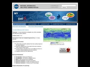
Variables Affecting Earth's Albedo
Students study the variables that affect the Earth's albedo. In this environmental data analysis activity students interpret and graph information and calculate changes.
Orange County Water Atlas
Location, Location, Location…
Young geographers discover not only how to read and recognize coordinates on a map, but also gain a deeper understanding of latitude and longitude and how climate changes can vary significantly across latitudes.
Montana State University
Everest Extremes: Biodiversity
How many animals can live in a climate as cold as Mount Everest's? Find out with a science lesson all about biodiversity. Activities include research, presentations, group work, coloring maps, and a simulation of a food web.
Star Wars in the Classroom
Star Wars Geography Unit
What kind of animals live on an ice planet like Hoth? How would the habitat on Tatooine allow different organisms to thrive? Connect social studies, science, and Star Wars in one engaging activity that focuses on the ecosystems of the...
Polar Trec
The Amazing Antarctic Trek
This resource provides two ways to engage learners in using latitude, longitude, and research skills. In pairs, or on their own, learners will locate several Antarctic regions on a map. They will write the name of the place and a few key...
Curated OER
Bering Sea Buffet - A Foodweb Activity
Life in the Bering Sea, food webs, and the ocean ecosystem are introduced with a map activity. The lesson plan starts as kids explore maps and images of the Bering Sea, then it kicks into high gear as they start to discuss the types of...
Curated OER
NIGHT AND DAY: DAILY CYCLES IN SOLAR RADIATION
Students examine how Earth's rotation causes daily cycles in solar energy using a microset of satellite data to investigate the Earth's daily radiation budget and locating map locations using latitude and longitude coordinates.
Curated OER
Where in the World Is That Volcano?
Identify the Earth's major volcanoes with an earth science lesson plan. Elementary and middle schoolers locate major volcanoes on a world map. Then, in groups, they research how the volcano affects the region in which it is located.
Curated OER
Geology and it’s Influence
Students compare current geological map and the one from 1800's. In this earth science lesson, students discuss differences between the two and explain the factors that caused the change. They write an essay about how these changes...
Curated OER
Why Here? Why Not There?
Students analyze a map and graph information on eleven countries. Using the characteristics of the countries, they determine if they should host the summer or winter Olympic games. After viewing a video, they locate the latitudes of...
Curated OER
Great North
Students view a video about the Arctic Circle, North Pole and Northern Europe. They locate areas using a map. They create a drawing of the countries where the Inuit live.
Curated OER
Kansas Land
Fourth graders discover the geographic regions of Kansas. In this geography lesson, 4th graders explore the different regions of Kansas and determine how the different geography affects daily life in Kansas.
Curated OER
Some Like it Cold: Canada's Northern Communities
Fifth graders examine cultures close to the arctic circle. In this geography instructional activity, 5th graders consider the impact of climate on cultural development of arctic communities. Students research a given community and...
Curated OER
ESL: Vegetation Biomes and Regions
In this ESL biomes and vegetation regions worksheet, students answer a set of 7 questions about plants, animals, and vegetation regions in their own countries, then color and draw native plants and animals of their country and complete a...


