Curated OER
Alaska Outline Map
In this Alaska outline map learning exercise, students examine political boundaries of the state and the placement its capital city as well as its major cities. This map is not labeled.
Curated OER
MAPPING YOUR NEIGHBORHOOD
Students uses atlases, maps, and Web resources to generate and examine maps of their own neighborhoods. This activity serve as background for the map-reading tasks in the next lessons.
Curated OER
City, County, Community
Students explore issues and situations that make for a city and its local environments. In this local government lesson, students design maps, define issues and create brochures that illustrate their understandings of these concepts and...
Curated OER
Mayor Puts City on Diet to Lose a Million Pounds
Learners read a story called Mayor Puts City on Diet to Lose a Million Pounds and answer vocabulary and comprehension questions about it. In this current event Lose a Million Pounds lesson plan, students respond to literature by...
Curated OER
Map Your House
Students are introduced to the concepts of maps as scale models of the whole. After a brief lecture on creating and using an accurate scale when drawing and reading a map. They create a scale drawing of the floorplan of their homes.
Curated OER
Virtual Field Trip
Are we there yet? Young trip planners learn about their state and plan a trip. They will select sites to see in three cities in their state, and record associated costs in a spreadsheet. While this was originally designed as a...
Curated OER
Around the Town
In the world of GPS, make sure your kids can still read maps and determine distances between locations. You will need neighborhood street maps, ideally of your class' home turf. Ask kids questions about different locations in relation to...
Curated OER
How Far Is It?
Students use a map key to estimate the distance from Salt Lake City, Utah, to ten other cities. Then they use an online distance calculator to see how close their estimates come!
Curated OER
Bermuda Triangle: Map Activity
In this Bermuda triangle worksheet, students complete a set of 4 questions using a given map of the Bermuda triangle. Answers are included on page 2.
Curated OER
Project Whistlestop:Missouri Vacation Learning Unit
Fourth graders reserach the state of Missouri. In this Missouri History lesson, 4th graders plan a vacation to a region of Missouri. Students work in collaborative groups to determine all aspects of the trip. Students use math...
Curated OER
Lesson 3: Seven Day Road Trip
Students plan a seven day road trip. In this travel lesson, students plan a driving trip that includes five major cities or attractions in Florida or another state of their choice. They show the trip on a map, calculate distances that...
Curated OER
Around the Town
Students explore reading maps. For this map reading lesson, students compare distances fom place to place. Students work in groups and predict the distance then find the actual distance using string or rulers.
Curated OER
Forestry and Changing Feelings
Students investigate how the forest affects their daily lives by creating a concept map. In this ecological instructional activity, students create a concept map linking the forest to the many things they use each day....
Balanced Assessment
Ford and Ferrari
Which is faster, a Ford or a Ferrari? The short assessment has pupils analyze graphs to determine the rates of change between the two. Individuals interpret the rates of change within the context of speeds of the cars and develop a map...
Curated OER
Locating IIT Using Ordered Pairs
Students investigate ordered pairs. In this math lesson, students plot and locate ordered pairs in a coordinate plane and are exposed to how to read and create a map.
Curated OER
Creating a Map for Future Reference
Students use Web and other resources to create maps of either the site of their day trip, their final destination, the entire trip, or some combination of these.
Curated OER
Distance Formula
Young scholars watch teacher demonstration of distance formula, view non-collinear cities on maps, plot points on coordinate plane, evaluate square roots, compute distance between two points, and use Heron's formula to find area of...
Curated OER
It's Greek to Me!
Students explore Greek Mythology. In this Greek Mythology unit, students read myths, pantomime vocabulary words, practice research skills, create city-states, and demonstrate knowledge of ratios and proportions. This unit includes many...
Curated OER
Mapping Meteorites
After reading an article, "Cameras Capture a 5-Second Fireball and Its Meteorite's Secrets," space science superstars use the triangulation method to determine the location of a distant object. In-class activities and homework are...
Curated OER
The Weather Page: Comparing Data
Learners analyze data from maps. In this comparing data lesson, students use comparative and superlative statements to draw comparisons among the weather in different American cities based on USA Today weather maps.
Curated OER
Discovering New Mexico
Seventh graders discuss the elements of maps and using basic linear measurement. They calculate the distance between the cities and create a simulated journey around New Mexico using a road map. They write out the directions for their...
Curated OER
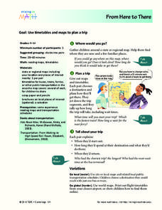
From Here To There
Students plan a trip while using maps and times tables. In this trip planning lesson plan, students work in pairs, and complete problems about gas, travel time, and more.
Curated OER
CHARTING THE COURSE
Students uses atlases, maps, and Web resources to determine the distance, driving time, and amount of money they need to make the trip (estimates should include hotel/motel stays, meals, and souvenirs).
Curated OER
From Hypothesis to Conclusion...Reading Maps to Understand Proofs
Tenth graders explore the concept of proof. In this proof instructional activity, 10th graders work in groups to collectively write proofs for directions to places on a map. Students give directions to specific places in big cities such...


