Curated OER
Olympic Mascots - and Mash-Ups
The Learning Network has formulated a fill-in the blank worksheet to go along with the New York Times article "Olympic Mascots Inspire Imitations". While the topic is not entirely about physical education, this article could be used for...
Curated OER
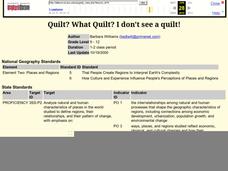
Quilt? What Quilt? I Don't See a Quilt!
Students analyze maps and cultures of major cities in the state of Arizona and designate different regions within the state according to geography and economy.
Curated OER
Re-Presenting Race in the Digital Age
Teen-aged scientists analyze a graphic organizer of how trash is removed from New York City and then answer standard questions about a graph and a diagram. Resources are mentioned, but there are no links to these resources, so you will...
Curated OER
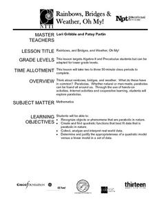
Rainbows, Bridges & Weather, Oh My!
Explore how real-world applications can be parabolic in nature and how to find quadratic functions that best fit data. A number of different examples of modeling parabolas are explored including a student scavenger hunt, the exploration...
Curated OER
Permit Trading
Emerging environmentalists work in groups and pretend that each is a power company generating electricity for a community. They consider the costs of building a renewable electricity generator that will increasingly replace generating...
Curated OER
Fields of Daffodils
Learners discuss the characteristics of a community. They discuss their local neighborhood, and brainstorm ways to help others in their community. Using recycled file folders and paint, students create their own daffodils. They discuss...
Curated OER
Moscow's Magnificent Domes
Students, after researching Russian architecture in Moscow, find pictures of onion-shaped domes on buildings such as St. Basil's Cathedral. They discover how Byzantine architecture reflects the orthodox faith and then create a replica of...
Curated OER
Welcome to Atlantis!
Students imagine they have discovered the ruins of the spectacular lost city-nation of Atlantis during a submarine voyage. They merge legend and facts that they discover in books and videos. They then experiment with art techniques to...
Curated OER
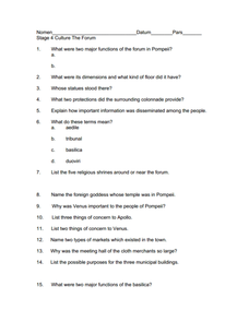
Culture of Pompeii
In need of a worksheet that focuses on the government and culture of the ancient Roman city of Pompeii? Here you'll find 16 questions related to the government, religion, society, and culture of Pompeii, prior to the eruption of Mr....
Curated OER
On the Other Hand
Do you live in the country, city, or suburbs? Use this conversational starter to discuss the advantages and disadvantages to living in a certain area. There's a small chart for your learners to take notes.
Curated OER
California Map
In this California blank outline map worksheet, students examine the political boundaries of the state and then mark the state capital, other cities, and other state attractions on the map.
Curated OER
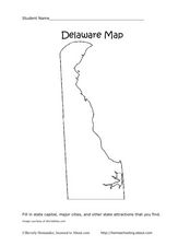
Delaware Map
In this state maps learning exercise, students identify the state of Delaware, and fill in the state capital, major cities, and other attractions in the state.
Curated OER
Idaho Map
In this outline state map of Idaho worksheet, students fill in the map with the state capital, major cities, and other state attractions or teacher created directions. Students draw at least 7 answers.
Curated OER
Connecticut Map
In this state maps worksheet, students identify the state of Connecticut, and fill in the state capital, major cities, and other major attractions.
Curated OER
Colorado Map
In this state maps worksheet, students identify the state of Colorado, and fill in the state capital, major cities, and other attractions for the state.
Curated OER
North Carolina Map
In this state maps worksheet, students identify the state map of North Carolina. Students fill in the state capital, the major cities, and other state attractions.
Curated OER
New Mexico Map
In this state maps activity, students identify the state of New Mexico. Students fill in the state capital, major cities, and other state attractions.
Curated OER
Ohio Map
In this Ohio activity, 4th graders explore the state of Ohio. Students look at the map of Ohio and fill in the state capital, major cities, and any other important landmark or site on the map.
Curated OER
South Dakota Map
In this South Dakota map worksheet, students fill in the state capital, major cities and other state attractions in an outline map of South Dakota.
Curated OER
Vermont Map
In this state maps activity, students identify the map of Vermont. Students fill in the state capital, the major cities, and other state attractions.
Curated OER
Wyoming Map
In this blank outline map worksheet, students fill in the state capital, major cities, landforms, and other places of interest on this map of Wyoming.
Curated OER
Tennessee Map
In this Tennessee outline map, students examine the political boundaries of the state. Students mark the state capital, major cities, and other state attractions.
Curated OER
Wisconsin Word Search
For this Wisconsin word search worksheet, students locate and identify 24 cities in the word bank within the word search puzzle.
Curated OER
Puerto Rico: The 51st State?
Learners research the history of Puerto Rico, its culture, and geography. In this Puerto Rico instructional activity, students find Puerto Rico on a map and find specific regions or cities. Learners discuss Puerto Rico's statehood and...
Other popular searches
- New York City
- Cell City Analogy
- City Planning
- Create a City
- Forbidden City
- Cityscape
- City States
- Mexico City
- Cell City
- City Government
- Create the Ideal City
- New York City Landmarks


