Curated OER
Suffix City The eed Family
In this language arts worksheet, students write the correct word with adding the suffixes to the root word in the three columns. Special attention is paid to the "ed" ending.
Curated OER
What is Climate?
In this weather worksheet, students identify and explain the factors that can affect the climate in each area of the illustrated map. Then they describe the various effects of these factors, such as air pressure systems and the land...
Curated OER
Maine Puzzle
In this Main puzzle, students identify the names of towns located in Main. A list of 45 towns is given to assist students in their search.
Curated OER
United States Regions
In this United States political map instructional activity, students examine regional census boundaries of the US. State boundaries are also included.
Curated OER
United States Map
In this United States political map worksheet, students examine national and state boundaries. The map also highlights the location of each of the state capitals and the national capital.
Curated OER
USA Capitals Map
In this United States political map worksheet, students examine state boundaries and locations of each of the state capitals.
Curated OER
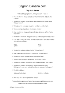
Nottingham, UK City Quiz 2
In this visiting and finding information about the Victoria Shopping Centre in Nottingham, UK worksheet, learners read questions and go on a scavenger hunt to discover the answers. Students write 15 answers.
Curated OER
Carbon Usage and Offsets on Putnam City Campuses and Area Businesses
Students examine carbon output. In this climate change lesson, students plan and complete an assessment of local businesses and schools based on the carbon output of their electrical usage.
Curated OER
Volcano Under the City
Students examine the different flow rates of liquids and how lava's viscosity influences flow. In this liquids lesson students complete several handouts and a lab activity.
Curated OER
Europe Map Quiz
In this online interactive geography quiz worksheet, students respond to 45 identification questions about the countries located in Europe. Students have 5 minutes to complete the quiz.
Curated OER
Cities as Transportation Centers
Middle schoolers work in small groups to identify some of the major transportation centers, recommending two as possible sites for a national political convention, based on population density and the travel networks available in 1835.
Latin America Network Information Center
Urbanization
Brazil's population has been changing dramatically in the last century. Study the causes of Brazilian urbanization, including industrialization and and migration, and the implications for the country of the populations'...
Student Handouts
Geography of Dr. Martin Luther King, Jr.
Young geographers follow Dr. Martin Luther King's journey during the civil rights movement by identifying major events on a map of the eastern United States, such as his birth in Atlanta, Georgia and his famous...
Curated OER
Edgar Allan Poe's First Lines
Try to guess the title of the Edgar Allan Poe work when you are given the first line of the poem! Fifteen mostly multiple-choice questions will have you racking your brain to recall the opening words of some not-so-well-known pieces. See...
Curated OER
Inverness and Highlands Heritage box
Students explore, experience and study the rich cultural heritage that Inverness and the Highlands has to offer to young people and takes a look into the future. They assess certain aspects of Highland culture through the expressive arts...
Curated OER
Hellenistic Greece 324-100 BCE
Although it is visually appealing, this presentation on Ancient Greece does not provide a lot of information. But,it could be used to spur a discussion. There are maps and diagrams that would be helpful when covering this topic. Adding...
Curated OER
Mystery State #45
In this mystery state worksheet, students answer five questions about this state in an effort to identify it. Students then locate and mark the state on a map.
Curated OER
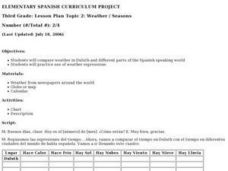
Weather/ Seasons Chart
After reviewing weather expressions with your Spanish scholars, have them do some research: what is the weather like in different parts of the world? They can choose up to four different cities to compare with the local weather of their...
Curated OER
Arkansas Map
In this Arkansas instructional activity, students analyze an outline map of the state of Arkansas and label the capital city. Students label other important cities and important attractions and color the map.
Curated OER
Michigan Map
In this state maps worksheet, learners identify the map of Michigan. Students then fill in the capital city, major cities, and other state attractions.
Curated OER
Maine Map
For this state maps worksheet, students identify the map of Maine. Students fill in the capital city, major cities, and other state attractions.
Curated OER
Montana Map
In this state maps worksheet, students identify the state map of Montana. Students fill in the capital city, the major cities, and other state attractions.
Curated OER
North Dakota Map
In this North Dakota worksheet, students study an outline map of North Dakota with the capital city marked. Students color the map and add other important cities and landmarks.
Curated OER
Utah Map
In this Utah worksheet, students analyze an outline map of the state of Utah. The capital city is marked. Students add other important cities, bodies of water or other important features. Students color the map.
Other popular searches
- New York City
- Cell City Analogy
- City Planning
- Create a City
- Forbidden City
- Cityscape
- City States
- Mexico City
- Cell City
- City Government
- Create the Ideal City
- New York City Landmarks


