Curated OER
Crossing Borders, Crossing Boundaries?
Students explore how the United States government is using biometrics to secure American borders. They examine the pitfalls of biometrics programs and propose possible ways to strengthen the program.
Curated OER
Establishing Borders: The Expansion of the United States 1846-48
Learners investigate how the United States acquired land after the Revolutionary War ended. In this establishing borders lesson, students use maps to identify territories acquired by the US and the states that later developed. Learners...
Curated OER
State of Alabama
For this reading passages about the state of Alabama worksheet, students read about the state's geography, history, exploration, industry, and people and use the information to answer multiple choice and true and false questions....
Tennessee State Museum
An Emancipation Proclamation Map Lesson
Did the Emancipation Proclamation free all slaves during the Civil War? Why was it written, and what were its immediate and long-term effects? After reading primary source materials, constructing political maps representing information...
Curated OER
Civil War Sites and Battlefields in Arkansas
Modern day and historic images grace an informative presentation. Learners can review multiple battles and effects of the Civil War on the state of Arkansas. Major sites and battle fields are shown as they looked in the past and as they...
Curated OER
Border Identity: AngloChicaNorteña
Students analyze concept of identity in the context of the border region, and in particular by considering the concept of identity in a movie concerning a famous border personality.
Curated OER
A State Divided - Maryland in the Civil War Era
Students use primary sources to see how Maryland was a divided state during the time leading up to the Civil War. In this Civil War lesson plan, students go over vocabulary, and look at maps that show the division of opinions of people...
Curated OER
United States of America
In this writing learning exercise, students read short paragraphs about United States facts. Students then generate questions about the paragraphs using given facts.
Curated OER
Al Otro Lado
Students view a video about the border between the United States and Mexico. They discuss the forces that influence human migration. They write a paper from the point of view of the main character in the film.
Curated OER
A New Federation
Students describe the relationships between state and federal parliaments in Australia. They identify responsibilities shared between federal and state and territory governments. Students explore an alternative federal structure by...
Curated OER
Wisconsin
In this Wisconsin state history worksheet, 4th graders read two pages of information about Wisconsin then complete 10 true and false questions.
Curated OER
Maps
Maps, globes, and computer software aid young explorers as they locate state capitols, major cities, geographic features, and attractions for states they are researching. They then use desktop publishing software to create a map to share...
Curated OER
Geography Golf
Students practice their knowledge of states and capitals while at the same time working on motor skills. This activity also promotes working together in small groups.
Curated OER
Creating a Geographical Fabric Collage
Students create a geographical fabric collage with a template from their state using various fabrics and a fabric glue stick.
Curated OER
States Around Ohio
Second graders locate Ohio on appropriate national and hemispheric maps. They write one sentence about the states that border Ohio including the names of the states and the direction that they are from Ohio.
Curated OER
United States Geography: Crossword Puzzle
In this geography learning exercise, students use the 14 clues in order to fill in the crossword puzzle with the appropriate United States geography answers.
Curated OER
Lincoln's Spot Resolutions
Students take a closer look at historical relations between the United States and Mexico. In this Texas annexation lesson, students examine primary documents authored by Zachary Taylor, James Polk, and Abraham Lincoln to consider why the...
Curated OER
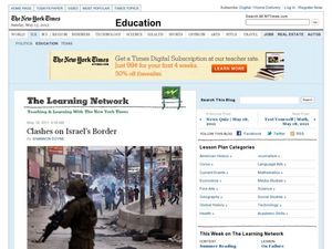
Clashes on Israel's Border
Here are 11 questions intended to guide learners as they read a New York Times article about the violence and conflict between Israel and Palestine. They can review the questions and then read the article to help answer them. A link to a...
C-SPAN
The Role of the Executive Branch in Policy Making
Although the president of the United States does not have the power to pass laws, they can propose legislation, veto bills passed by Congress, and issue executive orders that bypass Congress. Six video clips show middle schoolers these...
Curated OER
Border to Border
Students use the Internet to gather information on the country of Mexico. They also discover the culture of their people and compare them with the United States population. They take a virtual tour of some of Mexico's most historical ruins.
Curated OER
United States: Physical Features Fun
In this map worksheet, students color and trace eleven listed features on a map of the United States. Students answer six additional questions about the map. A United States map is not provided. However, websites are provided to find...
Curated OER
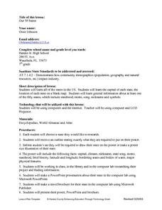
Our Fifty States
Seventh graders identify and locate all fifty states in the United States and their capitals. Individually, they research one state identifying when it became a state, its motto, song, flower and nicknames. To end the lesson plan, they...
Reporters Without Borders
2017 World Press Freedom Index
Freedom of the press was seen as a right so important that the Founding Fathers listed it as part of the first amendment to the United States Constitution. Americans pride themselves on this freedom, but just how free are American...
Other popular searches
- Civil War Border States
- Missouri Border States
- Eastern Border States
- Border States of Ohio
- Mexican Border States
- Tennessee Border States


