Curated OER
Identifying Border States of the U.S.
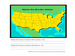
In this identifying border states of the U.S. worksheet, 3rd graders visually identify then write the names of the states that border Canada and Mexico; page 1 is a lesson, page 2 is the worksheet.
Curated OER
Capitals, Oceans, And Border States
Students investigate geography by completing games with classmates. In this United States of America activity, students examine a map of North America and identify the borders of Mexico and Canada as well as the Pacific and Atlantic....
Curated OER
Mystery State #32
There is no better way to start a lesson, than with a good problem-solving activity. Give your class the chance to see if they can use each of the five clues to determine the name of mystery state number 32. Hint: It's the eastern most...
Center for History Education
Maryland During the Secession Crisis
While many think the United States was neatly divided between Northern and Southern states during the Civil War, border states like Maryland are more complicated. Using hands-on activities to measure distance and primary sources,...
Curated OER
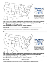
Mystery State #15
Do you know the name of the Badger State? Using five fantastic clues, your super sleuths will determine the name of mystery state number 15. A wonderful way to warm up the class!
Curated OER
Mystery State #43
How much does your class know about the states in the union? Could they determine the name of a state from given clues? Here, pupils consider each of the five clues to name mystery state number 43. Note: There are two handouts on one...
Curated OER
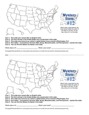
Mystery State #12
What's better than learning about US geography? Having fun while your doing it! After reviewing each of the five given clues, learners attempt to name the mystery state. A great way to reinforce geography skills and deductive reasoning...
Smithsonian Institution
Borders and Community: Early 20th Century Chicago Neighborhoods and Ethnic Enclaves
Chicago is one city, four neighborhoods, and countless nationalities. The lesson plan explores the ethnic division of Chicago in the early twentieth century. Academics read primary sources, analyze maps, and tour an online exhibit to...
Smithsonian Institution
Borders within the United States: Indian Boarding Schools and Assimilation
Native American Nations ... sovereign entities or removable tribes? A thought-provoking lesson explores the relationship between Native American tribes and the United States, including forced assimilation and removal from their ancestral...
National Endowment for the Humanities
Lesson 1: The United States Confronts Great Britain, 1793–1796
After the Revolutionary War, the success of the United States was far from guaranteed. Foreign powers coveted the new land, and Great Britain challenged American sovereignty. Learners consider the challenges facing the new nation using...
Curated OER
Title: Rivers as Borders
Students are introduced to the concept of borders. They read maps and identify rivers that separate different countries and states. They examine how or why a landform such as a river border might be the reason for different cultures.
Center for History Education
Maryland: A Middle Ground?
Is Maryland in or out? Using primary source documents that examine the state's geopolitical location, learners discuss whether the Old Line State is Northern or Southern to its core. The resource includes numerous documents and...
K12 Reader
United States Geography
Encourage reading for information with a text about United States geography. Kids read a short passage about the landforms in the United States, including mountain ranges and natural resources, and answer five reading comprehension...
Smithsonian Institution
Borders with the World: Mexican-American War and U.S. Southern Borderlands
The Mexican-American War created social borders—not just physical ones. Scholars learn about the effects of the Mexican-American War on the people living in the borderlands using text excerpts, maps, and partnered activities. Academics...
Freecloud Design
Stack the States™
Kids have fun learning US geography and state facts, including capitals, nicknames, major cities, and landmarks. They can choose between the game, or informational flashcards for each state.
Curated OER
Border History
High schoolers research primary sources to construct an outline of a border city's history.
Curated OER
Language: Border, Bridge or Barrier?
Students examine how they view language differences along the border between the US and Mexico.
Curated OER
High Temperature records by State
In this temperatures worksheet, students view a spreadsheet of the high temperatures of the states and change the data on it using spreadsheet tools. Students complete 4 tasks.
Curated OER
No Magic Borders: Haleakala Style
Students discuss borders and boundaries. They discuss pollution and the fact that boundaries cannot stop pollution and that pollution affects even protected wildlife and plants. They participate in an activity in which they must place...
Curated OER
Bordering States & VA Regions
For this Virginia geography worksheet, students respond to 2 fill in the blank questions and 16 multiple choice questions regarding the bordering states and regions of Virginia.
Curated OER
Solving the Puzzle
Students create a map showing the United States borders at a specific period in history and produce three questions to be answered by examining the map. They also write a productive paragraph explaining who, what, when, where, how/why a...
Curated OER
Rockin' Round New York State
Learners discuss their favorite rock groups and bands. They create rock groups that will be touring New York State. Students research cities in New York, determine dates of concerts, create touring itineraries, and develop Inspiration...
K20 LEARN
How Did We Get Here? Native Americans in the United States
High schoolers imagine what their lives would be like if they had no access to potable water and watch a morning news show about the water situation on a Navajo reservation. Groups investigate the policies that lead to the lack of water...
Curated OER
Border Forum
Students read, analyze, and synthesize news reports on a current border issues. They prepare an oral presentation and written support documents which must clearly and accurately explain an issue to an audience which may be unfamiliar...
Other popular searches
- Civil War Border States
- Missouri Border States
- Eastern Border States
- Border States of Ohio
- Mexican Border States
- Tennessee Border States


