Curated OER
Aerial Photographs
In this geography worksheet, students read an excerpt about aerial photographs and how they are taken. Then they identify shape, size, tone, shadows, and other hints that might be seen. Finally, students respond to 5 short answer...
Curated OER
Historical Air Photo Interpretation
Students identify and analyze land use changes over time with historical aerial photographs. They classify different land use into categories.
Curated OER
Ecology Explorers: Historical Air Photo Interpretation
Students identify and analyze land use changes over time with historic aerial photographs, and classify different land use into categories.
Curated OER
Aerial Photography
Eleventh graders compare the artistic values of Terry Evans' photography with LandSAT images and other images made for purely scientific, government and commercial purposes. They consider the artistic choices made in aerial photography.
Curated OER
Interpreting Aerial Photographs
Students interpret aerial photographs. They view aerial photographs or satellite-produced images to locate and identify physical and human features. They study satellite images and label their images for bodies of water, clouds,...
Curated OER
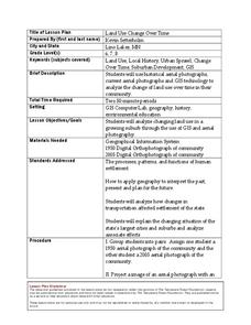
Land Use Change Over Time
Young scholars use historical aerial photographs and current aerial photographs to compare the change over time to the land. In this land changing lesson plan, students analyze, compare, contrast, and list the land change in their own...
Science Matters
Landforms from Volcanoes
Three major types of volcanoes exist: cinder cone, composite/strata, and shield. The 18th lesson in a 20-part series covers the various landforms created from volcanoes. Scholars work in pairs to correctly identify the three types based...
Curated OER
A VIEW FROM THE TOP
Students explore the idea of aerial photography through the story of Amelia the Pigeon. They view an actual aerial photograph of their school or home, and then write a story describing what Amelia would see if she flew over their school...
Curated OER
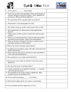
Spies That Fly
In this spy aircraft worksheet, students watch a video about unmanned aerial vehicles and other aircraft used by the military and answer 20 questions.
Curated OER
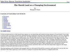
The Marsh Land as a Changing Environment
Sixth graders continue their examination of the state of Connecticut. After taking a field trip, they identify the types of birds, plants, invertebrates and vertebrates who make their home in the salt marshes. In groups, they identify...
Space Awareness
Let's Map the Earth
Before maps went mobile, people actually had to learn how to read maps. Pupils look at map elements in order to understand how to read them and locate specific locations. Finally, young cartographers discover how to make aerial maps.
Messenger Education
Look But Don’t Touch—Exploration with Remote Sensing
Mars is home to the tallest mountain in our solar system, Olympus Mons. In this set of two activities, learners review geologic land formations through the analysis of aerial maps. They then apply this knowledge to aerial maps of objects...
Curated OER
Images of Katrina
Students use maps and online data to find specific geographic areas. In hurricane Katrina lesson students use aerial photographic imagery to see some impacts of hurricane Katrina.
Curated OER
Map Your Local Watershed!
Students study how to map their local watershed from a topographic map. They find the watershed on an aerial photograph and use maps and aerial photos from the Web to identify the human activity within the watershed, as well as various...
Curated OER
Second Graders on the Map
Second graders explore the various types of maps. They examine the differences between street maps and aerial photographs. Students identify various features on each map. They use cardinal directions and the compass rose. They write...
Curated OER
Eagle Creek Park (A Hike)
Students plot a hiking course using aerial photos and a topographic overlay and find the latitude and longitude of absolute locations. They measure the total distance of a hiked area and figure the area of the ground walked using Heron's...
PBS
Reading Adventure Pack: Gardening
A Reading Adventure Pack invites scholars to start gardening. Following a reading of two books—fiction and nonfiction—young green thumbs repurpose food containers to grow an herb garden in their kitchen, plant seeds in starter pots out...
Curated OER
From a Distance
Students think about their neighborhood and get a mental picture of their community. They then interpret aerial photography, learning how to use shapes and patterns to describe urban, suburban and rural communities.
Curated OER
Aerial Cameras
Students will explore ways of documenting their landmarks by a creating visual display exhibition in this Youth Source activity. Each student will need a camera and film and reflecting worksheet.
Students will then reflect on their ideas...
Curated OER
Exploring the Design Process
Students analyze the design process and architecture of Ludwig van der Rohe. In this architecture and art analysis lesson, students explore the design process through photographic documentation and architectural plans. Students use...
Curated OER
Aerial Photography
Students are introduced to a basic property of light and how we use this property in our everyday lives. They understand how this image is inverted because light travels in straight lines.
Curated OER
From Pirates to Pilots to Spies
Sixth graders enjoy this introduction to the world of map projections, globes, aerial photographs, and satellite images. This lesson instructs students on the advantages and disadvantages of each earthly representation.
Curated OER
Lake Billy Chinook
Students explore aerial photographs and maps of Round Butte Dam. They examine the land modifications necessary to create a dam. After reading a book about building a dam, students compare the environmental impact of Lake Billy Chinook to...
Curated OER
Schoolyard Geology
Discover that maps show information about an area and that they have common features like scales and legends. View an aerial map of your school and find features on the map such as the playground, roads, and trees. Trace the outline of...
Other popular searches
- Maps, Aerial Photographs
- Maps Aerial Photographs
- Aerial Photographs Grade 9
- Aerial Photographs of Phoenix
- Maps\, Aerial Photographs


