Curated OER
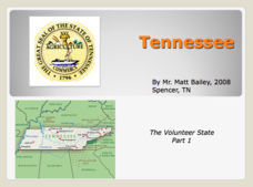
Tennessee: The Volunteer State Part 1
Explore the state of Tennessee, PowerPoint style! Regions, geographical features, and some amazing state facts are yours for the asking. Major cities are named and followed by related facts. This neat presentation on an interesting state...
Curated OER
States and Mates
Discuss and reflect on the concept of allies and alliances. The class examines the competition between the United States and Venezuela. Using the New York Times, they search for examples of geopolitical alliances. In addition, they write...
Curated OER
The United States and Canada Review Worksheet and Study Guide
In this geography skills worksheet, students respond to 34 short answer questions about the geographic features and climates found in the United States and Canada.
Curated OER
Idaho State Map
In this Idaho state map worksheet, students color and label important physical features and cities. Students also study the background map to learn the location of Idaho as related to the rest of the U.S.
Curated OER
Hawaii State Map
In this Hawaii state map instructional activity, students color and label important locations and physical features on the map of the 8 islands of Hawaii.
Curated OER
The Nifty Fifty- Facts and Figures
Students explore an assigned state. In this United States geography lesson, students identify facts and figures related to a particular state. Students use the Internet for research and create a PowerPoint presentation displaying these...
Curated OER
A Study of the United States of America
Students research information about each of the fifty states. They locate information using both the Internet and CD Roms and create databases using the research information. They insert graphics in a multimedia presentation using the...
Curated OER
State Facts
In this state fact chart worksheet, students are provided with a chart showing all 50 states, their abbreviations, state bird, flower, animal, and the year of statehood. There are also basic facts about each state. The worksheet...
New York State Education Department
Global History and Geography Examination: June 2015
Looking for a new writing prompt or primary source practice for your global history or geography class? Take a look at a helpful state standardized test for additional practice for your learners. Writing prompts include asking scholars...
New York State Education Department
Global History and Geography Examination: June 2012
Want to find out how much class members really know about history? A copy of a New York state test assesses scholars' knowledge of world geography and history in a multi-format test that includes multiple choice and essay items. The...
New York State Education Department
Global History and Geography Examination: January 2012
Familiarize future test takers with the format of standardized tests. The assessment covers world history topics, such as the French Revolution and South American civilizations. It also covers world geography. The test, designed for high...
New York State Education Department
Global History and Geography Examination: August 2014
What does the class know about world history and geography? The assessment tests high school scholars' skills in a state standardized test from the New York Department of Education. It covers topics such as the Enlightenment and the...
Baylor College
HIV/AIDS in the United States
In the final of five lessons about HIV/AIDS, groups create presentations to share data about the infection rates in the United States, examining demographic and geographic trends over the past ten years. Depending on how much time you...
New York State Education Department
Global History and Geography Examination: June 2013
Is it time to improve test-taking skills? The assessment is a copy of a state test for pupils to practice strategies for taking exams. It covers subjects such as the Chinese Dynasty's and ancient Indian history. It is divided into...
Curated OER
United States Map Lesson
Students explore basic map skills. In this United States geography instructional activity, students define "country" and "state," locate their state on a United States map, and identify and trace state boundaries defining their state...
Curated OER
Race to the Capital Geography Game
Student experience playing this geography game of racing to match states, provinces and countries to their capitals. After they think all the matches are made, line up in a large circle to evaluate whether the group has correctly...
Curated OER
My Summer Vacation
Students study the United States geography using Google Earth. In this U.S. geography lesson, students create travel journals about five U.S. geographical locations. Students research the human and physical characteristics for each region.
Arcademics
Penguin Hop
It's a race to learn the state capitals. Using a multi-player video game, participants hop from iceberg to iceberg as penguins in response to questions about state capitals. The real-time practice lets both teacher and learner assess...
New York State Education Department
US History and Government Examination: August 2011
Using primary source documents, pupils consider how the United States' democratic story has evolved over time. A second essay question examines the role of geography in history, and multiple-choice questions sharpen test-taking skills.
Curated OER
Nature and Place Names in Arkansas
Middle schoolers examine the way that many place names in Arkansas came to be. By looking at Arkansas highway maps, they find names that come from the characteristics of each of the state's six geographical divisions. This interesting...
Arcademics
Capital Penguin
Hop across the country like a penguin from ice floe to ice floe using an interactive video game. Acting as a penguin, learners match capitals to their states. Game features allow teachers to set up competitions and check learning progress.
Curated OER
Our 50 States
Students identify the location of the 50 states using an interactive map. They practice geography skills by playing a fun game. Pupils become familiar with the state abbreviations for the US states. Students become familiar with the...
Curated OER
States and Capitals
This map skills PowerPoint features an interactive states and capitals game. The object of the game is to identify the capital cities of each of the 50 states. The excellent presentation includes United States maps, game directions, and...
Curated OER
Geography Golf
Students practice their knowledge of states and capitals while at the same time working on motor skills. This activity also promotes working together in small groups.
Other popular searches
- State Political Maps
- State of Georgia Maps
- State Outline Maps
- State and Local Maps
- State Outlines Maps


