Curated OER
U.S. State Capitals Vocabulary Maze
In this United States worksheet, students complete a vocabulary maze involving 15 United States capitals. Students start at a specific point and end up at the bold letter A in red.
Curated OER
Capitals, Oceans, And Border States
Young scholars investigate geography by completing games with classmates. In this United States of America lesson, students examine a map of North America and identify the borders of Mexico and Canada as well as the Pacific and Atlantic....
Federal Reserve Bank
Sky Boys: How They Built the Empire State Building
How tall is the Empire State Building? Lead your class through a collaborative estimation activity to determine the number of quarters it would take to reach the top and teach the following concepts: human capital, human resources,...
Curated OER
State Symbols: California (ESL Lesson)
Take a trip to the Golden State with this informative ESL presentation about California. Slides detail the state bird, state flower, and state tree with pictures and explanations. Some of the information is dated, such as Arnold...
Los Angeles Unified School District
Capitalism and Socialism
Capitalism, socialism, communism ... these may seem like a whole bunch of isms to your scholars. High schoolers won't confuse them after completing an informative resource. Your class masters how to use primary sources to critically...
Curated OER
U.S. Geography for Children: State Capitals
In this United States map skills worksheet, students locate and label specified states and their capitals, and create icons and a map key to show something for each state that is famous. Students answer 5 questions.
Curated OER
Texas Map
For this Texas worksheet, students explore the state of Texas. Students look at a blank map of Texas and add the state capital, major cities, and any other major attractions of the state of Texas on the blank map.
Curated OER
U.S. State Capitals Dotted Handwriting Worksheet
In this U.S. state capitals handwriting worksheet, students trace 2 state names and write both their capital and the state name again on the lines provided.
Curated OER
Where in the United States Are We?
Students spend the lesson identifying the location of the fifty states and the capitals. Using a software program, they retrace te outline of each state numerous times. To end the lesson, they write a story about a state and city of...
Curated OER
Puerto Rico: The 51st State?
Learners explore Puerto Rico. In this Puerto Rico current events lesson, students conduct a Webquest to answer questions about Puerto Rico's culture. Learners discuss whether Puerto Rico is a country or a state, and defend their...
Curated OER
U.S. State Capitals Circle Spelling Worksheet
For this states worksheet, students circle the correct spelling of different states. Students complete 15 multiple choice questions where they pick the correct spelling.
Curated OER
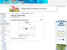
Kansas State Map
In this map of Kansas worksheet, students color and label major cities and physical features of this state. Students also study the location of Kansas in relation to the other states in the U.S. by studying the background map.
Curated OER
Idaho State Map
In this Idaho state map worksheet, learners color and label important physical features and cities. Students also study the background map to learn the location of Idaho as related to the rest of the U.S.
Curated OER
Iowa State Map
In this Iowa state map worksheet, students color and label the important cities and physical features. Students also study the background map that shows the location of Iowa in the United States.
Curated OER
Virginia State Map
In this geography of Virginia worksheet, students color the map and label major cities and physical features. Students also study a second map showing the location of the state of Virginia in the United States.
Curated OER
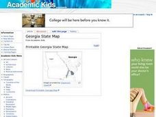
Georgia State Map
In this geography of Georgia worksheet, students color the map and label major cities and physical features. Students also study a second map showing the location of the state of Georgia in the United States.
Curated OER
Florida State Map
For this geography of Florida worksheet, students color the map and label major cities and physical features. Students also study a second map showing the location of the state of Florida in the United States.
Curated OER
Indiana State Map
In this Indiana state map worksheet, students color and label the important cities and physical features on this outline map. Students also learn of Indiana's location in the U.S. by studying the background map.
Curated OER
U.S. State Capitals Alphabetical Order Worksheet
In this states worksheet, students put names of different states into alphabetical order. Students complete alphabetical order for 15 states.
Curated OER
U.S. State Capitals Sentence Worksheet
In this U.S. states worksheet, learners use each state in a sentence. Students make 15 sentences out of the 15 states given to them.
Curated OER
U.S. State Capitals Cursive Handwriting Worksheet
In this states handwriting worksheet, students trace and write the names of 2 states in cursive writing. Students trace and write the names for Illinois and Michigan.
Curated OER
U.S. State Capitals Dotted Tracing Worksheet
In this tracing states worksheet, students trace the name of 2 U.S. states. Students trace the names of Illinois and Michigan in regular printing.
Curated OER
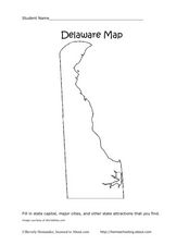
Delaware Map
In this state maps worksheet, students identify the state of Delaware, and fill in the state capital, major cities, and other attractions in the state.
Curated OER
The 50 States and its Holidays
Though the format of this ELL lesson is confusing (the standards listed are for plate tectonics, yet the objectives are for American geography and holidays), a teacher could glean some ideas from the main idea. Here, pupils complete a...
Other popular searches
- 50 States and State Capitals
- 50 State Capitals
- U.s. State Capitals
- Us State Capitals
- State Capitals Test
- State Capitals of Ms
- State Capitals in the Midwest
- U. S. State Capitals
- State Capitals Word Search
- U S State Capitals
- State Capitals Lesson Plan
- Webquest for State Capitals


