Curated OER
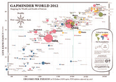
Gapminder World 2012
Here is a very interesting infographic that compares the average life expectancies, per capita incomes, and population sizes of every country in the world in 2012.
NASA
Outline Maps
Don't miss this gold mine of blank maps for your next geography lesson! Regions include traditional continents such as Asia, Europe, and Africa, as well as other major world areas such as the Pacific Rim and the Middle East.
Curated OER
Latin American Film
Students explore the Latin American film industry. In this Latin American film lesson, students compare Latin American films to American films as they watch segments of "Que Viva Mexico!" Students research the painters on the film and...
Curated OER
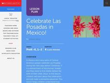
Celebrate La Posada in Mexico!
Students locate and identify Mexico on a world map. They develop an understanding of celebrating La Posada in Mexico as they listen to a story about the tradition of La Posada. They create a representation of a pointsettia. They act out...
Curated OER
Geography of the United States
Students examine the population growth of the United States. In this Geography lesson, students construct a map of the fifty states. Students create a graph of the population of the USA.
Curated OER
The Bread of the Sandwich
Students create relief maps of Canada and Mexico out of everyday objects like dried macaroni, dry rice, sand, etc. They create a clue card for a location game and try to stump their classmates. They host a travel fair to display their...
Curated OER
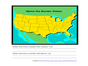
Identifying Border States of the U.S.
In this identifying border states of the U.S. worksheet, 3rd graders visually identify then write the names of the states that border Canada and Mexico; page 1 is a lesson, page 2 is the worksheet.
Curated OER
Foods and Languages of the World
Students review Mexico's location and language and learn to pronouns 10 new Spanish food words. Students listen as the book, Corn is Maize is read, touching and passing around an ear of Indian corn. Students discuss the contribution of...
Curated OER
Colonies and Revolution: Comparing US and Mexican History
Students examine the emergence of the United States and Mexico as independent nations. They compare the colonial history of the two countries and discover the emergence of social classes.
Curated OER
Living Swamps, Bayous and Forests
Third graders explore interesting environments by exploring Louisiana. In this wetland lesson, 3rd graders utilize the web to research the State of Louisiana, the bayous in the area, and the Gulf of Mexico. Students write a journal entry...
Curated OER
Dia de los Muertos
Second graders research the Day of the Dead, an important Mexican holiday. They view videos, investigate Mexican geography and history and compare the Day of the Dead to the celebration of Halloween.
Curated OER
From Sea to Shining Sea
Students study the geography of the United States of America. Students write letters, create travel brochures, make maps, graph population numbers, read fiction and nonfiction selections, complete KWL charts, and watch films.
Curated OER
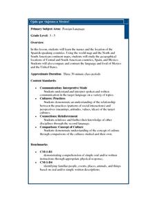
Ojala que viajemos a Mexico!
Students research the names and locations of Spanish speaking countries throughout the world. They use a world map to become familiar with the locations of these countries and use the Internet to conduct further research. They sing...
Curated OER
Let's Play Geography Twister
Students practice geography skills by playing a game based on Twister. Students manipulate their position on a map by placing their arms and legs on the appropriate state or country called out by the teacher.
Curated OER
Texas: U. S. Geography for Children
In this Texas map worksheet, students locate and label key features of Texas on the map and create icons to symbolize the economy and culture of Texas.
Curated OER
The Influence of Physical Geography
Students explore the limits and demands of their physical world and how it relates to the survival and well-being of people.
Curated OER
Bank Loans Money to Start Businesses
After locating Latin American countries on a world map, children read about how microbanks are loaning money to help start small businesses. Involving both current events and economics, the teacher introduces the article with a map...
Curated OER
Traveling Through Literature
Integrate geography with literature in this interdisciplinary lesson. Begin by reading a poem such as The Time We Climbed Snake Mountain by Leslie Marmon Silko. On a large map, place push pins in the cities or states mentioned. An...
Curated OER
Name the States Worksheet 1
In this name the states worksheet, students examine 6 state map outlines and identify each of them by writing the state names and postal abbreviations.
Curated OER
Celebrating Cinco de Mayo Without Stereotypes
Put more meaning into your Cinco de Mayo party with geography lessons, literature, and more!
Smithsonian Institution
Dia de los Muertos: Celebrating and Remembering
Help scholars understand the history, geography, traditions, and art of Dia de los Muertos, the Day of the Dead. Find background information for your reference as well as a detailed cross-curricular lesson plan. Learners compare...
Curated OER
Chiapas, Where Is It and Why Should We Care? And What Is the EZLN?
Students research and discuss the Zapatista National Liberation Army of Chiapas, Mexico. They role play the involved parties in the conflict and attempt to debate a peaceful solution.
Curated OER
Globe Skills Lesson 1 Some Early American Cultures
Young scholars apply their knowledge of geography. In this geography skills lesson, students read brief selections regarding early Americans. Young scholars respond to the questions included in the self-guided map skills lesson.
Curated OER
RACED Comprehension Sheet
In this race worksheet, high schoolers respond to 10 short answer questions regarding geography concepts that feature the letters of the word "raced" as mnemonic hooks.
Other popular searches
- Mexico Geography
- New Mexico Geography
- Mexico Geography Map
- Cultural Geography of Mexico
- Mexico Culture Geography
- The Geography of Mexico
- Physical Geography of Mexico
- Teaching Geography of Mexico
- Making Physical Maps Mexico


