NOAA
Mapping the Ocean Floor: Bathymetry
Bathymetry is not a measure of the depths of bathtubs! Through the three lessons, scholars explore two different types of maps and how they are made. The resource focuses on topographic and bathymetric maps and teaching the techniques...
Curated OER
Maps and Models
Students study maps of New Mexico examining settlement patterns over time and the location of water sources. They research the history of their community and discover how cultural groups interacted, adapted to their physical...
National Wildlife Federation
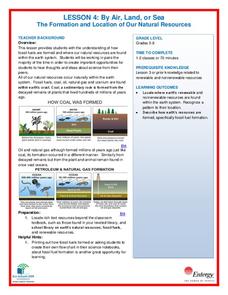
By Air, Land, or Sea: The Formation and Location of Our Natural Resources
Coal forms from the ancient remains of plants that were alive on Earth before the dinosaurs! Scholars use their t-charts from the previous lesson over resources and research to determine if their information is correct. Through analysis...
NOAA
Watching in 3D
Bring the ocean floor to life! Earth science scholars discover the process of deep sea mapping in the third installment in a series of five lessons about ocean exploration. The teacher's guide includes helpful resources, worksheets, and...
Curated OER
Outlandish Landforms
Seventh graders examine landforms. In this world Geography lesson, 7th graders research and create a physical model of a chosen landform. They then draw a 2-d paper map of that model.
Curated OER
Science: Draining the Land - the Mississippi River
Students use topographic maps to identify parts of rivers. In addition, they discover gradient and predict changes in the channels caused by variations in water flow. Other activities include sketching a river model with a new channel...
Curated OER
Wetlands/Watershed Model
Students make a model that will demonstrate the flow of surface water across the land in Texas and how materials that originate many miles away can end up in the wetland along the coast.
Curated OER
Wetlands/Watershed Model
Students work together to create a watershed model. They discover the flow of surface water on different topography. They examine how materials originate from miles away and end up in a different wetland.
Curated OER
Creeping
Students observe, measure, and graph a model of slow down slope movement representing soil creep. This task assesses students' abilities to collect, record, and organize data, set up graph axes, plot data points, draw line graphs, apply...
Curated OER
River Planning
Students use a model to conduct an experiment involving dam construction. Based on their observations, they draw conclusions about social, economic, and and environmental issues and make a decision concerning dam location. As a group,...
Curated OER
Animals of China and in Asia
Students write an animal report. For this research lesson, students use varied reference materials to find information about animals that live in China and Asia. They write a report about an animal and complete extension activities such...
Curated OER
Noncombatancy and the Seventh day Adventist Church
Upper graders investigate how the Seventh Day Adventists are objectors to the practice of war. The lesson covers the Civil War and examines the church's position about the practice of war. The research extends to modern wars and learners...
Curated OER
Science Italian Style: Eruption!
Students explore ways scientists prepare for a volcanic eruption. They observe films of earthquakes, oil spills, volcanoes and hurricanes. Students perform activities to demonstrate the relationship of viscosity to lava flow. They...
Curated OER
Probing Under the Surface
Eighth graders use a measuring stick to determine the shape of the inside of the bottom of a box, then apply their knowledge to an additional situation. This task assesses students' abilities to make simple observations, collect and...
Curated OER
Identifying Pennsylvania Watersheds
Ninth graders study and identify the six major drainage systems in Pennsylvania. In this watershed instructional activity students read an article, complete an activity and take a quiz on what they learned.


