Filter
39 results:
Coastal LandformsClear All
Curated OER
Coastal Erosion Diagrams
A set of super-descriptive and colorful slides demonstates the effects of ocean waves on coastal cliffs. You will need to do the verbal explanation, as little text is found on some of the slides, but the graphics really illuminate how...
Curated OER
Coastal Landforms
Students explore landforms. Using the internet, students research the main landforms. They define landforms and download images into a word document. Students create their own picture-dictionary.
Curated OER
Coastal Geology and Geomorphology
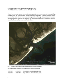
In this coastal geology worksheet, students use Google Earth to locate the Oregon coastline. Students then complete 6 short answer questions based on coastal geology.
Curated OER
Coastal Geology and Geomorphology
In this coastal geology worksheet, students use Google Earth to locate and identify different types of landforms and phenomena that occur along a coast. This worksheet has 2 short answer questions.
NorthEast Ohio Geoscience Education Outreach
Hydrology and Landforms
Three days of erosion exploration await your elementary geologists. Learners begin by examining rivers via Google Earth, then they model water flow in sand, and finally, they identify resulting landforms. This lesson is written...
Curated OER
Landforms
In this landform review worksheet, students use 17 provided terms to complete a paragraph about different landforms. After filling in the blanks, they name 4 kinds of mountains and provide examples of each.
Curated OER
Building New Landforms
In this landform worksheet, students read 6 paragraphs about the process the Dutch used to build new landforms and threats they face today. After reading the background information, students complete 3 short answer questions regarding...
Curated OER
Landforms and Resources of the United States and Canada
In this North American geography activity, students read about the physical features and resources of the United States and Canada. Students take notes and answer 3 short answer comprehension questions as they read the selection.
Curated OER
Landforms: Geomorphology of Arkansas
Second graders create large, salt dough maps of Arkansas and the natural regions in the state created by geographical and morphological features.
Curated OER
Oh, the Regions
Focus on the geography of Oklahoma. In this activity, learners compare different geographic regions in Oklahoma, create a collage to share their results, and identify important landforms throughout the United States, such as the...
Curated OER
North America Puzzle
For this geography worksheet, students complete a crossword puzzle in reference to North America. They identify capitals of some countries, the specific landforms of different areas, and languages spoken. There are 21 clues to solving...
Curated OER
Regional Landforms and Native People
Third graders study the Native American tribes of Maidu and Miwok by studying Internet artifacts, culture, language, music, storytelling, architecture, food, clothing, crafts and geology.
Curated OER
The Work of Waves and Wind
This is not revolutionary, but it is informative. Earth science viewers in grades 7-12 get carried away with wave and wind erosion. They view diagrams of how waves impact ocean shorelines. They see examples of the different types of sand...
Columbus City Schools
Constructive and Destructive Geologic Processes
Show the class the world as they've never seen it before—from way above! Learners try to unravel the mysteries presented by rich satellite imagery, learn to interpret topographic maps, and study erosion by constructing their very...
Curated OER
Mississippi Gulf Coast Islands
Fourth graders complete a variety of exercises as they study the creation, history, and geography of the Mississippi coastal islands. They discover the natuaral forces that act on the islands and how these forces affect the habitats and...
Mr. E. Science
Erosion and Deposition
Get an in-depth look into erosion and deposition with a 23-slide presentation that details how gravity, water, waves, wind, and glaciers cause changes to the Earth's surface. Each slide consists of detailed images equipped with labels,...
Curated OER
Virginia Geographic Regions
Third graders observe the five geographic regions of Virginia which have distinctive characteristics based on their landforms and bodies of water. They then describe the types of landforms and bodies of water in the region where they live.
Curated OER
California: Land and People
Fourth graders research information about some of California indigenous tribes to find out as much as possible about the first people found in the four regions of California. They research the history of a selected tribe and their...
Curated OER
Waves Lesson Plan
Young scholars demonstrate an understanding of tsunamis and possible causes. In this investigative instructional activity students view a video and explore earthquakes and movement of tectonic plates.
Curated OER
Tides
Students graph 40 days of high and low tide data for a site in Baja, Mexico near the Wetlands & Fisheries Live! research center. They identify patterns in the data and finally to make a connection between tidal heights and the phase...
Curated OER
The Silk Road, An Ancient Internet
Students examine how goods and ideas moved along an ancient trade route between China and Europe. They make charts of items, ideas, etc. that were transported along the Silk Route.
Curated OER
Water in Alabama History
Young scholars examine the role of water in Alabama's history. They discover the geographical regions of the state and how dams change Alabama's rivers.
Curated OER
4th Grade Geography Multiple Choice
For this grade 4 geography worksheet, 4th graders complete a total of 25 multiple choice questions relating to 4th grade geography concepts. An answer key is provided.
Curated OER
America the Beautiful
Students analyze the physical geography of the United States and how we have adapted to or altered the land to create the country we know today. Students complete maps with physical features, states and cities of interest.


