Curated OER
Coastal Erosion Diagrams
A set of super-descriptive and colorful slides demonstates the effects of ocean waves on coastal cliffs. You will need to do the verbal explanation, as little text is found on some of the slides, but the graphics really illuminate how...
Curated OER
Coasts and Reefs: Shallow Marine Processes
A more thorough presentation on coastal systems would be difficult to find! Detailed diagrams illuminate the offshore, shoreface, foreshore, and backshore zones of beach. The sources and movement of sediments along the coastline are...
NorthEast Ohio Geoscience Education Outreach
Hydrology and Landforms
Three days of erosion exploration await your elementary geologists. Learners begin by examining rivers via Google Earth, then they model water flow in sand, and finally, they identify resulting landforms. This lesson is written...
Curated OER
"Dead-Zones" and Coastal Eutrophication: Case-Study of Chesapeake Bay
Take an in-depth look at nutrient loading, eutrophication, and hypoxia using data on The Chesapeake Bay as an example. This comprehensive presentation includes detailed graphs, photos, and details about the changes in marine organism...
Curated OER
What Happens When Sea Level Rises or Falls
Students examine the impact of sea level on land formations. In this geography and map activity, students construct a contour map model illustrating how much of the clay "coastline" is covered as water is added. Metric measurement is...
Curated OER
Coastal Geology and Geomorphology
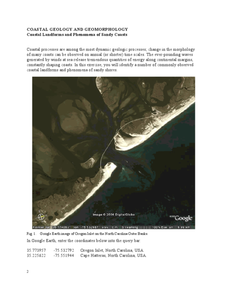
In this coastal geology worksheet, students use Google Earth to locate the Oregon coastline. Students then complete 6 short answer questions based on coastal geology.
Curated OER
Coastal Geology and Geomorphology
In this coastal geology worksheet, students use Google Earth to locate and identify different types of landforms and phenomena that occur along a coast. This worksheet has 2 short answer questions.
Curated OER
Coastal Landforms
Young scholars explore landforms. Using the internet, students research the main landforms. They define landforms and download images into a word document. Young scholars create their own picture-dictionary.
Curated OER
Australian Landforms
In this geography worksheet, students identify the various landforms of Australia. They use an atlas to draw in and color these various landforms on the given blank map of Australia.
Curated OER
Landforms
In this landform review worksheet, students use 17 provided terms to complete a paragraph about different landforms. After filling in the blanks, they name 4 kinds of mountains and provide examples of each.
Curated OER
Building New Landforms
For this landform worksheet, students read 6 paragraphs about the process the Dutch used to build new landforms and threats they face today. After reading the background information, students complete 3 short answer questions regarding...
Curated OER
Wave Erosion Lesson
Fourth graders examine the effects of waves as they erode coastal land. They discover how the power of water can change the appearance of land formations.
Curated OER
Mississippi Gulf Coast Islands
Fourth graders complete a variety of exercises as they study the creation, history, and geography of the Mississippi coastal islands. They discover the natuaral forces that act on the islands and how these forces affect the habitats and...
Curated OER
Mapping The Ocean Floor
Young scholars explore and analyze the bottom structure of underwater habitats. They describe and explain what can't see through the collection and correlation of accurate data. Learners assess that technology is utilized as a tool for...
Curated OER
Landforms: Geomorphology of Arkansas
Second graders create large, salt dough maps of Arkansas and the natural regions in the state created by geographical and morphological features.
Columbus City Schools
Constructive and Destructive Geologic Processes
Show the class the world as they've never seen it before—from way above! Learners try to unravel the mysteries presented by rich satellite imagery, learn to interpret topographic maps, and study erosion by constructing their very own...
Curated OER
The Work of Waves and Wind
This is not revolutionary, but it is informative. Earth science viewers in grades 7-12 get carried away with wave and wind erosion. They view diagrams of how waves impact ocean shorelines. They see examples of the different types of sand...
Curated OER
Biomes: Coastlines and Seas
Students study the different types of coastlines and their territories. In this marine coasts instructional activity students identify life forms that are in the coastal regions.
Curated OER
Between the Rivers
Second graders compare and contrast historical American cultures. In this American history lesson, 2nd graders participate in reading, writing, oral, and hands on activities. Students discuss the similarities and differences between...
Curated OER
The Ocean: A Watery World
Students discuss the proper clothing for the season. They make wind chimes to use as an indicator of movement of the air and observe and identify the various cloud formations. They determine the basic rules of storm safety and discuss...
Curated OER
Wetlands/Watershed Model
Students make a model that will demonstrate the flow of surface water across the land in Texas and how materials that originate many miles away can end up in the wetland along the coast.
Curated OER
Bermuda: Search for Deep Water Caves 2009: Out of Darkness
Students analyze the three models on the origin of troglobitic fauna. For this life science lesson, students also consider how the Zonation model explains the fauna's origin. They also use the Internet to research solutional and volcanic...
Curated OER
Stopping Deforestation in the Amazon: A Publicity Campaign
Students investigate the environment by designing a group project. In this ecology lesson, students identify the man made threats to the Amazon while reading environmentally conscience vocabulary terms. Students collaborate in groups...
Curated OER
Regional Landforms and Native People
Third graders study the Native American tribes of Maidu and Miwok by studying Internet artifacts, culture, language, music, storytelling, architecture, food, clothing, crafts and geology.


