Curated OER
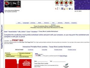
Texas Vocabulary Word Jumble
In this Texas words worksheet, students unscramble the letters in 20 words to spell key cities, people, attractions and regions pertaining to Texas. There is a word bank.
Curated OER
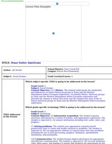
Texas Native Americans
Fourth graders research the Native Americans of Texas using the Internet. They create a Power Point presentation over the four Indian tribes of Texas - Caddo, Jumano, Karankawa, Apache.
Curated OER
Timeline for the Western Texas Frontier
Pupils work with a partner to create a timeline on the western Texas frontier. Using specific dates, they illustrate only one event for each year. They share their timelines with the class explaining why they picked that event.
Curated OER
Western Hemisphere
Fourth graders use a database to compare countries in the western hemisphere. They describe a variety of regions in Texas and the Western Hemisphere such as political, population, and economic regions that result from patterns of human...
Curated OER
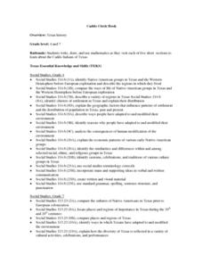
Caddo Circle Book
Students are introduced to the Caddo Indians of Texas. Using a compass, they draw a circle given specific dimensions and cut them out. Using the text, they read one section abut the Indians and complete the task listed on one of their...
Curated OER
Native American Indians
Fourth graders identify Native-American groups in Texas before European exploration and describe the regions in which they lived. They list Native American Indian tribes from Texas, describe them, and evaluate how the environment...
Curated OER
Veni, Vidi, Vici
Students participate in a Roman festival to complete a unit on Roman Civilization. In this Roman Civilization lesson plan, students learn about Cleopatra, Julius Caesar, the Mediterranean Region, and more. Students share what they...
Curated OER
Border History
High schoolers research primary sources to construct an outline of a border city's history.
Curated OER
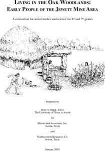
Living in the Oak Woodlands: Early People of the Jewett Mine Area
Students examine the archeology and native peoples of the Jewett Mine area of Texas. Using a map, they explain the economic patterns of the native groups and how the geography of the area affected activities. They compare and contrast...
Curated OER
A Day in the Life
Young scholars examine the various roles people played on the 19th century Texas frontier. Using the internet, they get to know five residents of Fort Griffin and take notes on their characteristics. They choose one person to research...
Curated OER
Alamo
Students access a variety of Alamo and Mexican-American War related resources on the Internet. They take a 360 degree virtual tour of the Alamo site, view photos and timelines, read first-person accounts, and view the flags from the...
Curated OER
Moving West with the Forts: Using an Interactive Map
Students discern a map of Texas and it's forts in the early to mid-1800's. From this map they analyze movement from the moment Texas became a state to its involvement in the Civil War.
Curated OER
Moving West with the Forts: Using an Interactive Map
Seventh graders practice reading maps and locating the forts stationed in Texas. Using the internet, they analyze westward movements from statehood to the Civil War. In groups, they complete a worksheet about the forts and share their...
Curated OER
Mexican Cessation
Eighth graders create a propaganda poster. In this US history instructional activity students research the various sides during the Mexican-American War. They present their poster and their position for or against the war.
Curated OER
Our Brand of Segregation - West Texas
Students explore the concept of segregation. In this oral history lesson, students conduct interviews and research primary sources to learn about segregation practices that affected African Americans. Students present their research...
Curated OER
Alaska
Fourth graders explore how humans adapt to variations in physical environment, compare how people in different communities adapt to or modify the physical environment and identify and compare the human characteristics of selected regions.
Curated OER
Whose Business?
Fourth graders compare and contrast the businesses in Fort Griffin with those in their own community. Using the internet, they discover the factors that have influenced the development of businesses in a town. They also create a map of...
Richmond Community Schools
Map Skills
Young geographers will need to use a variety of map skills to complete the tasks required on this worksheet. Examples of activities include using references to label a map of Mexico, identify Canadian territories and European...
Curated OER
FROM SEA TO SHINING SEA
Identify agricultural products grown in each region of the country.
Discuss how geography affects what is grown or raised in a particular area.1. Hand out a copy of the two activity sheets "Food From Sea to Shining Sea" to each student....
Curated OER
Pieces of the Past
Seventh graders compare and contrast the way of life of Native Americans in Texas and around the country. As a class, they brainstorm about the uses of pottery today and use broken pieces of pottery to create an artifact. In groups,...
Agriculture in the Classroom
Wad-a-Watershed
What kind of impact do humans have on watersheds? Find out in a lesson that defines, explores, and promotes ways to protect our watersheds. The ultimate goal of the lesson is for learners to discover how a watershed is impacted by...
Smithsonian Institution
American Sabor Crossword
How much do you know about Latin American music? A crossword puzzle challenges learners to answer 24 questions about the history, genres, performers, and instruments of Latin American music.
Latin America Network Information Center
Urbanization
Brazil's population has been changing dramatically in the last century. Study the causes of Brazilian urbanization, including industrialization and and migration, and the implications for the country of the populations'...
Curated OER
Learning Landscapes
Fifth graders analyze a landscape depicting Yosemite during the time of the Wild West. They compare their perceptions of the West from film and television to this representation. They observe the use of scale and color to depict size and...
