Curated OER
Scaling it Down: Caves Have Maps, Too
Measurement and map skills are the focus of this lesson, where students crawl through a "cave" made out of boxes, desks and chairs, observing the dimensions. Your young geographers measure various aspects of the cave and practice...
Curated OER
Maps Reinforcement
In this map worksheet, students complete 6 multiple choice questions and 5 short answer questions about 3 different map figures.
Association of American Geographers
Project GeoSTART
Investigate the fascinating, yet terrifying phenomenon of hurricanes from the safety of your classroom using this earth science unit. Focusing on developing young scientists' spacial thinking skills, these lessons engage...
Curated OER
Designing a Hiking Trail
Put your students' map skills to the test with this engaging cross-curricular project. Given the task of developing new hiking trails for their local community, young cartographers must map out beginner and intermediate...
K-State Research and Extensions
Water
How are maps like fish? They both have scales. The chapter includes six different activities at three different levels. Scholars complete activities using natural resources, learn how to read a map, see how to make a compass rosette,...
Teach Engineering
Where Are the Plastics Near Me? (Mapping the Data)
The last activity in a nine-part series has teams create a Google Earth map using the data they collected during a field trip. Using the map, groups analyze the results and make adjustments to the map to reflect their analysis. A short...
Columbus City Schools
Constructive and Destructive Geologic Processes
Show the class the world as they've never seen it before—from way above! Learners try to unravel the mysteries presented by rich satellite imagery, learn to interpret topographic maps, and study erosion by constructing their very...
Curated OER
Map Puzzles
Students make puzzles from world maps, dramatizing how much of the globe is covered by ocean.
Curated OER
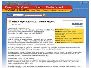
Middle Ages Cross Curriculum Project
Middle schoolers complete several projects on the Middle Ages. In this world history lesson, students complete language arts, social studies, math, and science projects. Some of these include: comparing a teenager's life now to that in...
Curated OER
Unit III: Worksheet 3 - Uniform Acceleration
This three-page worksheet moves physics masters to show what they know about motion. They analyze graphs of time versus displacement, solve instantaneous and average velocities, solve word problems, and graph results. This is an...
Curated OER
Mapping Your Schoolyard Habitat
Students explore the terrain, structures, plants and signs of habitats around their schoolyard. They draw a sketch map showing the different areas around the schoolyard. Students identify the location of weeds and native plants on their...
Curated OER
A Research Project and Article For the Natural Inquirer
Get your class to use the scientific process to solve a scientific problem. They utilize the Natural Inquirer magazine to identify a research question which they write an introduction to and collect data to answer. They use graphs,...
Curated OER
Freshman Project-Part One-Science Concept Map & 4-Questions Strategy
For this project worksheet, students are given a rubric to asses their concept map and their four question strategy completed for their science project.
Curated OER
Freshman Science Project-Part 1A-Science Concept Map
In this science project worksheet, students draw a concept map of their science project and use a rubric to determine their progress on their concept map.
Curated OER
Exploring Earth Through Maps and Technology
In this maps worksheet, students read 3 pages of detailed information about maps, latitude, longitude, topography, satellites and global positioning. Students then answer 10 questions. There is also a research project assignment available.
Curated OER
Fossil Fuels (Part II), The Geology of Oil
More of a mini-unit than a lesson plan, these activities lead inquisitors through a survey of oil deposits. In the first part, they read about and view diagrams of sedimentary rock layers that trap oil. Next, they test porosity and...
Star Wars in the Classroom
Star Wars Geography Unit
What kind of animals live on an ice planet like Hoth? How would the habitat on Tatooine allow different organisms to thrive? Connect social studies, science, and Star Wars in one engaging activity that focuses on the ecosystems...
PBS
Inspector Detector
How do spacecraft detect magnetic fields? The fourth installment of a five-part unit has learners develop a device with magnets that allows for the detection of magnetic fields. They use a map of an imaginary planet to try out their...
NASA
Biology Training Conclusion
Gravity is just one consideration when determining human habitability on a new planet. The lesson connects four different units and starts with connecting the various systems: planetary systems, human body systems, etc. After scholars...
Curated OER
Topographic Map Unit Plan
Students examine topographic maps and discover how to decipher contour intervals, use contour lines and apply information to complete a topographic map lab. Working in groups, they identify the scale of the map, latitude and longitude,...
Curated OER
Where in the Latitude Are You? A Longitude Here.
Students distinguish between latitude and longitude on the map. In this mapping lesson, students participate in mapping skills to recognize spatial relationships, and where to find natural resources on the map. Students create...
Curated OER
What's the Matter? (Grade 3)
Third graders organize information about the three types of matter and to reinforce concepts learned in the matter unit of the science curriculum. They use Inspiration software to create a concept map of the three types of matter.
Curated OER
Earth: Land Use Picture Project
Learners explore how changes in human land use are impacting local environments. They also explore some of the social impacts of various land uses in their area. They identify and discuss some social impacts of the different land uses.
Curated OER
Plate Tectonics: Second Grade Lesson Plans and Activities
Second graders explore convection currents and how they relate to the movement of tectonic plates. Then, young geologists reconstruct Pangaea with a worksheet and pinpoint plate boundaries on a map...


