Berkshire Museum
Where’s the Water?: Acting Out Science Cycles
Young scientists transform themselves into rivers, oceans, clouds, and drops of water in order to explore the water cycle. After assigning and explaining to students their different roles in the activity, the teacher reads aloud a...
PBS
Reading Adventure Pack: Rivers
A Reading Adventure Pack showcases a fiction and nonfiction book followed by a series of hands-on activities. First, learners widdle sticks to build a tiny raft, conduct sensory experiments, and create a rap or folk song about rivers and...
US Environmental Protection Agency
Non-Point Source Pollution
Investigate the different types of pollution that storm drain runoff carries into oceans, lakes, rivers, and streams with this class demonstration. Using an aquarium and an assortment of everyday items that contaminants like motor oil,...
NOAA
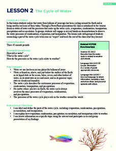
The Cycle of Water
Young water cycle enthusiasts discover the water they have been using has been cycling around the earth for billions of years. Through presentations, learners will understand that water has three states and how these forms...
Curated OER
Snapshot Day Definitions and Activities
Here is a document full of teaching notes on water quality and bodies of water that you can use in your ecology curriculum. It has information specific to the Hudson River area, but can easily be adapted to any local body of water....
Curated OER
Importance of Water
Students complete a KWL chart on what they comprehend about water. They complete a water activity determining how much usable water is available, and they determine the water usage in their households. Students take notes on water and...
Curated OER
Earth's Land and Water
Learners describe physical characteristics of bodies of water and landforms. In this land and water lesson plan, students model land and water with modeling clay and also discuss why people live near bodies of water.
Curated OER
River Otter Adaptations
Students study the body of the River Otter to understand animal adaptations to their habitats. For this animal adaptations lesson, students study the photo of the River Otter and discuss its body. Students then play a game of...
Curated OER
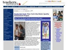
New York City Water Quality Assessment Project
Students investigate the chemistry of water and how its molecular structure supports life through its biochemcial, physical, and environmental roles. They investigate the quality of water as it interacts with the environment. Students...
Curated OER
Invasives and Macroinvertebrates
Students view macroinvertebrates, or discuss previous collection activity. They graph data on macroinvertebrates in the Hudson River. Students discuss the relationship between habitat, environmental changes, and invertebrate diversity or...
Curated OER
Michigan Quarter Reverse: A Coin Out of Water
Students examine the Michigan quarter reverse and differentiate between bodies of water. On copies of the quarter reverse, they color the land green and the water blue. After observing photos of water bodies, they complete a worksheet...
Curated OER
Salt Marsh in a Pan
Students create a model of a salt marsh to discover the impact of pollution and human activities on water-based habitats including bays and the ocean. They recognize the relationship between natural and developed areas. Students impact...
Curated OER
Water Quality Monitoring
Students comprehend the four parameters of water quality. They perform tests for salinity, dissolved oxygen, pH and clarity or turbidity. Students comprehend why scientists and environmental managers monitor water uality and aquatic...
Curated OER
Water Above the Ground
Students create a river drainage basin using a plastic tub, sand and a pitcher of water. They simulate the flow of water through the basin then add chocolate syrup to model what would happen if stormwater pollution entered the basin.
Curated OER
Water Pollution
Students explore the causes of water pollution. In this environmental lesson, students conduct experiments with natural filtration systems.
Curated OER
Mapping Landforms of South Carolina
Third graders analyze South Carolina maps. In this geography lesson, 3rd graders locate the five land regions in the state are and discuss how the regions are different. Students identify the major bodies of water and analyze how...
Curated OER
Eutrophication Lab
Students examine the effects of detergents and fertilizers on aquatic life and describe algae. Students define the term eutrophication as the process by which a body of water, such as a pond, lake, stream, or river, has a sudden increase...
Global Oneness Project
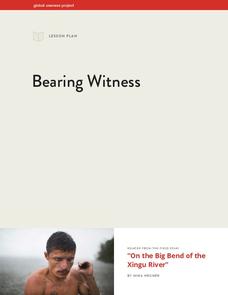
Bearing Witness
A controversial construction project in South America, the Belo Monte dam, is endangering local cultures, ecosystems, and communities. High schoolers create a concept map based on an online article they read before engaging in...
Curated OER
What is Happening to Our Water?
Learners compare and contrast Wisconsin's water resources to that of Puerto Rico. They research books about islands, particularly the Puerto Rican islands. Student view illustrations of island ecology. They discuss the illustrations and...
Curated OER
Watershed Model
Students view a presentation of water and land and how we need to protect our water resources. For this water lesson plan, students discuss how we rely on water, and complete activities in all subjects related to water.
Curated OER
River Study
Students study physical features of a local stream. They study how to identify water features on topographic maps.
Curated OER
Drop in the Bucket
Students study the sources for the water they use. They determine their town's major water supply and how many gallons per day does the population use.
Curated OER
Watersheds and Wetlands
Students investigate watersheds and wetlands. In this watersheds and wetlands lesson, students complete a 17 step lesson plan to build a watershed. Students then complete another 9 step lesson to build a watershed with wetlands and...
Curated OER
Interpreting Aerial Photographs
Students interpret aerial photographs. They view aerial photographs or satellite-produced images to locate and identify physical and human features. They study satellite images and label their images for bodies of water, clouds,...


