Owl Teacher
Creating a Map to My House
Here is a simple assignment that will introduce your young geographers to location, one of the five themes of geography, through an activity in which they map the directions and lines of latitude/longitude of where they live.
Curated OER
The Crash Scene
Fifth graders explore geography by participating in a mapping activity. In this engineering instructional activity, 5th graders identify the differences between latitude and longitude and practice locating precise points on a globe or...
Curated OER
Exploring Maps: Navigation
Students engage in a lesson that is concerned with the concept of navigation while research is conducted with the use of a variety of resources. The information is used to expand their perspective of the applications for navigation. The...
California Polytechnic State University
Australian Geography Unit
At the heart of this resource is a beautifully detailed PowerPoint presentation (provided in PDF form) on the overall physical geography of Australia, basic facts about the country, Aboriginal history, and Australia culture and lifestyle.
Curated OER
A Contouring We Go
Students examine the built environment and infrastructures of their community by constructing contour equipment, using the equipment, and comparing their results to current topographical maps of the same area
Curated OER
Comparing Kwakiutl, Cheyenne and Navajo tribes
Third graders study the difference between the Kwakiutl, Cheyenne and Navajo tribes. They identify the people, resources, lifestyle and beliefs of the Kwakiutl, Cheyenne, and Navajo Indians. Afterward, they present their projects on each...
Curated OER
Globe Raider: Part I
Students research a Spanish speaking countries using the Internet and other appropriate resources. They work in groups to complete a computer based treasure hunt before completing a Globe Raiders worksheet. They use the research...
PBS
Arthur's World Neighborhood: Building Global and Cultural Awareness
Kids become global anthropologists as they explore commonalities and differences both in their classroom and expanding across the globe. Throughout several activities, learners conduct partner interviews that culminate in Venn diagrams,...
Curated OER
Japan
First graders investigate the similarities and differences between Japan and the United States. They develop a KWL chart, locate Japan and the U.S. on a globe, conduct Internet research on life in Japan, conduct an interview, and create...
Curated OER
Harvesting Water from Fog
Students analyze the water issues of Cape Verde in the Peace Corp lesson. In this water resources lesson, students analyze the concept of water being harvested from fog. Students explore the Peace Corps project site by watching...
Curated OER
Researching the World's Oceans
Students research and compare important features of the oceans based on current data. They examine the globe or map, determine the major oceans of the world, and record their names on the data sheet.
Curated OER
Honing in on Hummingbirds
Students explore ruby-throated hummingbirds. In this cross-curricular hummingbirds lesson, students listen to the book The Mystery of the Missing Hummingbirds and choose related topics to research with a partner. Students draw or...
Curated OER
Geography: Snow Cover on the Continents
Students create maps of snow cover for each continent by conducting Internet research. After estimating the percentage of continental snow cover, they present their findings in letters, brochures or Powerpoint presentations.
Curated OER
Making Sense Of A Round World On A Flat Surface
Young scholars engage in a lesson that is concerned with the development of geography skills. They take part in a number of activities that center around finding and traveling to different locations. The lesson has resource links that...
Curated OER
Exploring the World's Geography
Students discuss the seven continents of Earth and the diverse geography. After discussion, they create their own paper-mache globes which properly display all seven continents, the equator, and the prime meridian. They conduct research...
Curated OER
Donde en el mundo estas?
Students give & follow directions given in Spanish, using oral, written and graphics. They use maps, globes, atlases, and remote sensing, GIS, and GPS to acquire and process information about places.
Curated OER
The Fifty States
Students become familiar with the states. They study capitols, mottos, nicknames, and other various details. They create group projects that be presented to the class.
Curated OER
Welcome to the Americas
Young scholars research and map the North and South American continents. For this geography lesson on the Americas, students can locate North, Central and South American countries and states. Young scholars choose a location to research...
Curated OER
Oh Canada!!
Fifth graders become familiar with the people, culture, government and geography of Canada. For this Canadian people and places lesson, 5th graders research and create a map of Canada reflecting their gathered...
Curated OER
Instruments From Around the World
How much does the environment affect how and what man creates? Children explore the effect of the environment on primitive man as they research raw materials from a specific location. They use their findings to write a short essay about...
August House
Go to Sleep, Gecko
Use this multidisciplinary lesson to delve into these subjects: English language arts, math, science, drama, and character education. After reading, discussing, and making interpretations about Go To Sleep, Gecko!: A Balinese...
Curated OER
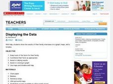
Displaying the Data
Students gather facts about their parent's families through the completion of parent interview forms. Using tally marks, the data gathered is counted, transferred to graphs and used to create family timelines.
Curated OER
Indiana Tornado Project
Learners become familiar with the use of GIS for research, natural phenomena in Indiana, and analyzing collected information.


