Teach Engineering
Using Map Scales to Figure Distances and Areas
The asteroid is getting closer and the question is whether the state of Alabraska is large enough for the shelter calculated in the previous activity. Teams determine the scale of their project and then use the scale on the map to...
Howard Hughes Medical Institute
Gorongosa: Making Observations Activity
Do you have young scientists wanting to make new discoveries rather than just completing the same experiments? Young scientists use their observational skills to identify animals and patterns in animal behavior. Through tracking...
Curated OER
European Explorers: Research Project
What will your students choose to include in their explorer's treasure chest? Youngsters research an early European explorer and gather items to reflect their research, such as a detailed map of the explorer's voyages, portrait,...
Curated OER
Arc GIS Project: Visualizing the Holocaust
A cross-curricular lesson for middle schoolers that covers language arts, social studies, geography, and math, this is a great extension activity if your class is reading The Diary of Anne Frank or learning about the Holocaust....
Curated OER
Mapping My Spot in History
Students create their own town's history. They place themselves on the map in a literal as well as figurative sense. Students produce portions of an updated version of an early twentieth century panoramic map. Students gather information...
Curated OER
E-mailing the Chamber of Commerce
Encourage effective internet research and e-mail correspondence as scholars investigate a US capital city they've never visited to find pertinent and relevant information. They begin by picking a city, then visit that city's chamber of...
Curated OER
Maps! Maps! Maps!
Third graders examine and identify different types of maps. They review the types of projections and which maps are better for different information. They answer comprehension questions at the end of the lesson.
Curated OER
Making Good Decisions
Students examine the consequences of behaviors and what the concept of trade offs are. In this good decision lesson students read an article and answer questions on making good decisions.
Curated OER
The Crash Scene
Fifth graders explore geography by participating in a mapping activity. In this engineering instructional activity, 5th graders identify the differences between latitude and longitude and practice locating precise points on a globe or...
PBS
Inspector Detector
How do spacecraft detect magnetic fields? The fourth installment of a five-part unit has learners develop a device with magnets that allows for the detection of magnetic fields. They use a map of an imaginary planet to try out their...
National Museum of the American Indian
The A:Shiwi (Zuni) People: A Study in Environment, Adaptation, and Agricultural Practices
Discover the connection of native peoples to their natural world, including cultural and agricultural practices, by studying the Zuni people of the American Southwest. This lesson includes examining a poster's photographs, reading...
Curated OER
World War II New Guinea Campaign
Although the big picture for this lesson on the New Guidea Campaign of WWII is taking a field trip to the Douglas MacArthur Memorial, you can easily use it as a guide to an independent or group research project as well. However, if you...
Super Teacher Worksheets
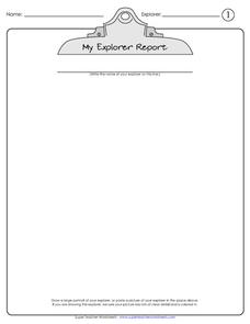
My Explorer Report
This is the perfect resource to accompany your class project on famous explorers! Learners detail basic information about their chosen explorer, his/her main events of exploration and means of transportation, and finally,...
101 Questions
Neptune
Examine an innovative approach to a large-scale model. Pupils across the state of Maine teamed up to create a model of the solar system that spans 40 miles. Put thinking skills to work within your classes as they make the calculations to...
Curated OER
Alien Plant Invasion: A Filed Study project at Saguaro National Park
Students are able to describe the purpose of National Parks and Monuments. They describe three ways alien plants species affect native populations of plants and animals. Students are able to properly set up a study plot, measure and...
Bowland
Alien Invasion
Win the war of the worlds! Scholars solve a variety of problems related to an alien invasion. They determine where spaceships have landed on a coordinate map, devise a plan to avoid the aliens, observe the aliens, and break a code to...
Science 4 Inquiry
An Investigative Look at Florida's Sinkholes
In May of 1981, the Winter Park Sinkhole in Florida first appeared and is now referred to as Lake Rose. Scholars learn about the causes of sinkholes through an inquiry project. Then, they analyze recent data and draw conclusions to...
Curated OER
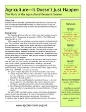
Agriculture: It Doesn't Just Happen
After reading an informational text on the Agricultural Research Service, learners research the role of the ARS in Oklahoma. Using reputable online sources, they label a map of the state with relevant areas. Researchers focus on one of...
California Academy of Science
Optimal and Sustainable: Renewable Energy Revamp
More than 100 cities around the world have shifted from fossil fuels to renewable energy sources. Scholars investigate a city wanting to make this switch, but needs help determining how to make the shift. Groups consider all options,...
Curated OER
Isolines on a Weather Map
Ninth graders explore weather by analyzing maps. In this temperature instructional activity, 9th graders view black and white weather maps of locations in which the weather changes often. Students identify the isolines used on the maps...
Curated OER
Using Concept Maps to Design 3D Spheres
Students create three dimensional shapes using concept maps. In this geometry lesson, students investigate the impact of mental schemas on humans. They collect data on this topic and plot their data on a coordinate plane.
Curated OER
Topographic Map Unit Plan
Learners examine topographic maps and discover how to decipher contour intervals, use contour lines and apply information to complete a topographic map lab. Working in groups, they identify the scale of the map, latitude and longitude,...
Curated OER
Mapping It Out
Fourth graders examine various aspects of the environment of Utah. In groups, they create four maps of Utah, based on temperature, precipitation and elevation. To end the lesson, they are asked a question as a group and use their maps...
Mathematics Vision Project
Similarity and Right Triangle Trigonometry
Starting with similar triangles and dilation factors, this unit quickly and thoroughly progresses into the world of right triangle features and trigonometric relationships. Presented in easy-to-attack modules with copious application...


