Curated OER
Compass Rose
Second graders practice identifying the four cardinal directions. After locating a compass rose on a map, 2nd graders explain each point that corresponds to a direction. Using a toy ship as a manipulative on a map, students observe its...
Curated OER
Compass Rose
Students describe the movement of the Earth as it relates to the sun. They construct a permanent compass rose and use it to find directions.
Curated OER
True North, Magnetic North
Students explain why compass angles need to be corrected for regional magnetic variation. They observe the difference between magnetic and true north. Each student measures the angle of variation for a town in a different state.
Curated OER
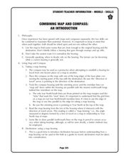
Combining Map and Compass
Learners practice using the map and compass to find a location. In this geography instructional activity series, students identify basic requirements needed when traveling in the wilderness. They plan a healthy menu for a backpacking trip.
Curated OER
Science: Reading a Compass
Young scholars demonstrate how to take bearings using a compass. In pairs, they select objects in the classroom then write down its first initial and bearing. They exchange papers and try to disciver their partner's object.
Curated OER
Orienteering - The Fundamentals
Students investigate the concept of a compass and it has been used in the past and in modern times. They practice using it in the wilderness in order to test its importance in various exploring activities. Each activity is accompanied by...
Science Matters
Magnetic Fields: The Earth Acts as a Giant Magnet
Attract learners to an interesting lesson plan! The third in a 14-part series of lessons on electricity and magnetism uses a hands-on approach to exploring magnetic fields. Scholars experiment with a compass to test Earth's magnetic...
California Academy of Science
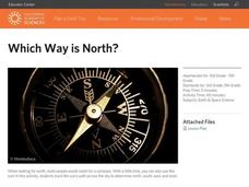
Which Way is North?
Who needs a compass to find cardinal directions? Just place a stick in the ground and record the movement of its shadow over the course of a day. Then, measure the shadow lengths in order to determine a north-south line. A simple...
Curated OER
TE Activity: Northward Ho!
Young scholars design a simple compass. They examine how the Earth's magnetic field has both horizontal and vertical components. They determine how a compass works and work with cardinal directions.
Curated OER
Topo Map Mania!
Students read and use topographical maps. They also use a compass to find bearing to an object on a map and in the classroom. Ask your students how they might travel to somewhere they have never been to befo
Curated OER
North, South, East, and West
A basic lesson on the teaching of the cardinal directions awaits your class. They are directed to go to different parts of the playground and where they attempt to describe their location in relation to each other by using the cardinal...
Curated OER
In Mr. Lincoln's Shoes
Students demonstrate basic map skills. In this US history lesson, students review cardinal directions and use a compass rose while at the same time discuss what life was like for Abraham Lincoln.
Curated OER
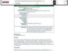
Leaf, Tree and Prairie Study
Students are introduced to the topic of Botany and the process of photosynthesis. Using various habitats, they research the amount of destruction it is facing and how to solve the problem. They make a leaf booklet with leaves they find...
Curated OER
Where in the World? The Basics of Latitude and Longitude
Students are introduced to the concepts of latitude and longitude. In groups, they identify the Earth's magnetic field and the disadvantages of using compasses for navigation. They identify the major lines of latitude and longitude on a...
Curated OER
Cardinal and Ordinal Directions
Students use a compass to locate cardinal and ordinal directions. In small groups, they describe and create a journey for their classmates using their compass. Groups create a scale map for their classmates to follow and relate this...
Curated OER
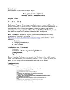
Cave Activity: Mapping Fractures
Students tour a cave and observe fractures in the cave's ceiling. They record characteristics of the fracture. They locate three major passages in the cave and ten major fractures.
EngageNY
Construct an Equilateral Triangle (part 1)
Drawing circles isn't the only thing compasses are good for. In this first installment of a 36-part series, high schoolers learn how to draw equilateral triangles by investigating real-world situations, such as finding the location of a...
Curated OER
Follow the Light
Here is another in the interesting series of lessons that use the special State Quarters as a learning tool. During this instructional activity, pupils learn about lighthouses, maps, the cardinal directions on a compass, and U.S....
Curated OER
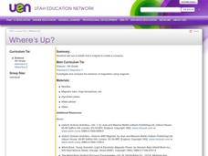
Where's Up?
Fifth graders brainstorm answers to the question why compasses point north. In groups, they use introduce the needle to the different ends of the magnet. They place the needles in a styroform disk and record their results in their...
Curated OER
Location, Location
Third graders draw and interpret simple scale maps, use maps to move around efficiently or plans to propose actions. They use of a compass to specify and find directions. They display and discuss a map of the local region.
Curated OER
Using Magnetotactic Bacteria to Study Natural Selection
Students observe bacteria that are able to orient themselves using the Earth's magnetic field.They comprehend the difference between anaerobic and aerobic organisms. Students can tell the difference of the shape of magnetic force field...
Curated OER
Yo Ho, Yo Ho, A Pirate's Map for Me: An Original Story
Students read Blackbeard and brainstorm their knowledge of maps. In this language arts and geography lesson, students use landmarks on their playground to review north, south, east and west and discuss the compass rose. Students read...
PHET
Measuring the Interplanetary Magnetic Field
Scientists need to figure out how to measure interplanetary magnetic fields, but the magnetic field of the spacecraft is interfering with their readings. Scholars attempt to solve the problem that has perplexed NASA scientists for years.
Curated OER
Compass Designs
Young scholars investigate the properties of two and three dimensional objects. In this geometry instructional activity, students differentiate polygons based on similarity and congruence. They make observation and interpret the data.
Other popular searches
- Compass Skills Worksheets
- Compass Skills 3rd Grade
- Compass Skills First Grade
- Compass Skills Elementary
- Map and Compass Skills
- Compass Skills Lesson Plans
- Map Compass Skills
- Math Compass Skills
- Tecahing Compass Skills
- Decaying Compass Skills
- Compass Skills Yr 10
- Math Compass Skills Triangle


