Curated OER
Mapping the Transcontinental Journey
Students develop their geography skills. For this Lewis and Clark lesson, students collaborate to calculate the time and distance of different segments of the expedition. Students compare their estimate to Lewis and Clark's.
Curated OER
Geo-Class Mapping My Neighborhood
Students create a map of the school and surrounding neighborhood. In this mapping lesson, students discover their school's location and learn about its past. Students use math skills and the steps in the design process to...
National Endowment for the Humanities
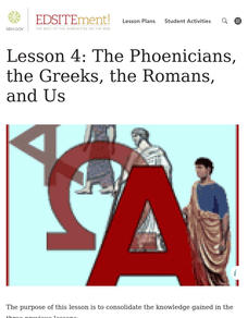
Lesson 4: The Phoenicians, the Greeks, the Romans, and Us
Learners review knowledge gained in the three-part unit on the history of the alphabet. Using maps and images, learners consolidate their understanding of ancient Greece, the Romans and the Phoenicians, and their respective impacts...
Curated OER
Map of Town
Third graders draw a map of the town given different sites to locate on the map by the teacher. They explain that latitude and longitude are used to locate places on maps and globes, identify the distinctive physical and cultural...
Curated OER
Math with Maps and Globes
Young scholars round out their math skills with these ‘round the world' ideas. In this math and geography lesson, students try out time zone sticks, a polar race, and tic-tac-globe to engage them in learning more about globes and the...
Curated OER
Memorable Maps
Students draw an assigned map from memory about the United States or any other region they are studying. In this maps lesson plan, students draw a map from their memory at the beginning of the year, and do the same assignment at the end...
Curated OER
French and Indian War: Make A Map
Fifth graders create a map of the battles that occurred during The French and Indian War. In this history lesson plan, 5th graders read about the war in their text books, then divide into groups to create a detailed map of a famous...
All for KIDZ
The Orphan of Ellis Island
Everyone comes from somewhere. An interdisciplinary lesson on Elvira Woodruff's The Orphan of Ellis Island includes discussion starter and writing prompts for the novel, as well as a graphic organizer to help learners begin their...
Star Wars in the Classroom
Star Wars Geography Unit
What kind of animals live on an ice planet like Hoth? How would the habitat on Tatooine allow different organisms to thrive? Connect social studies, science, and Star Wars in one engaging activity that focuses on the ecosystems...
Civil War Trust
Civil War Soldier: Experiencing the Battle of Franklin
Fighting a war over home soil makes a living nightmare even more real. Class members describe the experience of a Civil War soldier during the Battle of Franklin, poised right at a major turning point of the war, after researching the...
Curated OER
Draw an Inch, Walk a Mile
Students work in small groups to solve the problems presented. The main project, mapping the classroom, use these discussions to collaborate in creating a tangible demonstration of their understanding.
Owl Teacher
Teach Ancient Rome!
Teaching the class about Ancient Rome can be fun for you and for them! Check out this incredible resource that has everything you need to bring ancient Roman civilization back to life. Begin by scrolling to the bottom of the page and...
Curated OER
The Gift of the Nile: Egypt and its River
Middle schoolers begin with a piece of a puzzle that shows an artifact from ancient Egypt. They find others who have pieces that go with their puzzle piece. Students work in these groups to construct a relief map of the Nile River Valley.
Curated OER
Our City
Second graders familiarize themselves with the town they live in by practicing their imagination, library research and writing skills.
Curated OER
The Desert Alphabet Book
Young scholars explore world geography by researching a science book with their classmates. In this desert identification lesson, students utilize a U.S. map to locate the geographical locations of deserts. Young scholars create an oral...
Curated OER
Discovering New Mexico
Seventh graders discuss the elements of maps and using basic linear measurement. They calculate the distance between the cities and create a simulated journey around New Mexico using a road map. They write out the directions for their...
Curated OER
Title: Rivers as Borders
Students are introduced to the concept of borders. They read maps and identify rivers that separate different countries and states. They examine how or why a landform such as a river border might be the reason for different cultures.
Curated OER
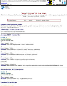
Our Class Is On the Map
Second graders review map keys, symbols, and the purpose of maps, then students design a poster size map of their classroom.
Curated OER
BIGGER AND BIGGER: (We Live in a family, a neighborhood, a city, and the United States)
Students discover that they are part of bigger and bigger groups. They begin with families and work up to belonging to North America as they initiate a study of the whole country.
Curated OER
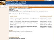
Immigration to the United States
Third graders search TDC database for images of immigration from other countries, maps, and diaries. They identify why immigrants came to the United States and engage in a role-play simulating an experience the immigrants might have had.
Curated OER
Touring the Regions of the United States
Fifth graders explore the regions of the United States. They use maps, research on the Internet and use measurements and estimations. Students create a presentation using spreadsheets and publishing software.
Curated OER
The Pilgrims
Students use distance measuring tools to follow directions and chart the path the pilgrims made from Plymouth, England to Boston, Massachusetts. In this Pilgrim voyage instructional activity, students use a map to chart the distance...
Curated OER
Site and Situation: Right Place at the Right Time
Students analyze geographic details. In this research skills lesson, students research maps as well as primary and secondary sources to analyze growth, population, and manufacturing in Altoona, Pennsylvania following World...
Sea World
Endangered Species
Study different endangered species with several activities that incorporate math, science, language arts, and research strategies. A great addition to your lesson on conservation or Earth Day.


