Curated OER
Geography A to Z: The Letter S
The letter S is the clue learners need to answer each of the seven geography questions on the worksheet. They answer questions about African, Canadian, Middle Eastern, and US geography using locations that begin with the letter S.
Curated OER
Geography A to Z: Letter O
The world is full of places that start with the letter O. It's true! Your class can use what they know about geography to answer seven curious questions related to world locations that all begin with letter O. Like Ohio, Ottowa, and...
Curated OER
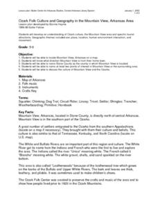
Ozark Folk Culture and Geography in the Mountain View, Arkansas Area
Upper grade through early high schoolers develop an understanding of Ozark culture, and the geography of the Ozark Plateau. They study place, location, human environmental impacts, and movement. This interesting plan incorporates muic,...
Curated OER
Expanding the Mission: Historical Parks
Students explore U.S. geography by viewing a documentary in class. In this national parks lesson, students view video clips of individual national parks and locate them using Google Earth software. Students create a persuasive...
Curated OER
United States Geography: Crossword Puzzle
In this geography worksheet, students use the 14 clues in order to fill in the crossword puzzle with the appropriate United States geography answers.
Curated OER
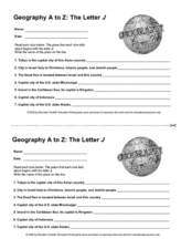
Geography A to Z: The Letter J
How many states, capitals, countries, and locations do your kids know that begin with the letter J? Hopefully they know seven of them, because that's the number of questions on the fun and fast worksheet.
Curated OER
Facts, Fictions and Perceptions of Regions
Students examine the different characteristics of the regions of the United States. They discuss places they have visited in the U.S., and in small groups conduct research on a selected region of the U.S. Each group labels a map of...
Curated OER
People Behind the Parks
Explore U.S. geography with your class by viewing a documentary. Show a portion of the Ken Burns documentary "The National Parks," and identify the individuals responsible for keeping the parks in order. Elementary and middle schoolers...
Curated OER
U.S. States Border Canada: Crossword Puzzle
For this United States history worksheet, students use the 14 clues in order to fill in the crossword puzzle with the appropriate states that border Canada as answers.
California Polytechnic State University
Australian Geography Unit
At the heart of this resource is a beautifully detailed PowerPoint presentation (provided in PDF form) on the overall physical geography of Australia, basic facts about the country, Aboriginal history, and Australia culture and lifestyle.
Sharp School
Geography Project
This very simple geography project can lead to a lot of useful referential information that can be displayed in your classroom! Learners construct a poster-size map of a country, identifying major demographic points and including pie/bar...
Curated OER
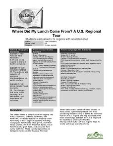
Where Did My Lunch Come From? A U.S. Regional Tour
Students explore the regions from which their food comes. For this social studies lesson, students identify the different agricultural products that are found in the major regions of the United States. Students create a lunch menu.
Curated OER
My Summer Vacation
Students study the United States geography using Google Earth. In this U.S. geography instructional activity, students create travel journals about five U.S. geographical locations. Students research the human and physical...
Curated OER
The United States and Canada: Climate and Vegetation
Display U.S. and Canadian climate and vegetation through this text-companion worksheet. Learners read about the geography of these regions, take notes, and answer 3 comprehension questions as they read the selection. A graphic organizer...
Curated OER
Mystery State # 28
Using clues is a great way to increase deductive and logical reasoning skills. Boost thinking skills while quizzing kids about us geography. They use five clues to determine which state is in question.
Curated OER
Geography: Intro to Canada
Students investigate the geography of Canada by analyzing a map of the country. In this North American geography lesson, students identify the 13 provinces of Canada and their locations by examining a Canadian map. Students may use...
Curated OER
Images of the Parks
Learners explore U.S. geography by completing a research project about the National Parks. In this scenery image analysis lesson, students identify the different national parks in our country and observe paintings and images by famous...
Curated OER
Canadian Symbols
Learners discover the ideals of Canada by analyzing its symbols. In this Canadian culture lesson plan, students identify the symbols that established the U.S. as its own nation and compare them to important Canadian symbols. Learners...
Curated OER
The Underground Railroad and The Fugitive Slave Law of 1850
Students discover racism and slavery by completing a role playing activity. In this U.S. history lesson, students analyze documents from the Civil War era and describe the Fugitive Slave Law. Students view a video on YouTube about the...
Curated OER
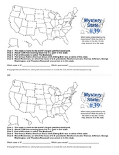
Mystery State # 39
Which state will be the answer to the five clues today? After considering each clue, learners will name the mystery state. If your class can determine which state was home to Chief Sitting Bull, they'll be able to answer South Dakota.
NASA
Outline Maps
Don't miss this gold mine of blank maps for your next geography lesson! Regions include traditional continents such as Asia, Europe, and Africa, as well as other major world areas such as the Pacific Rim and the Middle East.
Curated OER
Geography and Topography, History and Architecture
In this social studies lesson plan, learners answer short answer questions about the geography, topography, history, and architecture of the east part of the United States. Students complete 24 questions.
New York City Department of Education
Geography and Early Peoples of the Western Hemisphere
Young historians discover the early people of the western hemisphere. The unit explores how the land changed, how it was used and homes of early Americans such as Incas, Mayans, Inuits, Aztecs, and Pueblos. Individuals also examine these...
Curated OER
Kansas vs the U.S.
Learners demonstrate an understanding of the physical and political geography of Kansas. They view maps and films to gain knowledge of Kansas. They calculate the percentage Kansas harvests for each crop out of the national total.


