Curated OER
Orienteering: Welcome to the Jungle
Students work together in groups to complete a treasure hunt. Using the school grounds, they search for pictures and stuffed animals of different species. They use a GPS to locate them and record which habitat they live. They calculate...
CK-12 Foundation
Direction on the Earth: Using a Compass
Navigate the world of orienteering in an informative interactive. Earth science scholars learn practical direction skills, such as proper polar coordinates and pairing compasses with maps. The interactive map allows them to practice...
National Wildlife Federation
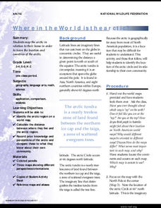
Where In the World Is the Arctic?
Exactly how far away is the Arctic? Learners use maps to orient themselves to their locations on the globe. They then make calculations to describe how their location relates to the location of the Arctic regions.
Curated OER
MAPS AND TOPOGRAPHY
Students analyze the details of a topographic map and create one of their own by utilyzing a map of elevations.
Curated OER
Mapping The Ocean Floor
Young scholars explore and analyze the bottom structure of underwater habitats. They describe and explain what can't see through the collection and correlation of accurate data. Learners assess that technology is utilized as a tool for...
Curated OER
Basic Orienteering
Students study orienteering. In this science lesson, students study the parts of a compass and use the compass to set a bearing and follow the bearing on the compass.
Curated OER
Mapping Potato Island
Students create their own topographical map using a potato. In this hands on lesson students construct a topographical map and explain what contour lines are using a potato.
Curated OER
Mapping the Ocean Floor
Students study the bottom structure of underwater habitats and how they can be mapped.
Curated OER
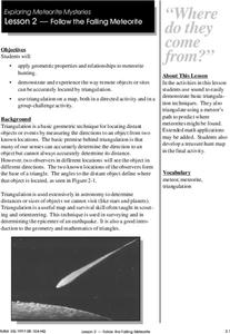
Follow the Falling Meteorite
Students use triangulation method to locate meteorite landing site on the map. In this earth science instructional activity, students participate in a meteorite treasure hunt set up by the teacher. They explain how this method is used by...
Channel Islands Film
Island Rotation: Lesson Plan 1
How do scientists provide evidence to support the theories they put forth? What clues do they put together to create these theories? After watching West of the West's documentary Island Rotation class members engage in a series of...
Curated OER
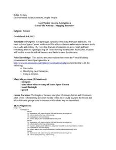
Cave Activity: Mapping Fractures
Students tour a cave and observe fractures in the cave's ceiling. They record characteristics of the fracture. They locate three major passages in the cave and ten major fractures.
Curated OER
Glaciers Worksheet #2
A map of the Hudson River Valley is exhibited here. Arrows representing glacial striations are spread across the map for learners to analyze. They answer five multiple choice questions in response. The worksheet is a compact review of...
Curated OER
Orientation of the Earth in Space
Students hypothesize the location of the sun in the sky at diferent times of day and at different latitudes. They perform several experiments to provide evidence for their hypothesis. Experiments including observing the sun's position at...
Curated OER
Terrabagga Activity Using a Magnetometer
Clever! Earth science learners construct a model of a planet containing a magnetic core. The planet, Terrabagga, is made out of a paper grocery bag, magnets, a dead D battery, and rubber bands. Pictures of each step of the construction...
Curated OER
Follow The Falling Meteorite
Students investigate the supposed traveling path of a meteorite. They use sound in order to triangulate the path. The results of the experiment are written on a map to display the path of the meteorite. The culminating activity is when...
Curated OER
Navigating by the Numbers
Students observe how math is important in navigation and engineering. They study how surveyors use math and science to calcute, count, measure, label, and indicate distances on a map. They estimate specific distances.
Curated OER
GPS Treasure Hunt for Knowledge
Students examine themselves as being part of a global community. In this global community instructional activity, students investigate GPS systems. Students gain knowledge on how the device works. Students discover that satellites...
Curated OER
Native Americans and Topography at Rose Bay
Students visit a wetland ecosystem. While they are there, students explore how to read topography maps of Rose Bay.
Curated OER
Measure Up!
Students examine parallax and angular measurements. In this investigative lesson students calculate distances of objects and map their results.
Curated OER
TE Activity: Northward Ho!
Students design a simple compass. They examine how the Earth's magnetic field has both horizontal and vertical components. They determine how a compass works and work with cardinal directions.
Curated OER
True North, Magnetic North
Students explain why compass angles need to be corrected for regional magnetic variation. They observe the difference between magnetic and true north. Each student measures the angle of variation for a town in a different state.
Curated OER
The Monarch Butterfly Watch
Students explore monarch migration through the Journey North web site. In this butterfly lesson plan, students use the internet to identify a butterfly's migration pattern. Students write in electronic journals.
Curated OER
Tables, Charts and Graphs
Learners examine a science journal to develop an understanding of graphs in science. In this data analysis lesson, students read an article from the Natural Inquirer and discuss the meaning of the included graph. Learners create a...
Curated OER
Science: Reading a Compass
Students demonstrate how to take bearings using a compass. In pairs, they select objects in the classroom then write down its first initial and bearing. They exchange papers and try to disciver their partner's object.


