Science Matters
Energy and Winds
In the study of wind energy, scholars build a small windmill and observe how it transfers wind into mechanical energy. Learners will make connections to the previous lesson with concepts such as the creation of wind through convection.
Curated OER
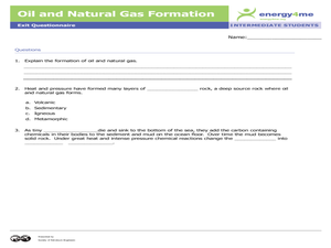
Oil and Natural Gas Formation
Pupils complete a narrative paper and a drawing depicting how the formation of oil and natural gas taken from the Earth's crust were once plants and animals millions of years ago. In this oil and natural gas lesson plan, students read,...
Curated OER
Magnetometer Extension Activities
Students observe magnetic fields and locate the position of "ore deposits" patterns using models and maps. For this magnetometer lesson students complete a hands on activity and a reading/writing exercise.
Curated OER
Microclimates of Our School
Learners read the story "Weslandia" by Paul Fleischman, define the term microclimate, gather and record data in various places on school grounds to establish the presence of difference microclimates, analyze and compare microclimates,...
Curated OER
Weather Forecasting
Students study how to forecast the weather. In this weather forecasting lesson students read different meters and understand basic cloud formations in their relationship to weather.
Curated OER
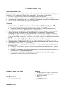
Earth's Energy Balance Performance Standard
Students examine how Earth-Sun relationships affect Earth's energy balance and the pattern of world temperatures. Students study a Surface Temperature Regions map and write a paragraph describing the temperature pattern from the Equator...
Curated OER
Circle the Earth - Explore Surface Types on a Journey around Earth
Students use CERES percent coverage surface data with a world map in locating landmasses and bodies of water at Earth's Equator.
Curated OER
THE GULF STREAM
Students explore how to describe the Gulf Stream, how Benjamin Franklin charted it, and correctly plot it on a map.
Curated OER
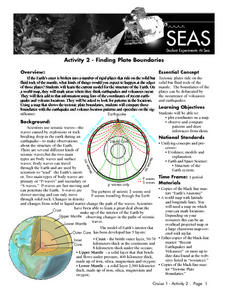
Recent Volcanoes And Earthquakes:
Students investigate the current model for the structure of the Earth. On a world map, they mark areas where they think earthquakes and volcanoes occur and compare those areas with earthquake and volcano location patterns.
Curated OER
Off to the Future
Students read a handout and predict the position of the San Andreas Fault far in the future. For this future world lesson, students use a map worksheet to demonstrate the path of the Pacific Plate millions of years from now.
Curated OER
How would an oil spill affect a Marine Sanctuary?
Students explore the concept of environmental stewardship. In this science lesson, students discover how scientists assess damages to the environment following oil spills. Students conduct a simulation of a public meeting in order to...
Science 4 Inquiry
Deforestation
Young scientists observe deforestation from satellite photos and discuss the importance of forests to the global environment. They then simulate a plot of forest when farmers move into the area over the course of seven years. Finally,...
Curated OER
Simulation: Yum, Yum Trees Simulation: Yum Yum Trees Conservation of Resources
Students weigh the uses of the yum yum tree against the problem of conserving them. In this conservation lesson, groups of students discuss and make suggestion to conserve the yum, yum trees. Students apply knowledge to renewable and...
Channel Islands Film
Island Rotation: Lesson Plan 1
How do scientists provide evidence to support the theories they put forth? What clues do they put together to create these theories? After watching West of the West's documentary Island Rotation class members engage in a series of...
Curated OER
Student Tracking
Here is an interesting lesson on satellite tracking. Learners use various tracking techniques to find out where they go on a daily basis, what the environmental conditions are, and what they are doing during their "migrations." A...
Curated OER
Possible Locations
Middle schoolers create maps with cutout pieces of paper that represent caverns. They develop a scale for their map and decide where the best location is to live. They discover the importance of map reading skills.
Curated OER
Continents and Oceans on the Move
Students create an awareness of the vast percentage of water covering the earth. They relate similarities/differences between topographical maps and other maps of various time periods. Students examine how to use a topographical map.
Curated OER
Watersheds, Watersheds Everywhere
Students identify the watershed in which their school is located. They use maps to locate their homes and school. They define and use the correct vocabulary.
Curated OER
Animal Invasion
Students research and illustrate the natural habitats and evolution of giraffes and other animals imported into ancient Rome. They draw a map of Europe, North Africa, and West Asia and draw the animals from each region in their proper...
Curated OER
Animaters and Lego Mania!
Students use various technology elements to storyboard and create an animal animation story based on a nonfiction story they've read. In this animation story instructional activity, students work in groups and read nonfiction animal...
Orange County Water Atlas
Location, Location, Location…
Young geographers discover not only how to read and recognize coordinates on a map, but also gain a deeper understanding of latitude and longitude and how climate changes can vary significantly across latitudes.
Curated OER
Soils
Students apply knowledge of soil, environmental impacts, economics, multiple human demands, and use given data for a proposed scenario in making land use decisions. They debate land use issues and/or scenarios and discuss a case study.
Curated OER
Living in the Desert
Conduct an investigation on the plants used by the Hohokam tribe. To survive in the harsh desert environment the Hohokam used many natural resources. Learners read, research, map, and graph multiple aspects of Hohokam plant use as a...
Curated OER
Geography: World Dynamics
Students discuss and examine how the world is changing. After reading an article, they discover the immediate changes that have taken place and how they have effected living things. They complete a worksheet identifying the changes as...


