Curated OER
United States Map - Lesson 4: States
Students use a United States Map to locate their state and use map symbols to determine the boundaries of a state. In this states lesson plan, students learn the definition of a state and identify their own on a map.
Curated OER
The Country of Chile - Map Work
In this map worksheet, students label a map of Chile by following 11 directions given at the bottom of the page. They label landforms and water bodies associated with the country.
Curated OER
My Top Interdisciplinary Social Studies Lesson Plans
Here are some top social studies lesson plans and activities which present concepts in a memorable fashion.
Curated OER
Read a Map ... It's a Snap!
Students are introduced to map and globe skills. They use grids and are able to construct their own simple maps of familiar places. Students are able to define a map, globe, and symbol and use the direction words north, south, east,...
Curated OER
Directions, Directions
Third graders review cardinal directions, moving around the room so that they are standing in the part of the room that is nearest the north, south, east and west. They are asked what would you do if they are lost? Pupils work as a...
Scholastic
The Seven Wonders of the Ancient World
The Colossus of Rhodes, the Hanging Gardens of Babylon, the Lighthouse of Alexandria. Young archeologists investigate the Seven Wonders of the Ancient World, map their locations, and match their names with brief descriptions and images....
Curated OER
Mapping Community Values
Students discuss the origin of various maps focusing on the values behind them. Students also explore how human needs and geography influence community settlement patterns. Students extend learning by creating and mapping their own ideal...
Curated OER
Cardinal Directions
Young scholars explore cardinal directions. In this social studies lesson, students create maps of home and school using the cardinal directions.
Curated OER
Mapping India
Students participate in an activity in which they place placards listing geographic features, landmarks, etc. in the correct place on a large fabric map of a given country. They also examine artifacts, photos, sounds/music, etc. from...
Curated OER
Geography Puzzles
Students study the continents of the world. In this Internet geography lesson, students connect to online mapping games. Students collaborate in order to develop their understanding of world geography, including countries and capital...
Curated OER
Schoolyard Geology
Discover that maps show information about an area and that they have common features like scales and legends. View an aerial map of your school and find features on the map such as the playground, roads, and trees. Trace the outline of...
Curated OER
Lesson 2: Mapping Our Home
Students recognize the importance of community participation in the census. In this U. S. Census lesson plan, students use map-reading skills to find answers and learn the difference between senators and members of Congress.
Curated OER
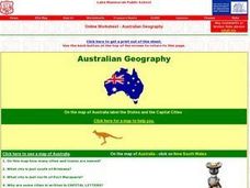
Australian Geography
In this map reading instructional activity, students label a map of Australia by adding the names of states and cities. They answer eight questions about the map.
Curated OER
Concept Map
A blank concept map graphic organizer helps learners get their information, thoughts, and ideas organized. One initial concept splits into three sub-topics, which then provide a larger section for more details.
Newark Public Schools
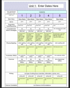
ELA Curriculum Map
Organize your curriculum of narratives and stories within an ELA unit and keep track of what elements are needed to ensure the unit's success. This curriculum map template allows you to plan for supporting texts, comprehension...
Curated OER
U.S. Geography- The Northeast
Students investigate the geography of the Northeast states. In this map skills lesson, students are shown a map of the Northeast states and identify the state names and borders. Students construct individual maps of the Northeast using...
Curated OER
Using Four Main Directions in the Classroom
Pupils identify the four cardinal directions. In this map skills geography lesson plan, students use a magnetic compass to label the four directions in the classroom. Pupils use the four directions to locate objects in the classroom.
Curated OER
Land Elevation
Students investigate land elevation. In this map skills lesson, students use a physical map to identify various elevations of the land. Students find landform features such hills and coastlines.
Curated OER
Introduction to the Globe
Students investigate how to use a globe. In this map skills lesson, students define what a globe is and locate the various continents on the globe. Students are also asked to locate the four oceans on the globe.
Curated OER
Blank US Map
In this blank outline map worksheet, students study the physical boundaries of the 50 states that make the United States. This outline map may be used for a variety of geographic activities.
Curated OER
Lesson Design Archaeology- World Map
Students practice locating positions on the world map. In this map skills lesson plan, students explore the world map and items such as the compass rose, Equator, mountains, cities, etc. The students practice locating positions on the...
Curated OER
United States Map- Land Elevation
Learners explore a physical map. In this map skills lesson, students discuss examples of elevation and investigate the symbols used to identify elevation on a map. Learners use the map to identify various land elevations.
Curated OER
In Mr. Lincoln's Shoes
Students demonstrate basic map skills. In this US history lesson, students review cardinal directions and use a compass rose while at the same time discuss what life was like for Abraham Lincoln.
NET Foundation for Television
1850-1874 Homestead Act Signed: Who were the Settlers?
Life in the great, wide-open spaces of the West! Scholars analyze the reasons behind the vast movement to the Great Plains after the passing of the Kansas-Nebraska Act and the Homestead Act. Using photographic, document, map, video, and...


