Newspaper Association of America
Community Connections with Geography and the Newspaper
Understanding geography and government begins at the local level. Using maps and the parts of a newspaper, a unit plan introduces the concept of community. It starts with the creation of classroom and school maps, and then moves through...
California Academy of Science
Tropical Belt
Where in the world is the equator? Explore a world map with your class, coloring in oceans, continents, and rainforests while locating the three major lines of latitude: the equator, Tropic of Cancer, and Tropic of Capricorn. Discuss how...
Curated OER
Geography
Introduce your second graders to geography with this 13-slide PowerPoint. Students discover the names of the 7 different continents, as well as review the four oceans on the Earth. This presentation contains fabulous graphics on each slide.
Curated OER
Play Doh Map of Your State
Students create a state map using Playdoh. In this hands-on state geography lesson, students work in groups to form a three-dimensional map of their state using Playdoh made at home following a (given) recipe. Students use four colors...
Curated OER
Map Puzzles
Students make puzzles from world maps, dramatizing how much of the globe is covered by ocean.
Living Rainforest
Finding the Rainforests
From Brazil to Indonesia, young scientists investigate the geography and climate of the world's tropical rain forests with this collection of worksheets.
Curated OER
Agriculture Cares for the World
Students explore world geography by analyzing agriculture. In this dietary habits lesson, students discuss the role parents play in their children's diet and where the food comes from. Students write agricultural research paragraphs and...
Curated OER
Alaska Virtual Field Trip
Students participate in an on-line virtual field trip to the state of Alaska. In this U.S. Geography lesson, students research several Internet sites dealing with travel to Alaska and activities to participate in. Students create story...
Curated OER
Cloudy with a Chance of Meatballs
Students explore the 5 themes of geography. In this cross curriculum literacy and geography lesson, students listen to Cloudy with a Chance of Meatballs by Judi Barrett, and make a list of the needs of the people in Chewandswallow....
Curated OER
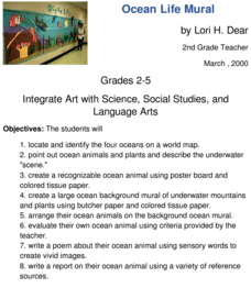
Ocean Life Mural
How many oceans can you name? First, have learners try to name as many oceans as they can, and then have them locate and identify the oceans on a world map. They create a recognizable ocean animal using poster board and tissue paper....
Curated OER
Rivers... for Kids
Students investigate U.S. geography by exploring it's bodies of water. In this river formation lesson, students identify the reasons rivers are needed in our country by reading assigned text. Students examine a diagram which explains how...
Curated OER
Math with Maps and Globes
Young scholars round out their math skills with these ‘round the world' ideas. In this math and geography lesson, students try out time zone sticks, a polar race, and tic-tac-globe to engage them in learning more about globes and the...
Curated OER
Explosive Geography
Students consider how volcanic eruptions can affect an environment and how a volcano works. The explosions of Mt. Saint Helen's, Mt. Redoubt, and Mt. Kilauea are researched and presented to the class in groups.
Curated OER
Cacao Tree Geography
Students use a map to learn about where chocolate comes from. For this lesson on the cacao tree, students locate various regions where the cacao tree grows. They will discuss why the cacao tree grows more favorably in particular climates...
Curated OER
Bodies of Water
Learners investigate the geography of the Earth by identifying bodies of water. In this global geography lesson, learners read a list of bodies of water which they must identify in a word scramble.
Curated OER
Ocean Currents
Students discover the geography of Earth by analyzing water currents. In this oceanography lesson plan, students create visual references on a map of the globe where and why major ocean currents are moving water. Students conduct a...
Curated OER
Geography: African Floor Maps
Learners explore the African continent and identify the various countries there. They examine the history, geography, environment, and inhabitants of the countries. Students create maps of Africa using a variety of materials.
PBS
Dear Pen Pal
Explore cultures from around the world with an engaging pen pal resource. Through a series of classroom activities and written correspondence, children learn about the favoritec pastimes, schooling, geography, and weather that is...
Curated OER
Dinosaurs
Second graders classify and analyze living things by structure and function and make predictions based on observations rather than random guesses. They make predictions about where dinosaurs lived and correctly place their databases onto...
Curated OER
The Big Circle
Students explore geography by participating in a mapping activity. In this concentric ring lesson plan, students utilize a poster board, string and markers to identify their current location within the entire world. Students write about...
Curated OER
Oh, the Regions
Focus on the geography of Oklahoma. In this activity, learners compare different geographic regions in Oklahoma, create a collage to share their results, and identify important landforms throughout the United States, such as the Rocky...
Curated OER
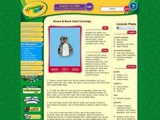
Stone & Bone Inuit Carvings
Students research information about Canadian Inuit history, geography, and culture. They study many forms of art created by the Inuit, including sculpture with stone, animal bones or teeth, and other items found in their northern Canada...
Curated OER
Natural Resources
Students explore Iowa geography and topographic maps. For this geography and topographic maps lesson, student investigate maps, newspapers, Iowa flora and fauna. Students gain an understanding of how different landforms can be identified...
Curated OER
Tracking Fall's Falling Temperatures
Young meteorologists track weather from day to day and record results on graphs, maps, or other places. They see firsthand how weather temperatures trend cooler as fall progresses and practice grade-appropriate skills in geography (map...
Other popular searches
- Five Themes of Geography
- U.s. Geography
- China Geography
- Africa Geography
- Mexico Geography
- Canada Geography
- Asia Geography
- France Geography
- Japan Geography
- World Map
- Ireland Geography
- Geography Studies


