Curated OER
Flower Power
This fascinating series of four lessons use the paintings of artist Robert Harris to illustrate different types of ecosystems, and the harm that comes to them from human policy. A global view of environmental policies are studied, which...
National Geographic
Types of Volcanic Eruptions
Blow the roof off your classroom with this multimedia science lesson on volcanic eruptions. A short online video teaches young geologists about shield and composite volcanoes and explores the examples of Kilauea and Mt. Vesuvius, before...
Mr. Head's 6th Grade Classroom
Absolute Location
How do we know where we are in the world? A presentation for middle schoolers explains absolute location and other geography terms such as relative location. It also gives scholars the opportunity to practice finding absolute location on...
Roy Rosenzweig Center for History and New Media
American Indians and their Environment
People could take a page in ingenuity and survival from the Powhatans. Deer skins became clothes, and the members of the Native American group farmed the rich Virginia soil and hunted in its forests for food. Using images of artifacts...
Geography for Geographers
Five Themes of Iceland
How do the five themes of geography relate to the country of Iceland? Pupils learn about everything from the differences between relative and absolute location to how humans both adapt and change the environment. The presentation...
Newspaper Association of America
Community Connections with Geography and the Newspaper
Understanding geography and government begins at the local level. Using maps and the parts of a newspaper, a unit plan introduces the concept of community. It starts with the creation of classroom and school maps, and then moves through...
Teach Engineering
What's Wrong with the Coordinates at the North Pole?
Here is an activity that merges technology with life skills as individuals use Google Earth to explore the differences between coordinate systems and map projections. The self-guided worksheet is the fourth segment in a nine-part unit....
School Improvement in Maryland
Demographic Investigation
What are the factors that influence voting patterns? How do these factors influence government funding? Is participation the squeaky wheel gets the grease? Class members interpret graphs and analyze trends to determine what demographic...
Delegation of the European Union to the United States
The Geography of Europe
What is the European Union? Where is it? Why is it? To begin a study of the EU, class members examine the physical geography of Europe and the size and population density of 28-member countries in comparison to non-member countries like...
Association of American Geographers
Project GeoSTART
Investigate the fascinating, yet terrifying phenomenon of hurricanes from the safety of your classroom using this earth science unit. Focusing on developing young scientists' spacial thinking skills, these lessons engage learners in...
Environment Agency - Abu Dhabi
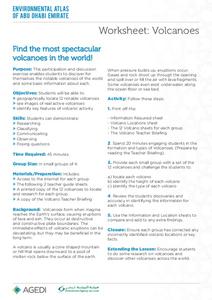
Find the Most Spectacular Volcanoes in the World!
Heat things up in your earth science class with this collaborative lesson on volcanoes. After first being introduced to the different types of volcanoes and how they are formed, young geologists work in small groups to research the...
Curated OER
Designing a Hiking Trail
Put your students' map skills to the test with this engaging cross-curricular project. Given the task of developing new hiking trails for their local community, young cartographers must map out beginner and intermediate paths that meet a...
NOAA
A Watery World
With about 70% of the earth's surface covered in oceans, it's fair to say that we live in a very wet world. Young scientists gain a better appreciation of this fact as they use maps to identify the world's ocean basins in the first...
National Geographic
Mapping the Americas
Celebrate the geography of the Americas and develop map skills through a series of activities focused on the Western Hemisphere. Learners study everything from earthquakes and volcanoes of the Americas and the relationship between...
Curated OER
Create Your Own Country Project
Young scholars demonstrate their knowledge of geography with this fun, collaborative social studies project. Working in small groups, students develop their very own countries, writing descriptions of their physical location, social...
Curated OER
Landforms of Illinois
Fifth and sixth graders are introduced to the primary landforms of Illinois and discover how they were created. Landform cards are made for each pupil. They use the twenty-questions format until they have identified each one. Then,...
Curated OER
Geography 12
Geography is such a fascinating subject for learners of all ages. Prepare learners with good guiding questions, which they can use while reading their texts. Each of the provided 13 questions requires a full paragraph response on the...
Curated OER
Map Puzzles
Students make puzzles from world maps, dramatizing how much of the globe is covered by ocean.
Curated OER
Climate Shifts
Eight slides of information related to shifts in the climate make up this presentation. The vocabulary and concepts displayed are geared toward high school meteorology learners. Content is not cohesive from slide to slide, but the...
Curated OER
Sub-Saharan Africa: Physical Geography
In this geography skills worksheet, students respond to 22 short answer and map skills questions about the location and geographic features of sub-Saharan Africa.
Curated OER
What in Our World Affects the Way People Live
Sixth graders study various maps that show geographical features and population. They compare the maps and make inferences about how various geographical features influence the population and human activities of an area.
Curated OER
Global History & Geography: Latin America
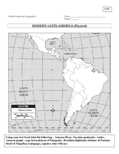
The instructions say to use a text-book to label 11 different regions in modern Latin America. If a text-book is not available a map can be found on-line and printed for student reference.
Curated OER
Social Studies: Looking at Regions
Quiz your 3rd graders on why we have regions. This regions quiz includes 16 questions on why and how we group areas into regions based on physical features, culture, politics or religion. A class discussion on technology completes this...
Curated OER
Geography: Physical Features
Physical features in our geography are outlined in this colorful PowerPoint. First, different physical features are listed. Then, they are defined with a corresponding graphic. Tip: While presenting this slideshow to your class, ask them...


